Fotografie
Waldgebiet in Bialowieza : Lageplan des Waldgebiets im Naturschutzgebiet Bialowieza
Lageplan des Waldgebiets im Naturschutzgebiet Bialowieza
Negativ aus Glas in schwarzweiß, hoch
- Other number(s)
-
df_hauptkatalog_0090605_001 (Aufnahmenummer)
71686356 (Dokumentennummer)
- Material/Technique
-
Originalnegativ, Glas (Fotografie)
- Classification
-
Fotografie (Gattung)
- Subject (what)
-
Wald
forest
Waldgebiet
forestland
Karte
map
Bialowieza
Bialowies
Bialowieza-Nationalpark
Bialowieza National Park
Polen
Poland
Europa
Europe
Übersichtskarte
- Subject (where)
-
Bialowieza, Polska (Dargestellter Ort)
- Subject (event)
-
Herstellung
- (who)
-
Zimmermann, Rudolf (zugeschrieben) (Zeichner)
- (description)
-
Erschaffung abgebildetes Objekt
- Event
-
Fotografische Aufnahme
- (who)
-
Zimmermann, Rudolf (Fotograf)
- (when)
-
1930
- Sponsorship
-
Digitalisierungsprojekt: DFG-Weltsichten
- Rights
-
Bitte beachten Sie die Nutzungsbedingungen der Deutschen Fotothek.
- Last update
-
05.03.2025, 4:18 PM CET
Data provider
This object is provided by:
Deutsche Fotothek. If you have any questions about the object, please contact the data provider.
Deutsche Fotothek. If you have any questions about the object, please contact the data provider.
Object type
- Fotografie
Associated
- Zimmermann, Rudolf (Fotograf)
- Zimmermann, Rudolf (zugeschrieben) (Zeichner)
Time of origin
- 1930
Other Objects (12)
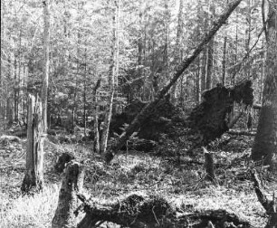
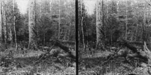
Wald in Bialowieza : Umgestürzte Bäume im Wald in Bialowieza
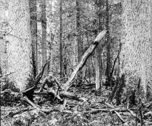
Mann im Wald in Bialowieza : Mann in Uniform im Wald von Bialowieza
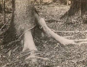
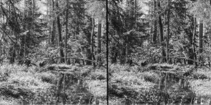
Im Wald : Mischwald im Białowieża-Nationalpark.
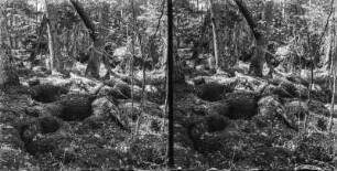
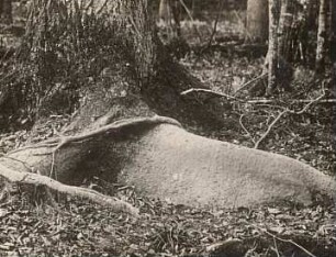
Im Wald : Waldboden im Białowieża-Nationalpark.
Bialowies (Bialowieza, Polska). Malbaum der Wildschweine
Bialowies (Bialowieza, Polska). Malbaum der Wildschweine
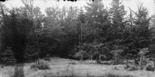
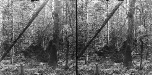
Im Wald : Ein Teil des Białowieża-Nationalparks.
Im Wald : Im Wald des Białowieża-Nationalparks.
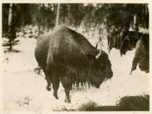
Wisent : Bialowieza, Wisent (Bison bonasus) im Wald

Bialowieza. Hallimasche oder Honigpilze (Armillaria mellea Fl. dan.)

Bialowieza. Hallimasche oder Honigpilze (Armillaria mellea Fl. dan.)
Im Wald : Bachlauf im Wald des Białowieża-Nationalpark.
Wald in Bialowieza : Umgestürzte Bäume im Wald in Bialowieza
Mann im Wald in Bialowieza : Mann in Uniform im Wald von Bialowieza
Im Wald : Mischwald im Białowieża-Nationalpark.
Im Wald : Waldboden im Białowieża-Nationalpark.
Bialowies (Bialowieza, Polska). Malbaum der Wildschweine
Bialowies (Bialowieza, Polska). Malbaum der Wildschweine
Im Wald : Ein Teil des Białowieża-Nationalparks.
Im Wald : Im Wald des Białowieża-Nationalparks.
Wisent : Bialowieza, Wisent (Bison bonasus) im Wald
Bialowieza. Hallimasche oder Honigpilze (Armillaria mellea Fl. dan.)
Bialowieza. Hallimasche oder Honigpilze (Armillaria mellea Fl. dan.)