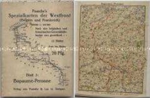
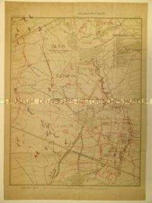
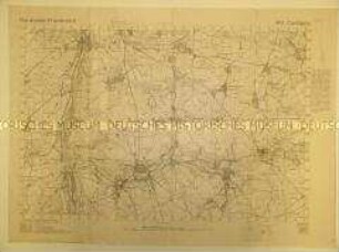
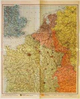
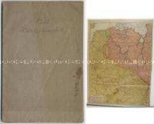
Militärstrategische Karte
Militärstrategische Karte um eine Artillerie- Beobachtungsstation
- Alternativer Titel
-
Zum Rundbild von der Art. Beob. St. Dammstraße
- Standort
-
Deutsches Historisches Museum, Berlin
- Inventarnummer
-
DG 64/4.2
- Maße
-
Höhe x Breite: 66,8 x 94,6 cm
- Material/Technik
-
Papier, gedruckt
- Klassifikation
-
Karten, Pläne, Risse (Gattung)
- Bezug (was)
-
Weltkrieg, 1.
- Ereignis
-
Herstellung
- (wer)
-
Vermesser: ? Gutsche
- (wo)
-
Deutschland [historisch: Deutsches Reich]
- (wann)
-
um 1916
- Rechteinformation
-
Deutsches Historisches Museum
- Letzte Aktualisierung
-
24.03.2023, 09:30 MEZ
Datenpartner
Dieses Objekt wird bereitgestellt von:
Stiftung Deutsches Historisches Museum. Bei Fragen zum Objekt wenden Sie sich bitte an den Datenpartner.
Stiftung Deutsches Historisches Museum. Bei Fragen zum Objekt wenden Sie sich bitte an den Datenpartner.
Objekttyp
- Militärstrategische Karte
Beteiligte
- Vermesser: ? Gutsche
Entstanden
- um 1916
Ähnliche Objekte (12)
Militärstrategische Karte von der Westfront

Militärstrategische Karte vom westlichen Kriegsschauplatz
Militärstrategische Karte eines Frontabschnittes in Frankreich
Militärstrategische Karte eines Frontabschnittes in Frankreich
Militär-strategische Karte von Groß-Britannien

Militärstrategische Karte zur Schlacht bei Cambrai
Militär-strategische Karte des Pazifik-Raumes
Militärstrategische Karte von der Westfront 1939
Militär-strategische Karte von Groß-Britannien

Militärstrategische Karte aus dem 1. Weltkrieg
Militärstrategische Karte des Kampfgebietes in Frankreich
Militärstrategische Karte des französich-belgischen Kriegsschauplatzes
Militärstrategische Karte von der Westfront
Militärstrategische Karte vom westlichen Kriegsschauplatz
Militärstrategische Karte eines Frontabschnittes in Frankreich
Militärstrategische Karte eines Frontabschnittes in Frankreich
Militär-strategische Karte von Groß-Britannien
Militärstrategische Karte zur Schlacht bei Cambrai
Militär-strategische Karte des Pazifik-Raumes
Militärstrategische Karte von der Westfront 1939
Militär-strategische Karte von Groß-Britannien
Militärstrategische Karte aus dem 1. Weltkrieg
Militärstrategische Karte des Kampfgebietes in Frankreich