Vegetationsgrenzen im extremen und multizonalen Hochgebirge (Zentraler Himalaya)
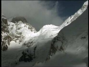
Abstract: Patterns of plant life-forms in the Central Himalayas (83°-84° E.) are presented together with remarks on the upper treeline of Mt. Everest and Nanga Parbat. In addition, causal aspects are discussed by comparing habitats with differing ecological conditions. The area of investigation, the Dhaulagiri- and Annapurna-Himalayas (28° 14'-29°N/83°14'-84°05' E.), has the greatest vertical distance of the continental earth's surface and a sharp decrease of precipitation from 6000 mm/p.a. in the Lower Himalayas to 300 mm/p.a. in the Tibetan Himalayas, an area spanning 50 km. These conditions produce extremely varied plant life-forms ranging from sub-tropical mountain forest to cloud forest, conifer forest and semi-desert dwarf scrublands. Between 28° 20' (Lower Himalayas) and 28°40' N (Tibetan Himalayas) the upper tree-line climbs up to 4400 m (Birch-woodlands on the shady slope only). Although deduction would lead one to conclude that north of the tropic the sunny slope maintains a higher.... https://www.erdkunde.uni-bonn.de/article/view/2052
- Location
-
Deutsche Nationalbibliothek Frankfurt am Main
- Extent
-
Online-Ressource
- Language
-
Englisch
- Bibliographic citation
-
Vegetationsgrenzen im extremen und multizonalen Hochgebirge (Zentraler Himalaya) ; volume:38 ; number:4 ; year:1984
Erdkunde ; 38, Heft 4 (1984)
- Creator
- DOI
-
10.3112/erdkunde.1984.04.03
- URN
-
urn:nbn:de:101:1-2410290921115.937445127198
- Rights
-
Open Access; Der Zugriff auf das Objekt ist unbeschränkt möglich.
- Last update
-
15.08.2025, 7:23 AM CEST
Data provider
Deutsche Nationalbibliothek. If you have any questions about the object, please contact the data provider.
Associated
Other Objects (12)
Landschaftsentwicklung extremen Hochgebirges - Karakorum und Kuenlun

Schwangerschaft in extremen Altersklassen
Fliegen unter extremen Bedingungen
Erinnerungsorte der extremen Rechten
Energieverbrauch unter extremen Witterungsbedingungen

Bindungsaktivierung unter extremen Bedingungen
Südwestafrika : Land zwischen d. Extremen
Lehren aus extremen Witterungsbedingungen 1979
Südwestafrika : Land zwischen den Extremen
Philosophische Lebenskünste in extremen Zeiten
Sparsamer Energieverbrauch unter extremen Witterungsbedingungen
Südwestafrika : Land zwischen d. Extremen
Landschaftsentwicklung extremen Hochgebirges - Karakorum und Kuenlun
Schwangerschaft in extremen Altersklassen
Fliegen unter extremen Bedingungen
Erinnerungsorte der extremen Rechten
Energieverbrauch unter extremen Witterungsbedingungen
Bindungsaktivierung unter extremen Bedingungen
Südwestafrika : Land zwischen d. Extremen
Lehren aus extremen Witterungsbedingungen 1979
Südwestafrika : Land zwischen den Extremen
Philosophische Lebenskünste in extremen Zeiten
Sparsamer Energieverbrauch unter extremen Witterungsbedingungen