Vorschläge zur kartographischen Darstellung der Industrie in großen, mittleren und kleinen Maßstäben
Abstract: The following facts play an important role in the cartographic representation of industry: the collection and applicability of relevant industrial statistical data; the way in which figures can be used as pictorial overlay material; and the ability to centre figures on the actual location; the large range between maximum and minimum values and a strong division in depth of industrial classification. In the latter case the industrial groupings defined in the maps of the German Land Planning Atlases have been found useful. Using these industrial groupings as a basis, a colour key for all scales was developed. Using the example of the town of Alfeld at a scale of 1 : 5,000, industrial premises are shown in a darker tone, and industrial land with storage areas and rail sidings in a lighter tone, of the same colour. At the 1 : 25,000 scale, coloured divided circles, proportional in area to the number of employees were laid over the industrial buildings, while the total industrial land u.... https://www.erdkunde.uni-bonn.de/article/view/1627
- Location
-
Deutsche Nationalbibliothek Frankfurt am Main
- Extent
-
Online-Ressource
- Language
-
Englisch
- Bibliographic citation
-
Vorschläge zur kartographischen Darstellung der Industrie in großen, mittleren und kleinen Maßstäben ; volume:25 ; number:1 ; year:1971
Erdkunde ; 25, Heft 1 (1971)
- Creator
-
Wenzel, Alfred
- DOI
-
10.3112/erdkunde.1971.01.01
- URN
-
urn:nbn:de:101:1-2410291132521.067611844365
- Rights
-
Open Access; Der Zugriff auf das Objekt ist unbeschränkt möglich.
- Last update
-
15.08.2025, 7:26 AM CEST
Data provider
Deutsche Nationalbibliothek. If you have any questions about the object, please contact the data provider.
Associated
- Wenzel, Alfred
Other Objects (12)

40: Der organische Wohnraum
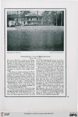
Personalkult und Werkschätzung

Personenheft Alfred Wenzel (*04.08.1910), SS-Obersturmführer
![39: Gedanken über Tradition, [1]](https://iiif.deutsche-digitale-bibliothek.de/image/2/e87532f1-3bda-42dc-a78a-7d92b5df4a70/full/!306,450/0/default.jpg)
39: Gedanken über Tradition, [1]

Freiheit und Zwang

Raubtiernummern, ohne Ortsangabe, ohne Jahr
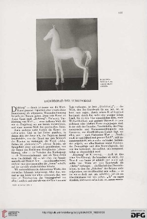
Dichtegrad des Kunstwerks

Über Kunst-Richtungen: der Ältere und der Jüngere
Caroli-Truppe, ohne Ortsangabe, ohne Jahr

Belebte oder Beseelte Form

Typisch und individuell

Pflanzen in der Wohnung
40: Der organische Wohnraum
Personalkult und Werkschätzung
Personenheft Alfred Wenzel (*04.08.1910), SS-Obersturmführer
39: Gedanken über Tradition, [1]
Freiheit und Zwang
Raubtiernummern, ohne Ortsangabe, ohne Jahr
Dichtegrad des Kunstwerks
Über Kunst-Richtungen: der Ältere und der Jüngere
Caroli-Truppe, ohne Ortsangabe, ohne Jahr
Belebte oder Beseelte Form
Typisch und individuell