Altkarte
Basis Karte : zu Bairischen Topographie, in der Richtung von München nach Aufkirchen gemessen über das Erdinger Moos im Jahr 1801, nebst der Gegend zwischen der Isar u. Erdinger Chaussée, Von nördl. Frauen Thurm bis zum Basis Anfang 22082 Basis Länge 74175, v. Endpt. bis Aufkirchen 1354
- Weitere Titel
-
Basis-Karte
- Standort
-
München, Bayerische Staatsbibliothek -- Mapp. XI,41 z
- Maße
-
29 x 19 cm
- Umfang
-
1 Kt.
- Anmerkungen
-
Lithogr.
NW oben. - Inselkt. - Maßstab in graph. Form (Bair. Schuh)
- Schlagwort
-
Geodäsie
Basis
Oberding-Aufkirchen
München
- Ereignis
-
Veröffentlichung
- (wo)
-
S.l. [München]
- (wer)
-
[Topograph. Bureau]
- (wann)
-
s.a. [nach 1801]
- Beteiligte Personen und Organisationen
- URN
-
urn:nbn:de:bvb:12-bsb00010745-3
- Letzte Aktualisierung
-
16.04.2025, 08:41 MESZ
Datenpartner
Dieses Objekt wird bereitgestellt von:
Bayerische Staatsbibliothek. Bei Fragen zum Objekt wenden Sie sich bitte an den Datenpartner.
Bayerische Staatsbibliothek. Bei Fragen zum Objekt wenden Sie sich bitte an den Datenpartner.
Objekttyp
- Altkarte
Beteiligte
- Pigenot, Josef von
- Schleich, Johann Carl
- [Topograph. Bureau]
Entstanden
- s.a. [nach 1801]
Ähnliche Objekte (12)
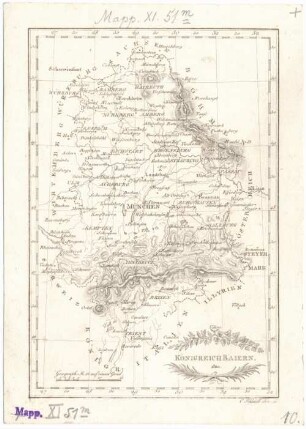
Königreich Baiern
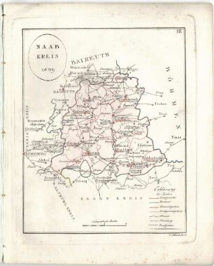
Naab-Kreis : 1809
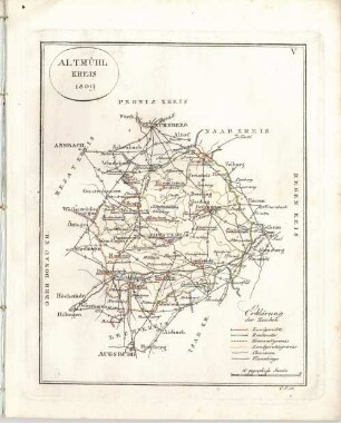
Altmühl-Kreis : 1809
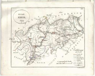
Eisak-Kreis : 1809

Messung der Basis zwischen München und Aufkirchen
Messung der Basis zwischen München und Aufkirchen
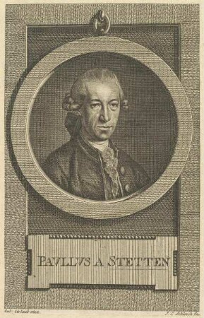
Bildnis des Pavlvs a Stetten

Bildnis des Joseph Clemens von Köln
Bildnis des Pavllvs a Stetten

Bildnis des Gideon a Loudon

Bildnis des Clemens August, Erzbischof von Köln

Bildnis des Joseph Konrad von Schroffenberg
Königreich Baiern
Naab-Kreis : 1809
Altmühl-Kreis : 1809
Eisak-Kreis : 1809
Messung der Basis zwischen München und Aufkirchen
Messung der Basis zwischen München und Aufkirchen
Bildnis des Pavlvs a Stetten
Bildnis des Joseph Clemens von Köln
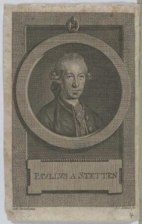
Bildnis des Pavllvs a Stetten
Bildnis des Gideon a Loudon
Bildnis des Clemens August, Erzbischof von Köln
Bildnis des Joseph Konrad von Schroffenberg
Königreich Baiern
Naab-Kreis : 1809
Altmühl-Kreis : 1809
Eisak-Kreis : 1809
Messung der Basis zwischen München und Aufkirchen
Messung der Basis zwischen München und Aufkirchen
Bildnis des Pavlvs a Stetten
Bildnis des Joseph Clemens von Köln
Bildnis des Pavllvs a Stetten
Bildnis des Gideon a Loudon
Bildnis des Clemens August, Erzbischof von Köln