Karten und Pläne
Loisachregulierung - Höhenplan der fixierten Wasserspiegel von km 85,8 - 73,0
- Archivaliensignatur
-
StAM, Plansammlung 7249
- Alt-/Vorsignatur
-
-
- Maße
-
70 x 34 cm
- Formalbeschreibung
-
Folie; 1 : 50000 / 1 : 100
- Sprache der Unterlagen
-
deutsch
- Kontext
-
Plansammlung >> Plansammlung >> 2. Plansammlung ab Nr. 4192 (nach Provenienzen) >> 2.1. Innere Verwaltung >> 2.1.5. Bauämter (Baupläne) >> 2.1.5.7. Straßen- und Flußbauamt Weilheim
- Bestand
-
StAM, Plansammlung Plansammlung
- Provenienz
-
Straßen- und Flußbauamt Weilheim
- Laufzeit
-
1938
- Weitere Objektseiten
- Letzte Aktualisierung
-
22.04.2025, 13:54 MESZ
Datenpartner
Dieses Objekt wird bereitgestellt von:
Staatsarchiv München. Bei Fragen zum Objekt wenden Sie sich bitte an den Datenpartner.
Staatsarchiv München. Bei Fragen zum Objekt wenden Sie sich bitte an den Datenpartner.
Objekttyp
- Karten und Pläne
Beteiligte
- Straßen- und Flußbauamt Weilheim
Entstanden
- 1938
Ähnliche Objekte (12)
Wasserspiegel

wasser.spiegel : Anthologie
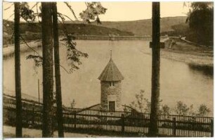
Neunzehnhain. Talsperre - Wasserspiegel
Loisachregulierung - Kochelsee - Beuerberg
Loisachregulierung - Charakteristische Querschnitte
Loisachregulierung - Lageplan Schönmühl
Loisachregulierung - Lageplan Schönmühl
Loisachregulierung - Kraftwerk Schönmühl
Loisachregulierung - Nantesbucher Straßenbrücke
Loisachregulierung - Kraftwerk Schönmühl
Loisachregulierung - Los Vb
Loisachregulierung - Schönmühl-Beuerberg
Wasserspiegel
wasser.spiegel : Anthologie
Neunzehnhain. Talsperre - Wasserspiegel
Loisachregulierung - Kochelsee - Beuerberg
Loisachregulierung - Charakteristische Querschnitte
Loisachregulierung - Lageplan Schönmühl
Loisachregulierung - Lageplan Schönmühl
Loisachregulierung - Kraftwerk Schönmühl
Loisachregulierung - Nantesbucher Straßenbrücke
Loisachregulierung - Kraftwerk Schönmühl
Loisachregulierung - Los Vb