- Location
-
München, Bayerische Staatsbibliothek -- Mapp. XXIV,82 lf
- Dimensions
-
60 x 57 cm
- Extent
-
1 Kt.
- Notes
-
Lithographie
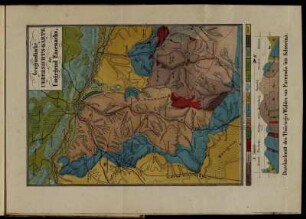
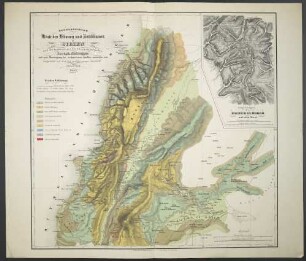
Aus: Wineberger, Ludwig: Versuch einer geognostischen Beschreibung des Bayerischen Waldgebirges und Neuburger Waldes
- Keyword
-
Geologie
Karte
Bayerischer Wald
- Event
-
Veröffentlichung
- (where)
-
S.l. [Passau]
- (when)
-
s.a. [1851]
- Contributor
-
Wineberger, Ludwig (Sonstige)
- URN
-
urn:nbn:de:bvb:12-bsb00090745-1
- Last update
-
27.11.2025, 8:35 AM CET
Data provider
This object is provided by:
Bayerische Staatsbibliothek. If you have any questions about the object, please contact the data provider.
Bayerische Staatsbibliothek. If you have any questions about the object, please contact the data provider.
Object type
- kartografisches Bild
Associated
- Wineberger, Ludwig (Sonstige)
Time of origin
- s.a. [1851]
Other Objects (12)
![[Geognostische Karte über] Die bayerische Pfalz](https://iiif.deutsche-digitale-bibliothek.de/image/2/ab98aa05-e5bc-4c5a-ab4f-a8da5e41eea2/full/!306,450/0/default.jpg)
[Geognostische Karte über] Die bayerische Pfalz
Geognostische Uebersichts-Karte ...
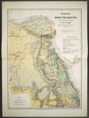
Geognostische Karte Von Aegypten
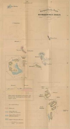
Geognostische Karte der Nicobarischen Inseln
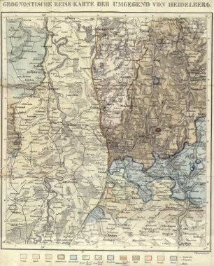
Geognostische Reise-Karte der Umgegend von Heidelberg

W. Sievers' Geognostische Karte der venezolanischen Cordillere

Geognostische Karte des Königreichs Bayern, XVIII. Abth. 5, Die Bayerische Rheinpfalz ;1. Blatt, Speyer

Taf. I. Geognostische Karte der Umgegend von Geyer
Geognostische Karte des Libanon und Antilibanon in Sirien
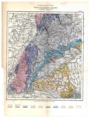
Tafel VI: Geognostische Karte von Württemebrg, Baden und Hohenzollern

Geognostische Karte Der Alpen In Savoyen Und Der Schweitz
Karte: Geognostische Skizze der Gegend um Berlin von G. Berendt
[Geognostische Karte über] Die bayerische Pfalz
Geognostische Uebersichts-Karte ...
Geognostische Karte Von Aegypten
Geognostische Karte der Nicobarischen Inseln
Geognostische Reise-Karte der Umgegend von Heidelberg
W. Sievers' Geognostische Karte der venezolanischen Cordillere
Geognostische Karte des Königreichs Bayern, XVIII. Abth. 5, Die Bayerische Rheinpfalz ;1. Blatt, Speyer
Taf. I. Geognostische Karte der Umgegend von Geyer
Geognostische Karte des Libanon und Antilibanon in Sirien
Tafel VI: Geognostische Karte von Württemebrg, Baden und Hohenzollern
Geognostische Karte Der Alpen In Savoyen Und Der Schweitz