Topographische Karten
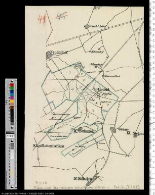
Topographische Karte des Gebietes um Birkenfeld (Rheinprovinz)
- Alternative title
-
Karte des Deutschen Reiches / 541. Birkenfeld
- Location
-
Deutsches Historisches Museum, Berlin
- Inventory number
-
Do 90/817
- Measurements
-
Höhe x Breite: 38 x 48 cm
- Material/Technique
-
Papier, gedruckt
- Classification
-
Kartografie (Gattung)
- Event
-
Herstellung
- (who)
-
Herausgeber: Reichsamt für Landesaufnahme
- (where)
-
Berlin, Deutschland [historisch: Deutsches Reich]
- (when)
-
02.04.1940
- Rights
-
Deutsches Historisches Museum
- Last update
-
24.03.2023, 9:30 AM CET
Data provider
This object is provided by:
Stiftung Deutsches Historisches Museum. If you have any questions about the object, please contact the data provider.
Stiftung Deutsches Historisches Museum. If you have any questions about the object, please contact the data provider.
Object type
- Topographische Karten
Associated
- Herausgeber: Reichsamt für Landesaufnahme
Time of origin
- 02.04.1940
Other Objects (12)

Topographische Karten der Rheinprovinz
Birkenfeld; Topographische Spezial-Karte von Mittel-Europa, Blatt 447: Birkenfeld
Rheinprovinz.- Regierungsbezirk Koblenz: Landkreis Birkenfeld
. Topographische Karte von Deutschland [Teile des Kartenwerks]: Birkenfeld
Unbezeichnetes Teilstück einer gedruckten Karte (Gebiet Birkenfeld)
Topographische Karte Rheinprovinz, Westfalen und Hessen-Nassau

Topographische Karte der Rheinprovinz, und der Provinz Westfalen
Topographische Karte der Rheinprovinz und der Provinz Westfalen
Blatt 7117 (Birkenfeld) der Topographischen Karte 1:25000, Stand 2006
Blatt 7117 (Birkenfeld) der Topographischen Karte 1:25000, Stand 1996
Blatt 7117 (Birkenfeld) der Topographischen Karte 1:25000, Stand 1991
Rheinprovinz.- Regierungsbezirk Koblenz: Landkreis Birkenfeld.- Vereinigung mit Preußen
Topographische Karten der Rheinprovinz
Birkenfeld; Topographische Spezial-Karte von Mittel-Europa, Blatt 447: Birkenfeld
Rheinprovinz.- Regierungsbezirk Koblenz: Landkreis Birkenfeld
. Topographische Karte von Deutschland [Teile des Kartenwerks]: Birkenfeld
Unbezeichnetes Teilstück einer gedruckten Karte (Gebiet Birkenfeld)
Topographische Karte Rheinprovinz, Westfalen und Hessen-Nassau
Topographische Karte der Rheinprovinz, und der Provinz Westfalen
Topographische Karte der Rheinprovinz und der Provinz Westfalen
Blatt 7117 (Birkenfeld) der Topographischen Karte 1:25000, Stand 2006
Blatt 7117 (Birkenfeld) der Topographischen Karte 1:25000, Stand 1996
Blatt 7117 (Birkenfeld) der Topographischen Karte 1:25000, Stand 1991