- Location
-
München, Bayerische Staatsbibliothek -- Mapp. XI,57 t
- Dimensions
-
42 x 43 cm
- Extent
-
1 Kt.
- Edition
-
Nach dem gegenwärtigen Umfang des Königreiches ergänzt
- Language
-
Deutsch
- Notes
-
Lithographie
Mit 1 Nebenkt.: Der Rhein Kreis. - Maßstab in graph. Form (8 Meilen, 16 Lieues)
- Keyword
-
Geschichte 1830
Verwaltungsgrenze
Bayern
- Event
-
Veröffentlichung
- (where)
-
München
- (who)
-
Geographisches Dépôt
- (when)
-
1830
- Contributor
- URN
-
urn:nbn:de:bvb:12-bsb00042068-8
- Last update
-
16.04.2025, 8:46 AM CEST
Data provider
This object is provided by:
Bayerische Staatsbibliothek. If you have any questions about the object, please contact the data provider.
Bayerische Staatsbibliothek. If you have any questions about the object, please contact the data provider.
Object type
- Altkarte
Associated
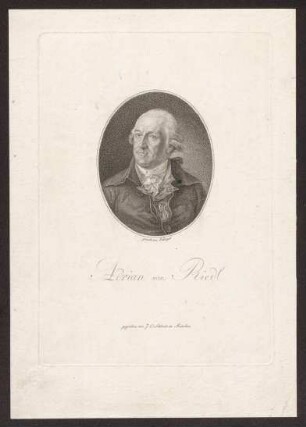
- Riedl, Adrian von
- Schleich, Johann Carl
- Geographisches Dépôt
Time of origin
- 1830
Other Objects (12)
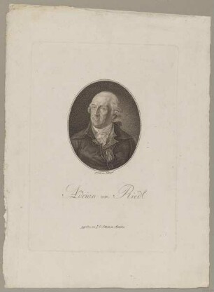
Bildnis des Adrian von Riedl
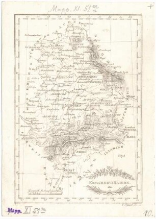
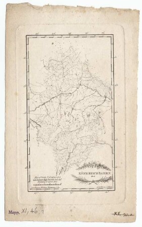
Königreich Baiern
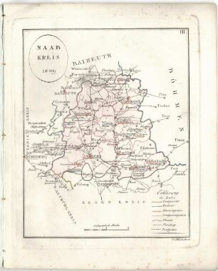
Naab-Kreis : 1809
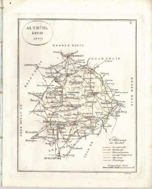
Altmühl-Kreis : 1809
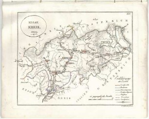
Eisak-Kreis : 1809
Riedl, Adrian von
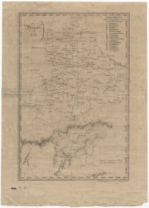
Baiern : 1808
Königreich Baiern
![Reise Atlas von Bajern oder Geographisch-geometrische Darstellung aller bajrischen Haupt- und Landstraßen mit den daranliegenden Ortschaften und Gegenden : nebst Kurzer Beschreibungen alles dessen, was auf und an einer jeden der gezeichneten Straßen für den Reisenden merkwürdig seyn kann. [Gewidmet] Joseph August Grafen von Toerring, 41. Karte des trocken gelegten Donaver Mooses dann der Chavssée von Poernbach Nach Nevburg](https://iiif.deutsche-digitale-bibliothek.de/image/2/d9ae0408-bc9f-4374-afc0-85eb57ccaf41/full/!306,450/0/default.jpg)
Reise Atlas von Bajern oder Geographisch-geometrische Darstellung aller bajrischen Haupt- und Landstraßen mit den daranliegenden Ortschaften und Gegenden : nebst Kurzer Beschreibungen alles dessen, was auf und an einer jeden der gezeichneten Straßen für den Reisenden merkwürdig seyn kann. [Gewidmet] Joseph August Grafen von Toerring, 41. Karte des trocken gelegten Donaver Mooses dann der Chavssée von Poernbach Nach Nevburg
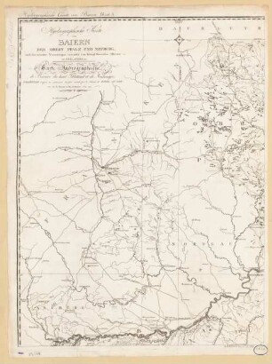
Hydrographische Karte von Baiern, Der Obern Pfalz und Neuburg : = Carte Hydrographique de Bavière, du haut Palatinat et de Neubourg
Reise Atlas von Bajern oder Geographisch-geometrische Darstellung aller bajrischen Haupt- und Landstraßen mit den daranliegenden Ortschaften und Gegenden : nebst Kurzer Beschreibungen alles dessen, was auf und an einer jeden der gezeichneten Straßen für den Reisenden merkwürdig seyn kann
Reise Atlas von Bajern oder Geographisch-geometrische Darstellung aller bajrischen Haupt- und Landstraßen mit den daranliegenden Ortschaften und Gegenden : nebst Kurzer Beschreibungen alles dessen, was auf und an einer jeden der gezeichneten Straßen für den Reisenden merkwürdig seyn kann
Bildnis des Adrian von Riedl
Königreich Baiern
Naab-Kreis : 1809
Altmühl-Kreis : 1809
Eisak-Kreis : 1809
Riedl, Adrian von
Baiern : 1808
Königreich Baiern
Reise Atlas von Bajern oder Geographisch-geometrische Darstellung aller bajrischen Haupt- und Landstraßen mit den daranliegenden Ortschaften und Gegenden : nebst Kurzer Beschreibungen alles dessen, was auf und an einer jeden der gezeichneten Straßen für den Reisenden merkwürdig seyn kann. [Gewidmet] Joseph August Grafen von Toerring, 41. Karte des trocken gelegten Donaver Mooses dann der Chavssée von Poernbach Nach Nevburg
Hydrographische Karte von Baiern, Der Obern Pfalz und Neuburg : = Carte Hydrographique de Bavière, du haut Palatinat et de Neubourg
Reise Atlas von Bajern oder Geographisch-geometrische Darstellung aller bajrischen Haupt- und Landstraßen mit den daranliegenden Ortschaften und Gegenden : nebst Kurzer Beschreibungen alles dessen, was auf und an einer jeden der gezeichneten Straßen für den Reisenden merkwürdig seyn kann