Stadtplan
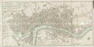
A New Plan of the City and Liberty of Westminster / A New Plan of the City of London and Borough of Southwark
- Alternative title
-
A NEW PLAN of the / CITY and LIBERTY of WESTMINSTER, / Exhibiting all the New Streets & Roads, with the Residences / of the Principal Nobility, Public Offices, &c.
A NEW PLAN of the / CITY of LONDON and BOROUGH of SOUTHWARK, / Exhibiting all the New Streets, Roads, &c. / Not extant in any other Plan.
- Location
-
Deutsches Historisches Museum, Berlin
- Inventory number
-
Do 2006/313
- Measurements
-
Höhe x Breite: 47,5 x 95 cm (Blatt)
Höhe x Breite: 44 x 88,8 cm (Karte)
Höhe x Breite: 46,2 x 91,3 cm (Platte)
- Material/Technique
-
Druckfarbe, Papier, Kupferstich, koloriert
- Classification
-
Kartografie (Gattung)
- Subject (what)
-
London
Westminster
- Event
-
Herstellung
- (who)
-
Stecher, Geograph, Verleger: Thomas Jefferys (1695)
Drucker, Verleger: Robert Sayer
Drucker, Verleger: Carington Bowles
- (where)
-
London, Großbritannien und Nordirland
- (when)
-
1766
- Rights
-
Deutsches Historisches Museum
- Last update
-
24.03.2023, 9:28 AM CET
Data provider
This object is provided by:
Stiftung Deutsches Historisches Museum. If you have any questions about the object, please contact the data provider.
Stiftung Deutsches Historisches Museum. If you have any questions about the object, please contact the data provider.
Object type
- Stadtplan
Associated
- Stecher, Geograph, Verleger: Thomas Jefferys (1695)
- Drucker, Verleger: Robert Sayer
- Drucker, Verleger: Carington Bowles
Time of origin
- 1766
Other Objects (12)

Memorandum on new incorporation plan of the city of Cologne
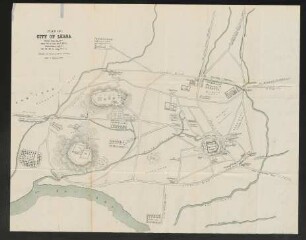
Plan of City of Lhasa
Plan of the City

Plan of Mexico City
Bowles's New Pocket Plan of the Cities of London & Westminster; with the Borough of Southwark
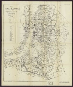
Plan Of The City Of Calcutta

Plan of ancient City of Mexiko
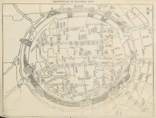
Ground-Plan of Shanghae city
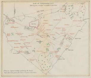
Plan of the Farukhabad city
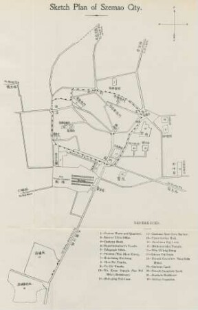
Sketch plan of Szemao City

A Plan of the city of Berlin.
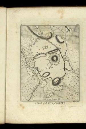
A Plan of the City of ALEPPO.
Memorandum on new incorporation plan of the city of Cologne
Plan of City of Lhasa
Plan of the City
Plan of Mexico City
Bowles's New Pocket Plan of the Cities of London & Westminster; with the Borough of Southwark
Plan Of The City Of Calcutta
Plan of ancient City of Mexiko
Ground-Plan of Shanghae city
Plan of the Farukhabad city
Sketch plan of Szemao City
A Plan of the city of Berlin.