Luftbildpläne
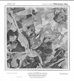
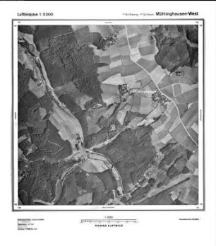
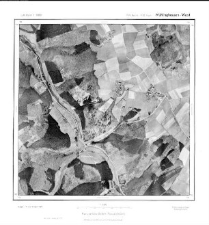
Mühlinghausen West, Gauß-Krüger-Koordinaten: Rechtswert: 2594, Hochwert: 5682
- title of record
-
Milspe Stöcken, Gauß-Krüger-Koordinaten: Rechtswert: 2592, Hochwert: 5680
- Dimensions
-
Maßstab: 1:10.000
- Further information
-
Land: NRW
- Context
-
Hansa Luftbild: Luftbildpläne 1:10.000 >> 2. Rechtswerte beginnend mit 25 >> Milspe Stöcken, Gauß-Krüger-Koordinaten: Rechtswert: 2592, Hochwert: 5680
- Holding
-
RW 0434 Hansa Luftbild: Luftbildpläne 1:10.000
- Creator
-
Hersteller: Hansa Luftbild
- Provenance
-
Hansa Luftbild
- Date of creation
-
1954
- Other object pages
- Delivered via
- Last update
-
30.04.2025, 2:34 PM CEST
Data provider
This object is provided by:
Landesarchiv Nordrhein-Westfalen. Abteilung Rheinland. If you have any questions about the object, please contact the data provider.
Landesarchiv Nordrhein-Westfalen. Abteilung Rheinland. If you have any questions about the object, please contact the data provider.
Object type
- Luftbildpläne
Associated
- Hersteller: Hansa Luftbild
- Hansa Luftbild
Time of origin
- 1954
Other Objects (12)

Mühlinghausen, Gauß-Krüger-Koordinaten: Rechtswert: 2594, Hochwert: 5682
Mühlinghausen, Gauß-Krüger-Koordinaten: Rechtswert: 2594, Hochwert: 5682
Mühlinghausen, Gauß-Krüger-Koordinaten: Rechtswert: 2594, Hochwert: 5682
Mühlinghausen West, Gauß-Krüger-Koordinaten: Rechtswert: 2594, Hochwert: 5682
Mühlinghausen West, Gauß-Krüger-Koordinaten: Rechtswert: 2594, Hochwert: 5682
Mühlinghausen - West, Gauß-Krüger-Koordinaten: Rechtswert: 2594, Hochwert: 5682
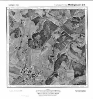
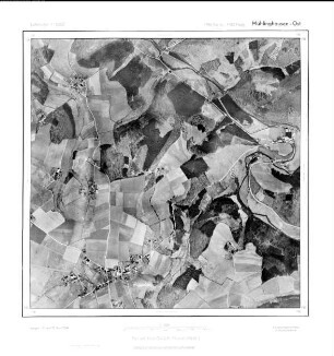
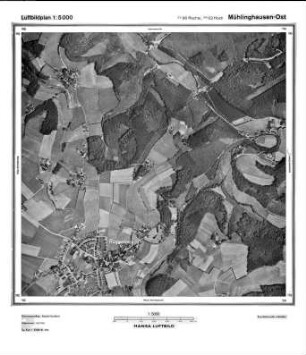
Mühlinghausen Ost, Gauß-Krüger-Koordinaten: Rechtswert: 2596, Hochwert: 5682
Mühlinghausen Ost, Gauß-Krüger-Koordinaten: Rechtswert: 2592, Hochwert: 5682
Mühlinghausen Ost, Gauß-Krüger-Koordinaten: Rechtswert: 2596, Hochwert: 5682
Mühlinghausen - Ost, Gauß-Krüger-Koordinaten: Rechtswert: 2596, Hochwert: 5682
Mühlinghausen Ost, Gauß-Krüger-Koordinaten: Rechtswert: 2596, Hochwert: 5682
Breckerfeld Eicken, Gauß-Krüger-Koordinaten: Rechtswert: 2594, Hochwert: 5682
Mühlinghausen, Gauß-Krüger-Koordinaten: Rechtswert: 2594, Hochwert: 5682
Mühlinghausen, Gauß-Krüger-Koordinaten: Rechtswert: 2594, Hochwert: 5682
Mühlinghausen, Gauß-Krüger-Koordinaten: Rechtswert: 2594, Hochwert: 5682
Mühlinghausen West, Gauß-Krüger-Koordinaten: Rechtswert: 2594, Hochwert: 5682
Mühlinghausen West, Gauß-Krüger-Koordinaten: Rechtswert: 2594, Hochwert: 5682
Mühlinghausen - West, Gauß-Krüger-Koordinaten: Rechtswert: 2594, Hochwert: 5682
Mühlinghausen Ost, Gauß-Krüger-Koordinaten: Rechtswert: 2596, Hochwert: 5682
Mühlinghausen Ost, Gauß-Krüger-Koordinaten: Rechtswert: 2592, Hochwert: 5682
Mühlinghausen Ost, Gauß-Krüger-Koordinaten: Rechtswert: 2596, Hochwert: 5682
Mühlinghausen - Ost, Gauß-Krüger-Koordinaten: Rechtswert: 2596, Hochwert: 5682
Mühlinghausen Ost, Gauß-Krüger-Koordinaten: Rechtswert: 2596, Hochwert: 5682