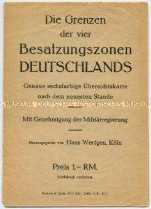
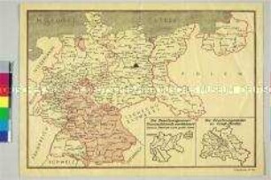
Politisch-administrative Karte
Politisch-administrative Karte mit der Einteilung der Besatzungszonen in Deutschland
- Alternativer Titel
-
Besatzungszonen in Deutschland
- Standort
-
Deutsches Historisches Museum, Berlin
- Inventarnummer
-
Do2 95/3601
- Maße
-
Höhe x Breite: 86,6 x 124,6 cm
- Material/Technik
-
Papier, gedruckt
- Klassifikation
-
Karten, Pläne, Risse (Gattung)
- Bezug (was)
-
Besetzte Gebiete
Besatzung (Militär)
Alliierte
- Ereignis
-
Herstellung
- (wer)
-
Verlag: Geographischen Verlagsanstalt Justus Perthes
- (wo)
-
Gotha, Deutschland [historisch: Deutschland, Sowjetische Besatzungszone]
- (wann)
-
um 1945
- Rechteinformation
-
Deutsches Historisches Museum
- Letzte Aktualisierung
-
24.03.2023, 09:27 MEZ
Datenpartner
Dieses Objekt wird bereitgestellt von:
Stiftung Deutsches Historisches Museum. Bei Fragen zum Objekt wenden Sie sich bitte an den Datenpartner.
Stiftung Deutsches Historisches Museum. Bei Fragen zum Objekt wenden Sie sich bitte an den Datenpartner.
Objekttyp
- Politisch-administrative Karte
Beteiligte
- Verlag: Geographischen Verlagsanstalt Justus Perthes
Entstanden
- um 1945
Ähnliche Objekte (12)
Politisch-administrative Karte der vier Besatzungszonen Deutschlands

Politisch-administrative Karte der Besatzungszonen und Postleitgebiete in Deutschland
Politisch-administrative Karte mit den Besatzungszonen in Deutschland und Groß-Berlin
Einteilung in die Besatzungszonen.

Politisch-administrative Karte von Deutschland und Österreich mit den Besatzungszonen nach dem II. Weltkrieg
Einteilung Deutschlands in Besatzungszonen, Länder und Provinzen
Politisch-Administrative Karte Osteuropas
Politisch-administrative Karte von Osteuropa
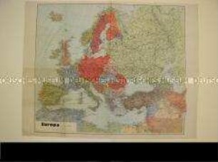
Politisch-administrative Karte von Europa
Politisch-administrative Karte der Sowjetunion
Politisch-administrative Karten von Europa
Politisch-administrative Karte des Mittelmeerraums
Politisch-administrative Karte der vier Besatzungszonen Deutschlands
Politisch-administrative Karte der Besatzungszonen und Postleitgebiete in Deutschland
Politisch-administrative Karte mit den Besatzungszonen in Deutschland und Groß-Berlin
Einteilung in die Besatzungszonen.
Politisch-administrative Karte von Deutschland und Österreich mit den Besatzungszonen nach dem II. Weltkrieg
Einteilung Deutschlands in Besatzungszonen, Länder und Provinzen
Politisch-Administrative Karte Osteuropas
Politisch-administrative Karte von Osteuropa
Politisch-administrative Karte von Europa
Politisch-administrative Karte der Sowjetunion
Politisch-administrative Karten von Europa