Diagramm
Standard deviation of the elevation error between the elevation of the true error points and the surface elevation at the horizontal location of the true error points (by Yan and Clark, 2000)
Bemerkung: dwg File in Attachment
- Location
-
Institut für Landtechnik TUM / Zeichenbüro, Weihenstephan
- Language
-
Englisch
- Subject (what)
-
Sensortechnik
Globales Positionierungssystem (GNSS)
- Event
-
Herstellung
- (who)
-
Auernhammer, H. (Autor)
Kolbinger, S. (Zeichner)
- Event
-
Herstellung
- (when)
-
2000
- Other object pages
- Rights
-
Es gelten die Nutzungsbedingungen von mediaTUM der Technischen Universität München.
- Last update
-
28.03.2025, 7:53 AM CET
Data provider
This object is provided by:
Agrartechnisches Archiv der Landtechnik Weihenstephan. If you have any questions about the object, please contact the data provider.
Agrartechnisches Archiv der Landtechnik Weihenstephan. If you have any questions about the object, please contact the data provider.
Object type
- Diagramm
Associated
- Auernhammer, H. (Autor)
- Kolbinger, S. (Zeichner)
Time of origin
- 2000
Other Objects (12)

On the uncertainty of stream networks derived from elevation data: the error propagation approach
THE EXPLAINABILITY OF GRADIENT-BOOSTED DECISION TREES FOR DIGITAL ELEVATION MODEL (DEM) ERROR PREDICTION
Error-Reduced Digital Elevation Model of the Qinghai-Tibet Plateau using ICESat-2 and Fusion Model
True value, error, and measurement uncertainty: two views
The Downside Risk of Elevation

Beauchamp; or, The error

The Progress Of Error.

Chapter X. Sixth Period: The Conflict With Error. The Birth Of Error
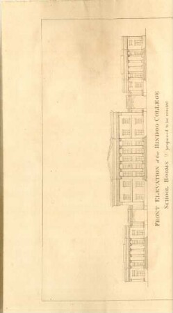
Front elevation of the Hindoo College ...
The Reference Elevation Model of Antarctica
The Reference Elevation Model of Antarctica
On the Iterative Proportional Fitting Procedure: Structure of Accumulation Points and L1-Error Analysis
On the uncertainty of stream networks derived from elevation data: the error propagation approach
THE EXPLAINABILITY OF GRADIENT-BOOSTED DECISION TREES FOR DIGITAL ELEVATION MODEL (DEM) ERROR PREDICTION
Error-Reduced Digital Elevation Model of the Qinghai-Tibet Plateau using ICESat-2 and Fusion Model
True value, error, and measurement uncertainty: two views
The Downside Risk of Elevation
Beauchamp; or, The error
The Progress Of Error.
Chapter X. Sixth Period: The Conflict With Error. The Birth Of Error
Front elevation of the Hindoo College ...
The Reference Elevation Model of Antarctica
The Reference Elevation Model of Antarctica