Karten / Pläne
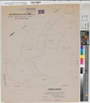
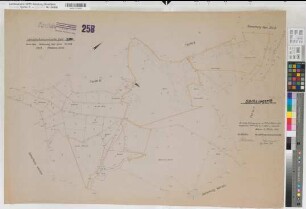
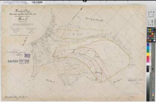
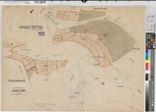
Olpe-Land (Olpe), Jahnschaftsteilungssache Dahl, Schätzungsriß Flur 9
- Reference number
-
W 051, 26497
- Dimensions
-
Höhe: 68, Breite: 57, Maßstab: 1:2000
- Context
-
Karten A (Allgemein) >> 11. Landesamt für Agrarordnung >> 11.2386. Olpe-Land (Olpe), Jahnschaftsteilungssache Dahl
- Holding
-
W 051 Karten A (Allgemein)
- Date of creation
-
1949
- Other object pages
- Delivered via
- Last update
-
24.06.2025, 1:35 PM CEST
Data provider
This object is provided by:
Landesarchiv Nordrhein-Westfalen. Abteilung Westfalen. If you have any questions about the object, please contact the data provider.
Landesarchiv Nordrhein-Westfalen. Abteilung Westfalen. If you have any questions about the object, please contact the data provider.
Object type
- Karten / Pläne
Time of origin
- 1949
Other Objects (12)
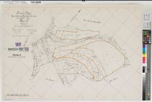
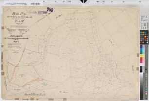
Olpe-Land (Olpe), Jahnschaftsteilungssache Dahl, Schätzungsriß Flur 10
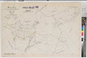
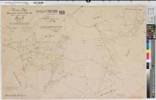
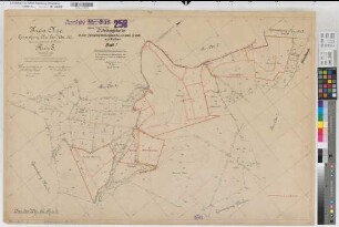
Olpe-Land (Olpe), Jahnschaftsteilungssache Dahl, Schätzungsriß Flur 8
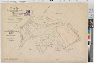
Olpe-Land (Olpe), Teilung Dahl, Reinkarte Flur 8
Olpe-Land (Olpe), Teilung Dahl, Reinkarte Flur 9
Olpe-Land (Olpe), Teilung Dahl, Urkarte Flur 9
Olpe-Land (Olpe), Teilung Dahl, Urkarte Flur 8
Olpe-Land (Olpe), Teilung Dahl, Urkarte Flur 10
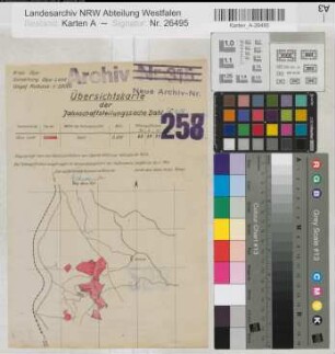
Olpe-Land (Olpe), Jahnschaftsteilungssache Dahl, Übersichtskarte
Olpe-Land (Olpe), Teilung Dahl, Übersichtskarte
Olpe-Land (Olpe), Jahnschaftsteilungssache Dahl, Bl.1 Zuteilungskarte Flur 8
Olpe-Land (Olpe), Jahnschaftsteilungssache Dahl, Bl.3 Zuteilungskarte Flur 10
Olpe-Land (Olpe), Jahnschaftsteilungssache Dahl, Bl.2 Zuteilungskarte Flur 9
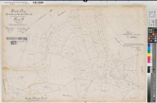
Olpe-Land (Olpe), Jahnschaftsteilungssache Dahl, Schätzungsriß Flur 10
Olpe-Land (Olpe), Jahnschaftsteilungssache Dahl, Schätzungsriß Flur 8
Olpe-Land (Olpe), Teilung Dahl, Reinkarte Flur 8
Olpe-Land (Olpe), Teilung Dahl, Reinkarte Flur 9
Olpe-Land (Olpe), Teilung Dahl, Urkarte Flur 9
Olpe-Land (Olpe), Teilung Dahl, Urkarte Flur 8
Olpe-Land (Olpe), Teilung Dahl, Urkarte Flur 10
Olpe-Land (Olpe), Jahnschaftsteilungssache Dahl, Übersichtskarte
Olpe-Land (Olpe), Teilung Dahl, Übersichtskarte
Olpe-Land (Olpe), Jahnschaftsteilungssache Dahl, Bl.1 Zuteilungskarte Flur 8
Olpe-Land (Olpe), Jahnschaftsteilungssache Dahl, Bl.3 Zuteilungskarte Flur 10
Olpe-Land (Olpe), Jahnschaftsteilungssache Dahl, Bl.2 Zuteilungskarte Flur 9
Olpe-Land (Olpe), Jahnschaftsteilungssache Dahl, Schätzungsriß Flur 10
Olpe-Land (Olpe), Jahnschaftsteilungssache Dahl, Schätzungsriß Flur 8
Olpe-Land (Olpe), Teilung Dahl, Reinkarte Flur 8
Olpe-Land (Olpe), Teilung Dahl, Reinkarte Flur 9
Olpe-Land (Olpe), Teilung Dahl, Urkarte Flur 9
Olpe-Land (Olpe), Teilung Dahl, Urkarte Flur 8
Olpe-Land (Olpe), Teilung Dahl, Urkarte Flur 10
Olpe-Land (Olpe), Jahnschaftsteilungssache Dahl, Übersichtskarte
Olpe-Land (Olpe), Teilung Dahl, Übersichtskarte
Olpe-Land (Olpe), Jahnschaftsteilungssache Dahl, Bl.1 Zuteilungskarte Flur 8
Olpe-Land (Olpe), Jahnschaftsteilungssache Dahl, Bl.3 Zuteilungskarte Flur 10