Karte / Plan
km 11,6707-13,750; Nivellements- und Situationsplan von Kilometer 11,6707 bis Kilometer 13,750
- Dimensions
-
Höhe: 66 cm, Breite: 106,5 cm, Maßstab: 1:2500/1:250
- Further information
-
Ort: Büren-Brenken, Büren
- Context
-
Bahndirektion Wuppertal und Elberfeld, Karten und Pläne, Band 3 >> 1. Bahnstrecken >> 1.31. Strecke 2963 (alt: BDW 97/ BDE77b) Geseke-Steinhausen-Büren(-Brilon) >> 1.31.1. Streckenlagepläne (Iul/ Iuh)
- Holding
-
BR 1213 Bahndirektion Wuppertal und Elberfeld, Karten und Pläne, Band 3
- Indexentry place
-
Büren-Brenken, Büren
- Date of creation
-
1897
- Other object pages
- Provenance
-
DB Netz AG Niederlassung West, Essen
- Delivered via
- Last update
-
17.09.2025, 3:08 PM CEST
Data provider
This object is provided by:
Landesarchiv Nordrhein-Westfalen. Abteilung Rheinland. If you have any questions about the object, please contact the data provider.
Landesarchiv Nordrhein-Westfalen. Abteilung Rheinland. If you have any questions about the object, please contact the data provider.
Object type
- Karten / Pläne
Time of origin
- 1897
Other Objects (12)

km 13,750-15,458,9; Nivellements- und Situationsplan von Kilometer 13,750 bis Kilometer 15,458,9
km 11,5-13,5; Nivellements- und Situations-Plan. Kilometer 11,4 bis Kilometer 13,6.
km 11,6-13,8; Nivellements- und Situations-Plan von Kilometer 11,6 (+70,7) bis Kilometer 13,7 (+50). Blatt 7.
km 11,6-13,8; Nivellements- und Situations-Plan von Kilometer 11,6 (+70,7) bis Kilometer 13,7 (+50). Blatt 7.
km 9,6-11,6; Nivellements- und Situationsplan von Kilometer 9,9 bis Kilometer 11,6+0,7
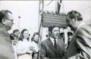
Übergabe des 750. Kilometers elektrifizierter Eisenbahn-Strecke seit 1981
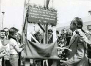
Übergabe des 750. Kilometers elektrifizierter Eisenbahn-Strecke seit 1981
km 11,3-13,3; Höhen- und Lageplan von Kilometer 11,3 bis Kilometer 13,3. Blatt 3.
km 22,1-24,0; Nivellements- und Situations-Plan. Blatt 6. Kilometer 12,0 bis Kilometer 13,9.
km 24,0-25,9; Nivellements- und Situations-Plan. Blatt 7. Kilometer 13,9 bis Kilometer 15,8.
km 48,4-50,7; Nivellements- und Situations-Plan. Blatt 11. Kilometer 38,2 bis Kilometer 40,5.
Fast 11 Kilometer Heckenschnitt
km 13,750-15,458,9; Nivellements- und Situationsplan von Kilometer 13,750 bis Kilometer 15,458,9
km 11,5-13,5; Nivellements- und Situations-Plan. Kilometer 11,4 bis Kilometer 13,6.
km 11,6-13,8; Nivellements- und Situations-Plan von Kilometer 11,6 (+70,7) bis Kilometer 13,7 (+50). Blatt 7.
km 11,6-13,8; Nivellements- und Situations-Plan von Kilometer 11,6 (+70,7) bis Kilometer 13,7 (+50). Blatt 7.
km 9,6-11,6; Nivellements- und Situationsplan von Kilometer 9,9 bis Kilometer 11,6+0,7
Übergabe des 750. Kilometers elektrifizierter Eisenbahn-Strecke seit 1981
Übergabe des 750. Kilometers elektrifizierter Eisenbahn-Strecke seit 1981
km 11,3-13,3; Höhen- und Lageplan von Kilometer 11,3 bis Kilometer 13,3. Blatt 3.
km 22,1-24,0; Nivellements- und Situations-Plan. Blatt 6. Kilometer 12,0 bis Kilometer 13,9.
km 24,0-25,9; Nivellements- und Situations-Plan. Blatt 7. Kilometer 13,9 bis Kilometer 15,8.
km 48,4-50,7; Nivellements- und Situations-Plan. Blatt 11. Kilometer 38,2 bis Kilometer 40,5.