- Alternativer Titel
-
CARTA / DE LA ISLA DE / SAN CHRISTOVAL, / REDUCIDA Y GRAVADA, POR
- Standort
-
Deutsches Historisches Museum, Berlin
- Inventarnummer
-
Do 2006/36
- Maße
-
Höhe x Breite: 49 x 63,8 cm (Blatt)
Höhe x Breite: 34 x 36,8 cm (Karte)
Höhe x Breite: 41 x 43 cm (Platte)
- Material/Technik
-
Druckfarbe, Papier, Kupferstich, grenzkoloriert
- Klassifikation
-
Kartografie (Gattung)
- Bezug (was)
-
Kleine Antillen
- Ereignis
-
Herstellung
- (wer)
-
Kartograf, Geograph: Juan Lopez
- (wo)
-
Madrid, Spanien
- (wann)
-
1780
- Rechteinformation
-
Deutsches Historisches Museum
- Letzte Aktualisierung
-
24.03.2023, 09:28 MEZ
Datenpartner
Dieses Objekt wird bereitgestellt von:
Stiftung Deutsches Historisches Museum. Bei Fragen zum Objekt wenden Sie sich bitte an den Datenpartner.
Stiftung Deutsches Historisches Museum. Bei Fragen zum Objekt wenden Sie sich bitte an den Datenpartner.
Objekttyp
- Küstenkarte
Beteiligte
- Kartograf, Geograph: Juan Lopez
Entstanden
- 1780
Ähnliche Objekte (12)
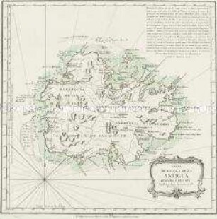
Carta de la Isla de la Antigua
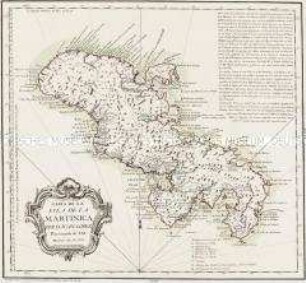
Carta de la Isla de la Martinica
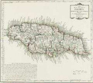
Carta de la Isla de la Jamayca
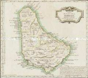
Carta de la Isla de la Barbada

Carta-relacion de la Islas Filipinas ...
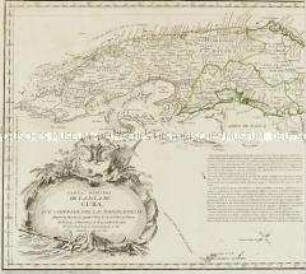
Carta Maritima de la Isla de Cuba

Carta plana de la Isla de Santo Domingo
La isla de San Balandrán
La isla de San Balandrán

Carta reducida de las Islas de Canaria

La nueva isla de San Balandrán
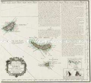
Carta Reducida y General de las Islas de los Azores. Mit sieben Ansichten und drei Nebenkarten: Costa meridional de la Isla de San Miguel; Fayal; Costa meridional de la Isla Tereca
Carta de la Isla de la Antigua
Carta de la Isla de la Martinica
Carta de la Isla de la Jamayca
Carta de la Isla de la Barbada
Carta-relacion de la Islas Filipinas ...
Carta Maritima de la Isla de Cuba
Carta plana de la Isla de Santo Domingo
La isla de San Balandrán
La isla de San Balandrán
Carta reducida de las Islas de Canaria
La nueva isla de San Balandrán