- Alternative title
-
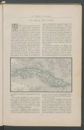
CARTA MARITIMA / DE LA ISLA DE / CUBA, / QUE COMPREHENDE LAS JURISDICCIONES DE
- Location
-
Deutsches Historisches Museum, Berlin
- Inventory number
-
Do 2006/26.1-2
- Measurements
-
Höhe x Breite: 46 x 60 cm (Blatt 1)
Höhe x Breite: 34 x 39,3 cm (Karte 1)
Höhe x Breite: 39,5 x 42,2 cm (Platte 1)
Höhe x Breite: 46,4 x 60,7 cm (Blatt 2)
Höhe x Breite: 34 x 42,3 cm (Karte 2)
Höhe x Breite: 40 x 46 cm (Platte 2)
- Material/Technique
-
Druckfarbe, Papier, Kupferstich, grenzkoloriert
- Classification
-
Kartografie (Gattung)
- Subject (what)
-
Große Antillen
Kuba
- Event
-
Herstellung
- (who)
-
Geograph: Juan Lopez
- (where)
-
Madrid, Spanien
- (when)
-
1783
- Rights
-
Deutsches Historisches Museum
- Last update
-
24.03.2023, 9:27 AM CET
Data provider
This object is provided by:
Stiftung Deutsches Historisches Museum. If you have any questions about the object, please contact the data provider.
Stiftung Deutsches Historisches Museum. If you have any questions about the object, please contact the data provider.
Object type
- Gerichtskarte
Associated
- Geograph: Juan Lopez
Time of origin
- 1783
Other Objects (12)
La isla de Cuba.

Biografia de una isla : (Cuba)
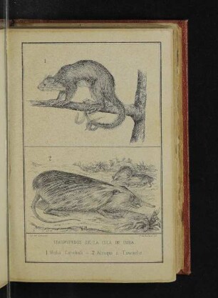
Cuadrupedos de la isla de Cuba.
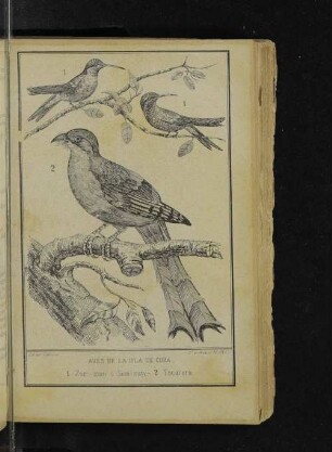
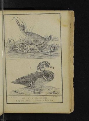
Aves de la isla de Cuba.
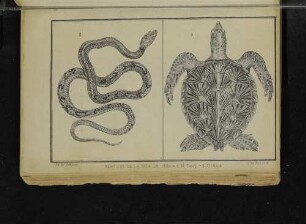
Reptiles de la isla de Cuba

Posesiones De America : Isla De Cuba
Aves de la isla de Cuba.

Carta Maritima De La Isla De Cuba : Que Comprehende Las Jurisdicciones De Filipina, la Havanna, las quatro Villas, la de la Villa del Puerto del Principe, el Bayamo, y la de la Ciudad de Cuba
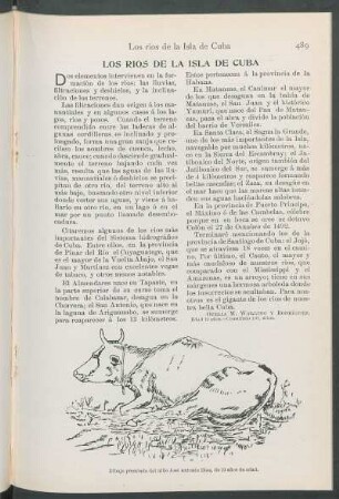
Los ríos de la Isla de Cuba.
Capítulo IV - Carta de Cuba
Capítulo XV - Carta de Cuba
Como se formo la isla de Cuba
La isla de Cuba.
Biografia de una isla : (Cuba)
Cuadrupedos de la isla de Cuba.
Aves de la isla de Cuba.
Reptiles de la isla de Cuba
Posesiones De America : Isla De Cuba
Aves de la isla de Cuba.
Carta Maritima De La Isla De Cuba : Que Comprehende Las Jurisdicciones De Filipina, la Havanna, las quatro Villas, la de la Villa del Puerto del Principe, el Bayamo, y la de la Ciudad de Cuba
Los ríos de la Isla de Cuba.
Capítulo IV - Carta de Cuba
Capítulo XV - Carta de Cuba