- Alternative title
-
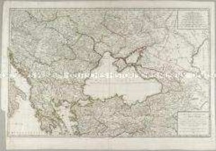
Carte de la/ PRUSSE OCCIDENTALE/ où font tracées les PROVINCES/ cédées par la POLOGNE/ au ROI DE PRUSSE./ Suivant l'Exemplaire/ HOMANIEN de l'an 1775./ À VENISE/ Par P. Santini/ 1776
- Location
-
Deutsches Historisches Museum, Berlin
- Inventory number
-
Do 2002/139
- Measurements
-
Höhe x Breite: 50,5 x 69,5 cm (Blatt), Höhe x Breite: 46 x 65,8 cm (Platte)
- Material/Technique
-
Papier, Kupferstich
- Classification
-
Kartografie (Gattung)
- Subject (what)
-
Westpreußen
- Event
-
Herstellung
- (who)
-
Kartograph, Verleger: P. Santini
- (where)
-
Venedig, Italien [historisch: Republik Venedig]
- (when)
-
1776
- Rights
-
Deutsches Historisches Museum
- Last update
-
24.03.2023, 9:31 AM CET
Data provider
This object is provided by:
Stiftung Deutsches Historisches Museum. If you have any questions about the object, please contact the data provider.
Stiftung Deutsches Historisches Museum. If you have any questions about the object, please contact the data provider.
Object type
- Regionalkarte
Associated
- Kartograph, Verleger: P. Santini
Time of origin
- 1776
Other Objects (12)
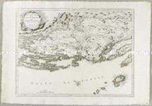
Nouvelle Carte de la Partie Occidentale de Dalmatie

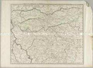
La Prusse
La Prusse
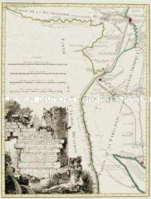
Carte de la Babylonie
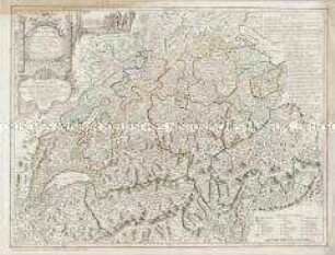
Carte de la Suisse
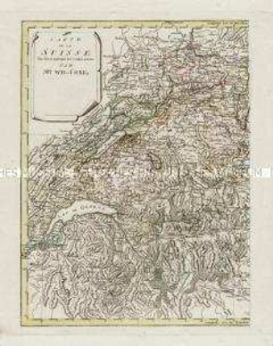
Carte de la Suisse
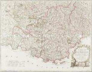
Carte de la Provence
Carte de la Principauté de Halberstadt
Carte du Comté de la Marck
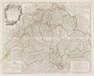
Carte de la Republique des Suisses
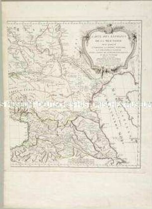
Carte des environs de la Mer-Noire
Carte des environs de la Mer-Noire
Nouvelle Carte de la Partie Occidentale de Dalmatie
La Prusse
La Prusse
Carte de la Babylonie
Carte de la Suisse
Carte de la Suisse
Carte de la Provence
Carte de la Principauté de Halberstadt
Carte du Comté de la Marck
Carte de la Republique des Suisses
Carte des environs de la Mer-Noire
Carte des environs de la Mer-Noire
Nouvelle Carte de la Partie Occidentale de Dalmatie
La Prusse
La Prusse
Carte de la Babylonie
Carte de la Suisse
Carte de la Suisse
Carte de la Provence
Carte de la Principauté de Halberstadt
Carte du Comté de la Marck
Carte de la Republique des Suisses
Carte des environs de la Mer-Noire