Politisch-Geografische Landkarte
Politisch-geografische Karte von Spanien und Portugal
- Alternative title
-
Spanien und Portugal
- Location
-
Deutsches Historisches Museum, Berlin
- Inventory number
-
Do2 2011/395
- Measurements
-
Höhe x Breite: 93 x 107 cm
- Material/Technique
-
Papier, gedruckt
- Classification
-
Kartografie (Gattung)
- Subject (what)
-
Spanien
Portugal
Frankreich
Marokko
Kolonie
Weltkrieg, 2.
- Event
-
Herstellung
- (who)
-
Verlag: Velhagen & Klasing
- (where)
-
Bielefeld Leipzig, Deutschland [historisch: Deutsches Reich]
- (when)
-
um 1940
- Rights
-
Deutsches Historisches Museum
- Last update
-
24.03.2023, 9:29 AM CET
Data provider
This object is provided by:
Stiftung Deutsches Historisches Museum. If you have any questions about the object, please contact the data provider.
Stiftung Deutsches Historisches Museum. If you have any questions about the object, please contact the data provider.
Object type
- Politisch-Geografische Landkarte
Associated
- Verlag: Velhagen & Klasing
Time of origin
- um 1940
Other Objects (12)
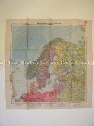
Geografische Karte von Nordeuropa
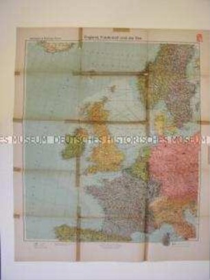
Geografische Karte von Großbritannien und Frankreich
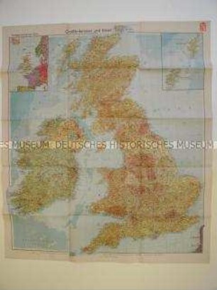
Wirtschafts-geografische Karte von Großbritannien und Irland

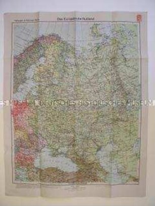
Politisch-geografische Karte des europäischen Teils der Sowjetunion
Geografische Karte des europäischen Teils der UdSSR
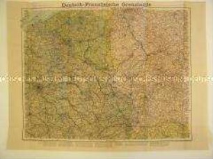
Geografische Karte des Grenzgebietes zwischen Deutschland und Frankreich

Karte von Frankreich
Politisch-administrative Karte von Europa
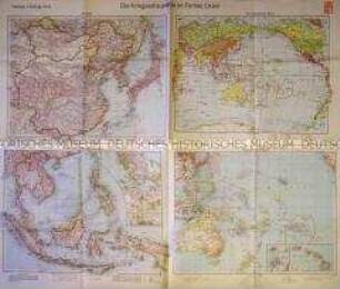
Karten der Kriegsschauplätze im Fernen Osten
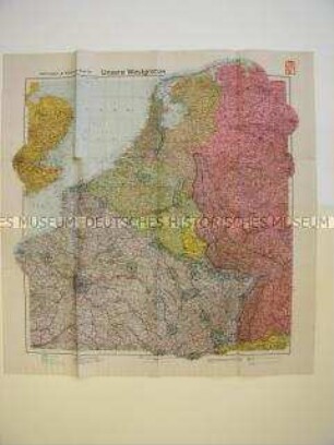
Geographische Karte von Westeuropa mit militärstrategischen Angaben
Karte des Deutschen Reiches und seiner Nachbarstaaten
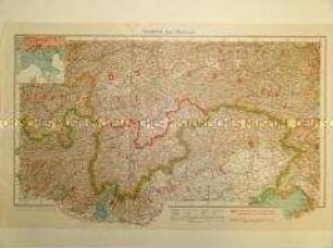
Karte von Südtirol und Venetien mit eingezeichneter Sprachgrenze
Geografische Karte von Nordeuropa
Geografische Karte von Großbritannien und Frankreich
Wirtschafts-geografische Karte von Großbritannien und Irland
Politisch-geografische Karte des europäischen Teils der Sowjetunion
Geografische Karte des europäischen Teils der UdSSR
Geografische Karte des Grenzgebietes zwischen Deutschland und Frankreich
Karte von Frankreich
Politisch-administrative Karte von Europa
Karten der Kriegsschauplätze im Fernen Osten
Geographische Karte von Westeuropa mit militärstrategischen Angaben
Karte des Deutschen Reiches und seiner Nachbarstaaten