Karten / Pläne
Bad Driburg (Bad Driburg) Stadtplan mit Bebauungsplan 1938 1 : 5000 60 x 58 Pause Gauleitung Westfalen Nord Bauamt für Volkswohlfahrt Nr. 53
- Former reference number
-
Gauleitung Westf.Nord Volkswohlfahrt 53
- Further information
-
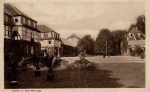
Ort: Bad Driburg, Bad Driburg
- Context
-
Karten A (Allgemein) >> 1. Topographische Karte, Übersichtskarten >> 1.5. Stadt-/ Ortspläne
- Holding
-
W 051 Karten A (Allgemein)
- Indexbegriff subject
-
Bebauungsplan, Stadtplan, Bad Driburg, 1938
- Indexentry place
-
Bad Driburg, Bad Driburg
Bad Driburg, Stadtplan mit Bebauungsplan, 1938
- Provenance
-
Sammlungsregistraturbildner
- Date of creation
-
1938
- Other object pages
- Delivered via
- Last update
-
23.06.2025, 9:18 AM CEST
Data provider
This object is provided by:
Landesarchiv Nordrhein-Westfalen. Abteilung Westfalen. If you have any questions about the object, please contact the data provider.
Landesarchiv Nordrhein-Westfalen. Abteilung Westfalen. If you have any questions about the object, please contact the data provider.
Object type
- Karten / Pläne
Associated
- Sammlungsregistraturbildner
Time of origin
- 1938
Other Objects (12)

Bad Driburg, Bahnhof Bad Driburg
Bad Driburg, Bahnmeisterei Bad Driburg
Bad Driburg, Postamt Bad Driburg
Bad Driburg
Bad Driburg
Bad Driburg
Bad Driburg
Bad Driburg
Bad Driburg

Bad Driburg
Bad Driburg
Bad Driburg
Bad Driburg, Bahnhof Bad Driburg
Bad Driburg, Bahnmeisterei Bad Driburg
Bad Driburg, Postamt Bad Driburg
Bad Driburg
Bad Driburg
Bad Driburg
Bad Driburg
Bad Driburg
Bad Driburg
Bad Driburg
Bad Driburg
Bad Driburg
Bad Driburg, Bahnhof Bad Driburg
Bad Driburg, Bahnmeisterei Bad Driburg
Bad Driburg, Postamt Bad Driburg
Bad Driburg
Bad Driburg
Bad Driburg
Bad Driburg
Bad Driburg
Bad Driburg
Bad Driburg
Bad Driburg