Karte / Plan
Schottland Übersichtskarte Magnae Britanniae pars septentrionalis qua regnum Scotiae in suas partes et subjacentes insulas divisum (1.H. 18.Jh.) 10 dt. Meilen = 7,8 cm 55,5 x 46 kol. Stich Johann Baptist Homann, Nürnberg B Nr. 320a
- Former reference number
-
B 320a
- Further information
-
Ort: Königreich Schottland
- Context
-
Karten A (Allgemein) >> 1. Topographische Karte, Übersichtskarten >> 1.2. Übersichtskarten >> 1.2.2. einzelne Orte
- Holding
-
W 051 Karten A (Allgemein)
- Indexentry place
-
Königreich Schottland
Schottland, Übersicht, 1725
- Date of creation
-
1725
- Other object pages
- Provenance
-
Sammlungsregistraturbildner
- Delivered via
- Last update
-
05.11.2025, 4:25 PM CET
Data provider
This object is provided by:
Landesarchiv Nordrhein-Westfalen. Abteilung Westfalen. If you have any questions about the object, please contact the data provider.
Landesarchiv Nordrhein-Westfalen. Abteilung Westfalen. If you have any questions about the object, please contact the data provider.
Object type
- Karten / Pläne
Time of origin
- 1725
Other Objects (12)
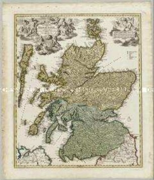
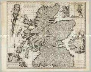
Magnae Britanniae Pars Septentrionalis qua Regnum Scotiae in Suas Partes et subjacentes Insulas divisum Accurata Tabula

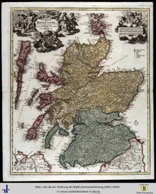
Magnae Britanniae Pars Septentrionalis qua Regnum Scotiae
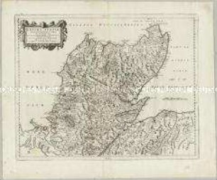
Extima Scotiae Septentrionalis Ora

Großbritannien "MAGNAE BRITTANNIAE PARS SEPTENTRIONALIS QUA REGNUM SCOTIAE..."

Descriptio Britanniae, Scotiae, Hyberniae et Orchadum

Magnae Brittaniae pars septentrionalis qua Regnum Scotia in suas partes et subjcentes Insulas divisum ; Accurata Tabula ex archetypo Vischeriano desumta
Magnae Britanniae pars septentrionales qua Regnum Scotiae
Magna Britanniae Pars Septentrionalis qua Regnum Scotiae in Suas Partes et subiacentes Insulas devisum Accurata Tabula ex archetypo Vischeriano desumpta exhibetur imitatore Iohann. Bapt. Homanno Noribergae Karte des Königreichs Schottland Zeichner: Johann Baptist Homann (Laufzeit erschlossen)
Novissima Regni Scotiae Septentrionalis et Meridionalis Tabula. Mit einer Nebenkarte: Orcades Insulae
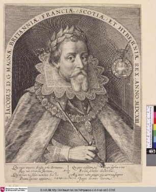
Jacobus D. G Magnae Britanniae / Franciae / Scotiae / et Hyberniae Rex
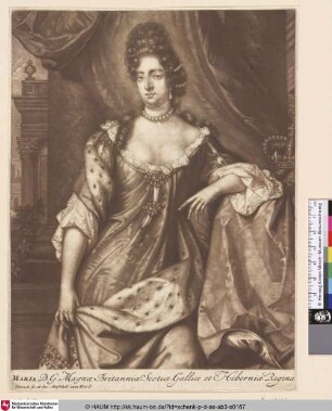
Maria D. G. Magnae Britanniae, Scotiae, Galliae et Hiberniae Regina
Novus Orbis sive America Meridionalis et Septentrionalis per sua Regna, Provincia et Insulas. [Südamerika, Nordamerika]
Magnae Britanniae Pars Septentrionalis qua Regnum Scotiae in Suas Partes et subjacentes Insulas divisum Accurata Tabula
Magnae Britanniae Pars Septentrionalis qua Regnum Scotiae
Extima Scotiae Septentrionalis Ora
Großbritannien "MAGNAE BRITTANNIAE PARS SEPTENTRIONALIS QUA REGNUM SCOTIAE..."
Descriptio Britanniae, Scotiae, Hyberniae et Orchadum
Magnae Brittaniae pars septentrionalis qua Regnum Scotia in suas partes et subjcentes Insulas divisum ; Accurata Tabula ex archetypo Vischeriano desumta
Magnae Britanniae pars septentrionales qua Regnum Scotiae
Magna Britanniae Pars Septentrionalis qua Regnum Scotiae in Suas Partes et subiacentes Insulas devisum Accurata Tabula ex archetypo Vischeriano desumpta exhibetur imitatore Iohann. Bapt. Homanno Noribergae Karte des Königreichs Schottland Zeichner: Johann Baptist Homann (Laufzeit erschlossen)
Novissima Regni Scotiae Septentrionalis et Meridionalis Tabula. Mit einer Nebenkarte: Orcades Insulae
Jacobus D. G Magnae Britanniae / Franciae / Scotiae / et Hyberniae Rex
Maria D. G. Magnae Britanniae, Scotiae, Galliae et Hiberniae Regina