- Alternative title
-
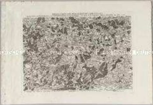
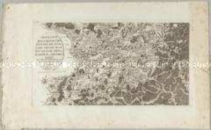
SPECIAL CARTE DES RHEIN LAUFES VON STRASBURG BIS NACH LAUTERBURG NEBST DEN ANGRAENZENDEN GEGENDEN VON BEIDEN UFERN DESSELBEN 1797
- Location
-
Deutsches Historisches Museum, Berlin
- Inventory number
-
Do 2006/978
- Measurements
-
Höhe x Breite: 33,5 x 50,3 cm (Blatt)
Höhe x Breite: 28,3 x 38,3 cm (Karte)
- Material/Technique
-
Papier, Kupferstich
- Classification
-
Kartografie (Gattung)
- Subject (what)
-
Rhein
Oberrhein
- Event
-
Herstellung
- (who)
-
Landvermesser, Kartograf: Peter Dewarat
Stecher, Kartograf, Verleger: Johann Georg Klinger
Verlag: Schwan und Götz
- (where)
-
Mannheim Nürnberg, Deutschland
- (when)
-
1797
- Rights
-
Deutsches Historisches Museum
- Last update
-
24.03.2023, 9:29 AM CET
Data provider
This object is provided by:
Stiftung Deutsches Historisches Museum. If you have any questions about the object, please contact the data provider.
Stiftung Deutsches Historisches Museum. If you have any questions about the object, please contact the data provider.
Object type
- Flusskarte
Associated
- Landvermesser, Kartograf: Peter Dewarat
- Stecher, Kartograf, Verleger: Johann Georg Klinger
- Verlag: Schwan und Götz
Time of origin
- 1797
Other Objects (12)

Special Carte des Rhein Laufes von Lauterburg bis Speyer
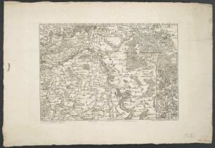
Special-Carte von der Gegend des Lahn Flusses
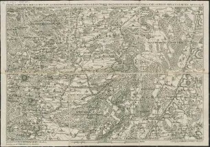
Special-Carte des Rhein-Laufes von Lauterburg bis Speyer : nebst den angraentzenden Gegenden von beiden Ufern bis an die Gebirge
Special-Carte Von Der Gegend Des Lahn-Flusses. von Giesen bis nächst Lahnstein
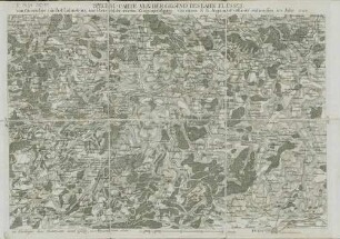
Special-Carte Des Rheinlaufes Von Speier Bis Bingen Nebst Den Angraentzenden Gegenden Von Beiden Ufern Bis An Die Gebirge
Special Carte der Laender zwischen dem Rhein, der Mosel, Nahe und Saar bis an das Vogesische Gebirge, Hundsruck und Westrich genannt
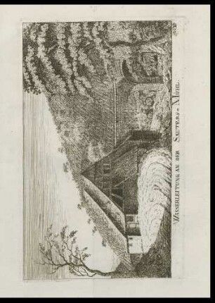
Sautersmühle
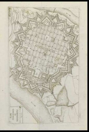
Stadtplan Mannheim mit Wasserleitung
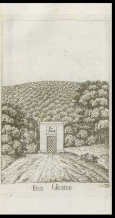
Pius Quelle
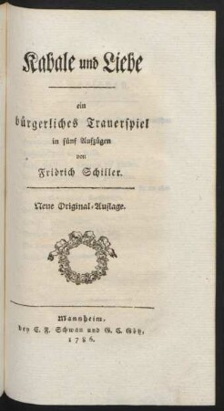
Kabale und Liebe
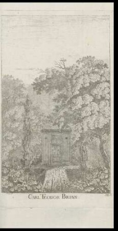
Karl Theodor-Brunnen
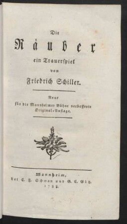
Die Räuber
Special Carte des Rhein Laufes von Lauterburg bis Speyer
Special-Carte von der Gegend des Lahn Flusses
Special-Carte des Rhein-Laufes von Lauterburg bis Speyer : nebst den angraentzenden Gegenden von beiden Ufern bis an die Gebirge
Special-Carte Von Der Gegend Des Lahn-Flusses. von Giesen bis nächst Lahnstein
Special-Carte Des Rheinlaufes Von Speier Bis Bingen Nebst Den Angraentzenden Gegenden Von Beiden Ufern Bis An Die Gebirge
Special Carte der Laender zwischen dem Rhein, der Mosel, Nahe und Saar bis an das Vogesische Gebirge, Hundsruck und Westrich genannt
Sautersmühle
Stadtplan Mannheim mit Wasserleitung
Pius Quelle
Kabale und Liebe
Karl Theodor-Brunnen