Karte / Plan
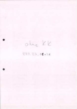
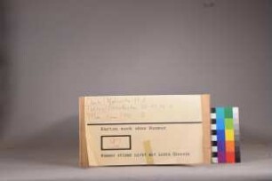
Westfalen topographische Karte Blatt 14 Hannover, Braunschweig, Lippe, Schaumburg, Minden, Ravensberg, Paderborn, Corvey, Pyrmont (1805) 1959 48 x 77 1 : 100 000 Nachdruck Generalmajor von LeCoq B Nr. 26
- Former reference number
-
B 26
- Further information
-
Ort: Westfalen
- Context
-
Karten A (Allgemein) >> 1. Topographische Karte, Übersichtskarten >> 1.1. Geographische, topographische Karten
- Holding
-
W 051 Karten A (Allgemein)
- Indexentry place
-
Westfalen
Braunschweig, topographische Karte s. Westfalen, 1959
Corvey, topographische Karte s. Westfalen, 1959
Hannover, topographische Karte s. Westfalen, 1959
Lippe, topographische Karte s. Westfalen, 1959
Minden, topographische Karte s. Westfalen, 1959
Paderborn, topographische Karte s. Westfalen, 1959
Pyrmont, topographische Karte s. Westfalen, 1959
Ravensberg, topographische Karte s. Westfalen, 1959
Schaumburg, topographische Karte s. Westfalen, 1959
Westfalen, topographische Karte, Übersicht, 1959
- Date of creation
-
1959
- Other object pages
- Provenance
-
Sammlungsregistraturbildner
- Delivered via
- Last update
-
17.09.2025, 2:39 PM CEST
Data provider
This object is provided by:
Landesarchiv Nordrhein-Westfalen. Abteilung Westfalen. If you have any questions about the object, please contact the data provider.
Landesarchiv Nordrhein-Westfalen. Abteilung Westfalen. If you have any questions about the object, please contact the data provider.
Object type
- Karten / Pläne
Time of origin
- 1959
Other Objects (12)

Lecoq (le Coq)
LeCoq Turkestan
LeCoq Turkestan
LeCoq : ein sächsisches Soldatenleben
Korrespondenz des Barons de Gaultier mit LeCoq zu London
![Lettres de Son Excellence Monseigneur le Comte de Manteuffel à Monseigneur LeCoq à Londres [Briefe Seiner Exzellenz Graf von Manteuffel an Herrn LeCoq in London]](https://iiif.deutsche-digitale-bibliothek.de/image/2/c54a73fd-39e4-40a6-8298-241d3f9fccce/full/!306,450/0/default.jpg)
Lettres de Son Excellence Monseigneur le Comte de Manteuffel à Monseigneur LeCoq à Londres [Briefe Seiner Exzellenz Graf von Manteuffel an Herrn LeCoq in London]
Korrespondenz des Grafen von Manteuffel mit LeCoq zu London, Bd. 1
Korrespondenz des Grafen von Manteuffel mit LeCoq zu London, Bd. 4
Korrespondenz des Grafen von Manteuffel mit LeCoq zu London, Bd. 3

Korrespondenz des Grafen von Manteuffel mit LeCoq zu London, Bd. 2
Korrespondenz zwischen dem Grafen von Manteuffel und LeCoq zu London, Bd. 7a
Korrespondenz zwischen dem Grafen von Manteuffel und LeCoq zu London, Bd. 7b
Lecoq (le Coq)
LeCoq Turkestan
LeCoq Turkestan
LeCoq : ein sächsisches Soldatenleben
Korrespondenz des Barons de Gaultier mit LeCoq zu London
Lettres de Son Excellence Monseigneur le Comte de Manteuffel à Monseigneur LeCoq à Londres [Briefe Seiner Exzellenz Graf von Manteuffel an Herrn LeCoq in London]
Korrespondenz des Grafen von Manteuffel mit LeCoq zu London, Bd. 1
Korrespondenz des Grafen von Manteuffel mit LeCoq zu London, Bd. 4
Korrespondenz des Grafen von Manteuffel mit LeCoq zu London, Bd. 3
Korrespondenz des Grafen von Manteuffel mit LeCoq zu London, Bd. 2
Korrespondenz zwischen dem Grafen von Manteuffel und LeCoq zu London, Bd. 7a