- Alternative title
-
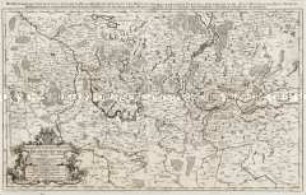
Das Hertzogthum Pommern. / Wie es theils der Cron / Schweden, theils der Chür=Branden= / burg zugehörig. ans Liecht ge=
- Location
-
Deutsches Historisches Museum, Berlin
- Inventory number
-
Do 2006/522
- Measurements
-
Höhe x Breite: 61,2 x 96,8 cm (Blatt)
Höhe x Breite: 48,9 x 83,5 cm (Karte)
Höhe x Breite: 53,8 x 86,3 cm (Platte)
- Material/Technique
-
Papier, Kupferstich
- Classification
-
Kartografie (Gattung)
- Subject (what)
-
Pommern
Brandenburg
Mecklenburg-Vorpommern
Polen
- Event
-
Herstellung
- (who)
-
Verleger: Johann Hoffmann
Geograph, Kartograf: Guillaume Sanson
- (where)
-
Nürnberg, Deutschland
- (when)
-
um 1700
- Rights
-
Deutsches Historisches Museum
- Last update
-
24.03.2023, 9:28 AM CET
Data provider
This object is provided by:
Stiftung Deutsches Historisches Museum. If you have any questions about the object, please contact the data provider.
Stiftung Deutsches Historisches Museum. If you have any questions about the object, please contact the data provider.
Object type
- Regionalkarte
Associated
- Verleger: Johann Hoffmann
- Geograph, Kartograf: Guillaume Sanson
Time of origin
- um 1700
Other Objects (12)
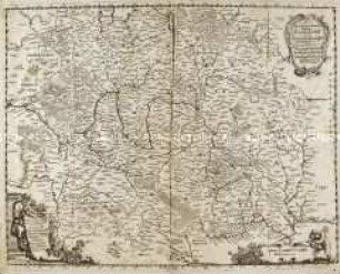
Das Marggraf= und Churfurstenthum Brandenburg
Grundrichtiger Entwurff des gantzen Franckenlandes / Totius Franconiae accurata descriptio
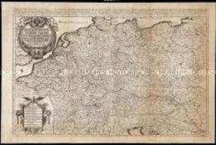
Das heyl. Römische Reich Teutscher Nation Worinnen begriffen desselben Chur- und Fürstenthümber, auch Länder sampt einen Theil von desselben angrentzenden Königreichen und Provinzien
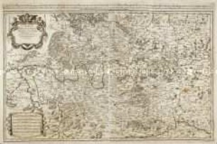
Circulus Franconiae
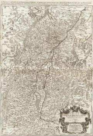
L'Alsace divisée en ses principales Parties.

Ansiedlungsgesuch des Johann Hoffmann, Inwohners in der Gemeinde Möslberg (LG Wegscheid)
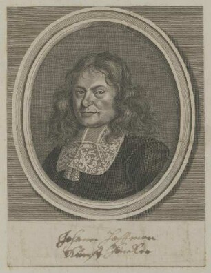
Bildnis des Johann Hoffmann
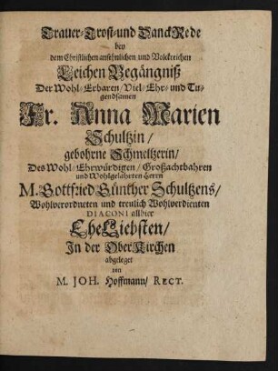
Trauer- Trost- und DanckRede bey dem ... LeichenBegängniß Der ... Anna Marien Schultzin/ gebohrne Schmeltzerin/ Des ... Gottfried Günther Schultzens ... Diaconi allhier EheLiebsten

Kurtze Relation und Entwurff, der Röm: Käyserl. Mayest: LEOPOLDI, Zu Nürnberg gehaltenen Einzugs, geschehen den 6. (16.) Augusti. Im Jahr Christi. 1658.
Gaststättenkonzessionen in der Gemeinde Hallstadt (Johann Hoffmann, Hs.Nr. 15)
Bau einer Brücke über die Aufseß durch Johann Hoffmann in Königsfeld
Konzessionsgesuch und Verehelichungsgesuch des Nagelschmiedgesellen Johann Hoffmann von Pleofen nach Thurnau
Das Marggraf= und Churfurstenthum Brandenburg
Grundrichtiger Entwurff des gantzen Franckenlandes / Totius Franconiae accurata descriptio
Das heyl. Römische Reich Teutscher Nation Worinnen begriffen desselben Chur- und Fürstenthümber, auch Länder sampt einen Theil von desselben angrentzenden Königreichen und Provinzien
Circulus Franconiae
L'Alsace divisée en ses principales Parties.
Ansiedlungsgesuch des Johann Hoffmann, Inwohners in der Gemeinde Möslberg (LG Wegscheid)
Bildnis des Johann Hoffmann
Trauer- Trost- und DanckRede bey dem ... LeichenBegängniß Der ... Anna Marien Schultzin/ gebohrne Schmeltzerin/ Des ... Gottfried Günther Schultzens ... Diaconi allhier EheLiebsten
Kurtze Relation und Entwurff, der Röm: Käyserl. Mayest: LEOPOLDI, Zu Nürnberg gehaltenen Einzugs, geschehen den 6. (16.) Augusti. Im Jahr Christi. 1658.
Gaststättenkonzessionen in der Gemeinde Hallstadt (Johann Hoffmann, Hs.Nr. 15)
Bau einer Brücke über die Aufseß durch Johann Hoffmann in Königsfeld