- Alternativer Titel
-
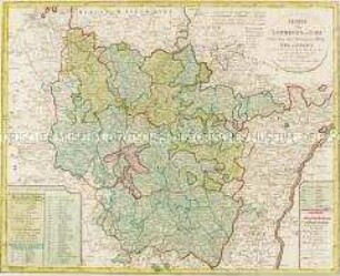
CHARTE / von der / ALTEN MARK / Nach einer neuen astronomischen Be-
- Standort
-
Deutsches Historisches Museum, Berlin
- Inventarnummer
-
Do 2006/505
- Maße
-
Höhe x Breite: 58,5 x 68,2 cm (Blatt)
Höhe x Breite: 45 x 45,4 cm (Karte)
Höhe x Breite: 48,5 x 49,3 cm (Platte)
- Material/Technik
-
Druckfarbe, Papier, Kupferstich, koloriert
- Klassifikation
-
Kartografie (Gattung)
- Bezug (was)
-
Altmark
Brandenburg
- Ereignis
-
Herstellung
- (wer)
-
Kartograf: Franz Ludwig Güssefeld
Verlag: Homannsche Erben
- (wo)
-
Nürnberg, Deutschland
- (wann)
-
1796
- Rechteinformation
-
Deutsches Historisches Museum
- Letzte Aktualisierung
-
24.03.2023, 09:29 MEZ
Datenpartner
Dieses Objekt wird bereitgestellt von:
Stiftung Deutsches Historisches Museum. Bei Fragen zum Objekt wenden Sie sich bitte an den Datenpartner.
Stiftung Deutsches Historisches Museum. Bei Fragen zum Objekt wenden Sie sich bitte an den Datenpartner.
Objekttyp
- Regionalkarte
Beteiligte
- Kartograf: Franz Ludwig Güssefeld
- Verlag: Homannsche Erben
Entstanden
- 1796
Ähnliche Objekte (12)

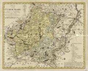
Charte von der Ucker Mark

Tabula Geographica Totam Borussiam ut et Districtum Notecensem. Mit einer Nebenkarte: Charte welche den Netz District vorstellet
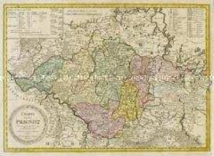
Charte von der Prignitz
Charte von der Uckermark
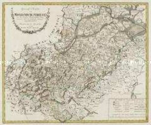
Special Charte von Mecklenburg Strelitz
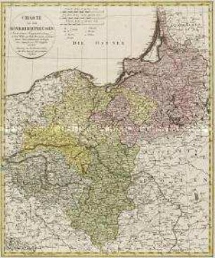
Charte von dem Königreich Preussen
Charte von Lothringen und Barr
Charte von Schwaben Und Den Angränzenden Ländern
Tabula Geographica Campaniae. Mit zwei Nebenkarten: Reims und Troyes
Pläne der kanadischen Städte Louisburg, Québec und Halifax unter französischer und englischer Herrschaft
Repraesentatio Geographica Circuli Egerani
La Comtè de Glatz
Charte von der Ucker Mark
Tabula Geographica Totam Borussiam ut et Districtum Notecensem. Mit einer Nebenkarte: Charte welche den Netz District vorstellet
Charte von der Prignitz
Charte von der Uckermark
Special Charte von Mecklenburg Strelitz
Charte von dem Königreich Preussen
Charte von Lothringen und Barr
Charte von Schwaben Und Den Angränzenden Ländern
Tabula Geographica Campaniae. Mit zwei Nebenkarten: Reims und Troyes
Pläne der kanadischen Städte Louisburg, Québec und Halifax unter französischer und englischer Herrschaft
Repraesentatio Geographica Circuli Egerani