Altkarte
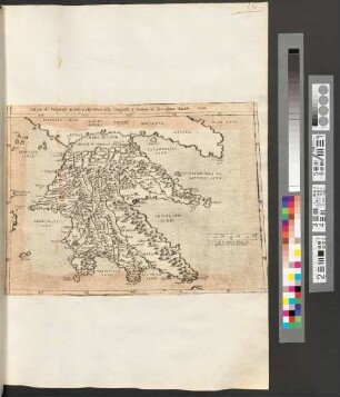
Disegno particolare de parte d'Italia, secondo la descritione della geografia di strabone la quale non s'a potesto desciuerla nel disegno dell'italia ch' e nel fine del sesto libro ma per magior lucidatione di quelle ch' a descritto strabone nel quinto libro suo s'a fatto questa tauola iiii
- Location
-
München, Bayerische Staatsbibliothek -- 2 Mapp. 464
- Dimensions
-
36 x 24 cm
- Extent
-
1 Kt.
- Language
-
Italienisch
- Notes
-
Kupferst.
Maßstab in graph. Form (Stadi di strabone, Miglia d'italia). - Literatur in Meurer, Peter H.: The Strabo Illustratus Atlas ; 1545-1571
- Bibliographic citation
-
Cosmografia Universale ; [25]
- Keyword
-
Latium
Toskana
Kampanien
- URN
-
urn:nbn:de:bvb:12-bsb00092383-1
- Last update
-
16.04.2025, 8:51 AM CEST
Data provider
This object is provided by:
Bayerische Staatsbibliothek. If you have any questions about the object, please contact the data provider.
Bayerische Staatsbibliothek. If you have any questions about the object, please contact the data provider.
Object type
- Altkarte
Associated
Time of origin
- [ca. 1560]
Other Objects (12)
Nel Nome d'Italia
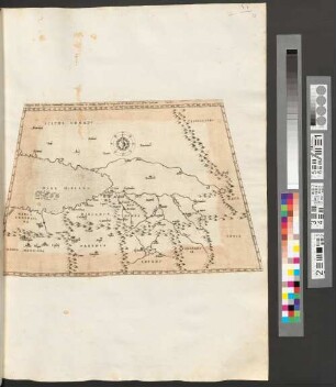
Disegno del Peloponeso secondo la descrittione della Geografia di Strabone nel libro ottauo Tauola VIIII

Disegno della germania, secondo la descrittione della geografia di strabone nel Libro settimo, Tavola V
Disegno della Gallia secondo la descrittione della Geografia di Strabone, nel libro Quarto Tavola II
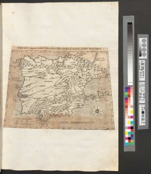
Disegno della Spagna, secondo la descritione della Geografia di strabone, nel libro Terzo Tauola I.
Frammenti Di Ornati Per Li Giovani Principianti Nel Disegno
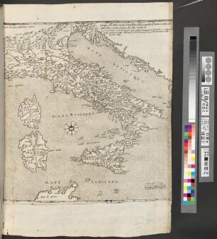
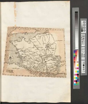
Disegno dell'italia secondo la descrittione della Geografia di strabone, nel fine del quarto libro, e sequita il quinto, et il sesto, Tavola iiii
Disegno della Sogdiana, Battriana, Hircania, Parthia, et Media, Secondo la Geografia di Strabone, nel Libro Undecimo : Tavola
![10: L' Accademia del disegno nel decennio 1805-1815, [2]](https://iiif.deutsche-digitale-bibliothek.de/image/2/fbb402a3-41f0-4291-92ce-3806b0c0d469/full/!306,450/0/default.jpg)
10: L' Accademia del disegno nel decennio 1805-1815, [2]
![10: L' Accademia del disegno nel decennio 1805-1815, [1]](https://iiif.deutsche-digitale-bibliothek.de/image/2/5742180f-c21c-410e-8349-13a243101840/full/!306,450/0/default.jpg)
10: L' Accademia del disegno nel decennio 1805-1815, [1]
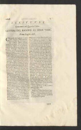
Scritture Contenute nel Quarto Libro.
Scritture contenute nel Libro Secondo.
Nel Nome d'Italia
Disegno del Peloponeso secondo la descrittione della Geografia di Strabone nel libro ottauo Tauola VIIII
Disegno della germania, secondo la descrittione della geografia di strabone nel Libro settimo, Tavola V
Disegno della Gallia secondo la descrittione della Geografia di Strabone, nel libro Quarto Tavola II
Disegno della Spagna, secondo la descritione della Geografia di strabone, nel libro Terzo Tauola I.
Frammenti Di Ornati Per Li Giovani Principianti Nel Disegno
Disegno dell'italia secondo la descrittione della Geografia di strabone, nel fine del quarto libro, e sequita il quinto, et il sesto, Tavola iiii
Disegno della Sogdiana, Battriana, Hircania, Parthia, et Media, Secondo la Geografia di Strabone, nel Libro Undecimo : Tavola
10: L' Accademia del disegno nel decennio 1805-1815, [2]
10: L' Accademia del disegno nel decennio 1805-1815, [1]
Scritture Contenute nel Quarto Libro.