- Alternative title
-
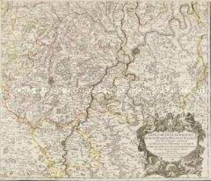
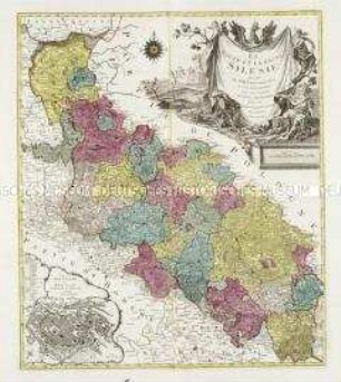
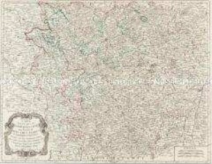
LE DUCHÉ DE / SILESIE / Tel quil est suivant l'Etat present / Par Tob. Maïer
- Location
-
Deutsches Historisches Museum, Berlin
- Inventory number
-
Do 2006/530
- Measurements
-
Höhe x Breite: 57,8 x 79 cm (Blatt)
Höhe x Breite: 44 x 52,8 cm (Karte)
Höhe x Breite: 50 x 58,3 cm (Platte)
- Material/Technique
-
Druckfarbe, Papier, Kupferstich, grenzkoloriert
- Classification
-
Kartografie (Gattung)
- Subject (what)
-
Schlesien
Polen
- Event
-
Herstellung
- (who)
-
Geograph, Kartograf, Astronom: Johann Tobias Mayer
Verleger: ? Basset
- (where)
-
Nürnberg, Deutschland
- (when)
-
1777
- Rights
-
Deutsches Historisches Museum
- Last update
-
24.03.2023, 9:28 AM CET
Data provider
This object is provided by:
Stiftung Deutsches Historisches Museum. If you have any questions about the object, please contact the data provider.
Stiftung Deutsches Historisches Museum. If you have any questions about the object, please contact the data provider.
Object type
- Regionalkarte
Associated
- Geograph, Kartograf, Astronom: Johann Tobias Mayer
- Verleger: ? Basset
Time of origin
- 1777
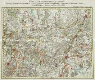
Other Objects (12)
Le Duché de Luxembourg
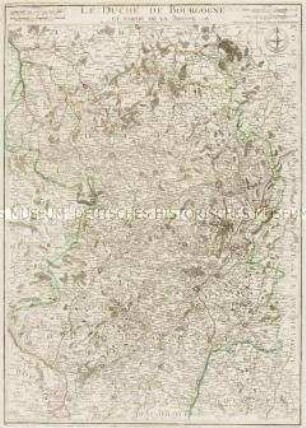
Le Duché de Bourgogne
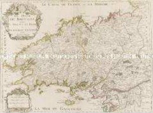
Le Duché de Bretagne
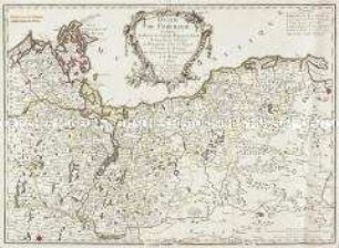
Duché de Pomeranie
Duché de Savoye
Grand Atlas . Bl. 44 (Böhmen, Schlesien): Contenant une Partie de la Royaume du Boheme Scavoir les Cercles de Königgraetz, et Chrudim, le Comte de Glatz, et une Partie du Duchè de la Silesie
Grand Atlas . Bl. 79 (Kärnten): Contenant le Duché de Carinthie Superieur et Inferieur et une Partie du Duché de Carniole
La Haute Et La Basse Silesie. Mit einem Stadtplan: La Ville Capitale de Breslau
Carte des Duchés de Lorraine et Bar
Grand Atlas . Bl. 29 (Brabant, Jülich, Geldern, Limburg, Liége): Contenant le Duché de Brabant, une Partie des Duchés de Iuliers, de Gueldre, de Limbourg, de l'Eveché de Liége et et
Grand Atlas . Bl. 71 (Österreich, Steiermark): Contenant une Partie de l'Arche Duché d'Autrüche et du Duché de Stirie
Grand Atlas , Bl. 8 (Pommern, Neumark) : Contenant le Duché de Pomeranie et ûne Partie de la Nouv. Marche.
Le Duché de Luxembourg
Le Duché de Bourgogne
Le Duché de Bretagne
Duché de Pomeranie
Duché de Savoye
Grand Atlas . Bl. 44 (Böhmen, Schlesien): Contenant une Partie de la Royaume du Boheme Scavoir les Cercles de Königgraetz, et Chrudim, le Comte de Glatz, et une Partie du Duchè de la Silesie
Grand Atlas . Bl. 79 (Kärnten): Contenant le Duché de Carinthie Superieur et Inferieur et une Partie du Duché de Carniole
La Haute Et La Basse Silesie. Mit einem Stadtplan: La Ville Capitale de Breslau
Carte des Duchés de Lorraine et Bar
Grand Atlas . Bl. 29 (Brabant, Jülich, Geldern, Limburg, Liége): Contenant le Duché de Brabant, une Partie des Duchés de Iuliers, de Gueldre, de Limbourg, de l'Eveché de Liége et et
Grand Atlas . Bl. 71 (Österreich, Steiermark): Contenant une Partie de l'Arche Duché d'Autrüche et du Duché de Stirie