Regionalkarte
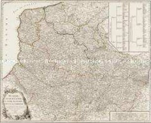
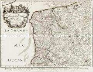
La Flandre, le Hainaut, le Brabant, l'Artois une partie de la Picardie, et du Luxembourg
- Alternative title
-
LA FLANDRE / LE HAINAUT / LE BRABANT / L'ARTOIS
- Location
-
Deutsches Historisches Museum, Berlin
- Inventory number
-
Do 2006/70
- Measurements
-
Höhe x Breite: 56,6 x 73 cm (Blatt)
Höhe x Breite: 47,2 x 60,5 cm (Karte)
Höhe x Breite: 50,2 x 64 cm (Platte)
- Material/Technique
-
Druckfarbe, Papier, Kupferstich, grenzkoloriert
- Classification
-
Kartografie (Gattung)
- Subject (what)
-
Artois
Flandern
Picardie
Hennegau
Frankreich
Belgien
Österreichische Niederlande
- Event
-
Herstellung
- (who)
-
Verlag: Mondhare et Jean
- (where)
-
Paris, Frankreich
- (when)
-
1792
- Rights
-
Deutsches Historisches Museum
- Last update
-
24.03.2023, 9:28 AM CET
Data provider
This object is provided by:
Stiftung Deutsches Historisches Museum. If you have any questions about the object, please contact the data provider.
Stiftung Deutsches Historisches Museum. If you have any questions about the object, please contact the data provider.
Object type
- Regionalkarte
Associated
- Verlag: Mondhare et Jean
Time of origin
- 1792
Other Objects (12)
Picardie, Artois, Boulenois, Flandre Françoise, Haynaut et Cambrésis
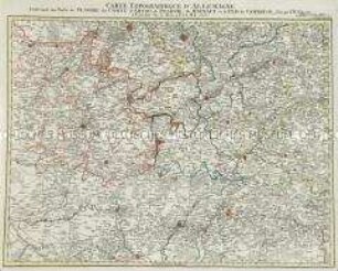
Grand Atlas . Bl. 37 (Flandern...): Contenant une Partie de Flandre, du Comté d'Artois, de Picardie du Haynaut, et le Pais de Cambresis et et
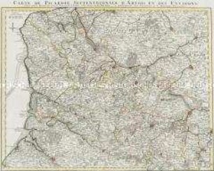
Carte de Picardie Septentrionale D'Artois Et Des Environs / Partie Meridionale de Picardie
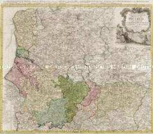
Carte du Gouvernement General De Picardie
Gouvernement General de Picardie (Titel nicht erhalten!)
Grand Atlas . Bl. 46 (Frankreich. Champagne, Picárdie): Contenante une Partie d'Isle de France, de Champagne, de Picardie etc.
Le Marquisat De Haute-Lusace / Le Marquisat De Basse-Lusace
Grand Atlas . Bl. 28 (Belgien, Flandern): Contenant une Partie de Pais Bas Autriches et de Flandre
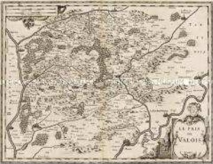
Le Pais de Valois

Le Royaume de Boheme
Le Duché de Luxembourg
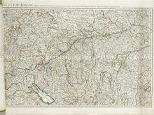
Le cours du Danube
Picardie, Artois, Boulenois, Flandre Françoise, Haynaut et Cambrésis
Grand Atlas . Bl. 37 (Flandern...): Contenant une Partie de Flandre, du Comté d'Artois, de Picardie du Haynaut, et le Pais de Cambresis et et
Carte de Picardie Septentrionale D'Artois Et Des Environs / Partie Meridionale de Picardie
Carte du Gouvernement General De Picardie
Gouvernement General de Picardie (Titel nicht erhalten!)
Grand Atlas . Bl. 46 (Frankreich. Champagne, Picárdie): Contenante une Partie d'Isle de France, de Champagne, de Picardie etc.
Le Marquisat De Haute-Lusace / Le Marquisat De Basse-Lusace
Grand Atlas . Bl. 28 (Belgien, Flandern): Contenant une Partie de Pais Bas Autriches et de Flandre
Le Pais de Valois
Le Royaume de Boheme
Le Duché de Luxembourg