Karte | map
Persien : nach seinem neuesten Zustande in das Oestliche und Westliche Reich eingetheilt

- Extent
-
1 Karte ; 50 x 67 cm
- Language
-
Deutsch
- Notes
-
und entworfen von C. G. Reichard
- Published
-
Weimar : im Verlage des Geographischen Instituts , 1804
- Sponsorship
-
Deutsche Forschungsgemeinschaft
- URN
-
urn:nbn:de:gbv:ha33-1-248081
- Last update
-
10.12.2024, 12:46 PM CET
Data provider
This object is provided by:
Franckesche Stiftungen. If you have any questions about the object, please contact the data provider.
Franckesche Stiftungen. If you have any questions about the object, please contact the data provider.
Object type
- map ; map ; Karte
Time of origin
- Weimar : im Verlage des Geographischen Instituts , 1804
Other Objects (12)

Graven der twee laatste Koningen van Persien
![Berlin nebst Potsdam : Beilage zum Berliner Adressbuch [1926] : [östliche und westliche Hälfte]](https://iiif.deutsche-digitale-bibliothek.de/image/2/e0ae52a7-cfcf-4aba-95d4-846f76df7086/full/!306,450/0/default.jpg)
Berlin nebst Potsdam : Beilage zum Berliner Adressbuch [1926] : [östliche und westliche Hälfte]
![1a: [Westlicher Teil, Hurbach bis Eckmauer]](https://iiif.deutsche-digitale-bibliothek.de/image/2/c4faa76f-9350-40a5-a257-74baca60e7c2/full/!306,450/0/default.jpg)
1a: [Westlicher Teil, Hurbach bis Eckmauer]
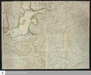
Karte vom Nördlichen Kriegstheater, enthaltend, das Westliche Rusland, ganz Polen und Preussen, nebst Dännemarck, Schweden, und Deutschland zum Theil : Nach der grossen Reymannschen Karte gezeichnet und gestochen im Jahre 1812

Das Herzogthum Ober und Nieder Baiern in seine Aemter oder Gerichter eingetheilt, nebst allen darinn liegenden und angrænzenden Lændern
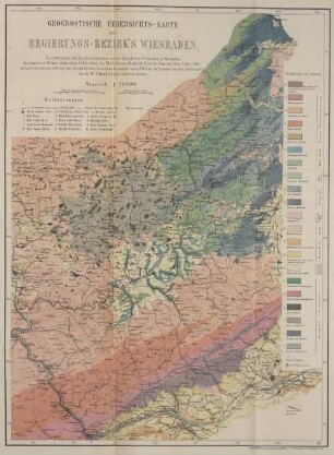
Geognostische Übersichts-Karte des Regierungs-Bezirk's Wiesbaden : Zu statist. Zwecken hrsg. von d. Kgl. Regierung in Wiesbaden
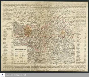
Charte vom Königlich Preussischen Regierungsbezirk Merseburg : nach seiner Eintheilung in 17 Kreise
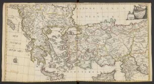
Seconde Feuille Du Theatre De La Guerre Entre Les Russes Et Les Turcs : contenant la Bulgarie la Macedonie la Thracie la Natolie ou petite Asie les Isles de Moree de Candie de Cypre et les autres Isles de l'Archipel avec le reste de la Mer noire et celle de Marmore
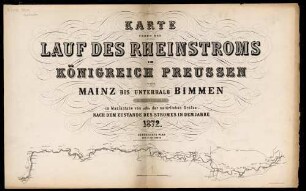
Karte Ueber Den Lauf Des Rheinstroms Im Königreich Preussen : Von Mainz Bis Unterhalb Bimmen ; Nach Dem Zustande Des Stromes In Dem Jahre 1872
Martis Area et Alea per Tractum Rheni, Mosellae, ac Mosae, in qua per plurimos annorum tractus variante eventu saepius certatum

Dauerwaldgelände des Verbandes Groß Berlin
Situations-Plan von Berlin mit dem Weichbilde und Charlottenburg
Graven der twee laatste Koningen van Persien
Berlin nebst Potsdam : Beilage zum Berliner Adressbuch [1926] : [östliche und westliche Hälfte]
1a: [Westlicher Teil, Hurbach bis Eckmauer]
Karte vom Nördlichen Kriegstheater, enthaltend, das Westliche Rusland, ganz Polen und Preussen, nebst Dännemarck, Schweden, und Deutschland zum Theil : Nach der grossen Reymannschen Karte gezeichnet und gestochen im Jahre 1812
Das Herzogthum Ober und Nieder Baiern in seine Aemter oder Gerichter eingetheilt, nebst allen darinn liegenden und angrænzenden Lændern
Geognostische Übersichts-Karte des Regierungs-Bezirk's Wiesbaden : Zu statist. Zwecken hrsg. von d. Kgl. Regierung in Wiesbaden
Charte vom Königlich Preussischen Regierungsbezirk Merseburg : nach seiner Eintheilung in 17 Kreise
Seconde Feuille Du Theatre De La Guerre Entre Les Russes Et Les Turcs : contenant la Bulgarie la Macedonie la Thracie la Natolie ou petite Asie les Isles de Moree de Candie de Cypre et les autres Isles de l'Archipel avec le reste de la Mer noire et celle de Marmore
Karte Ueber Den Lauf Des Rheinstroms Im Königreich Preussen : Von Mainz Bis Unterhalb Bimmen ; Nach Dem Zustande Des Stromes In Dem Jahre 1872
Martis Area et Alea per Tractum Rheni, Mosellae, ac Mosae, in qua per plurimos annorum tractus variante eventu saepius certatum
Dauerwaldgelände des Verbandes Groß Berlin