
- Location
-
Forschungsbibliothek Gotha
- Extent
-
1 Kt, 18 x 24 cm
- Language
-
Deutsch
- Notes
-
Maßstab in graph. Form (Geographische deutsche Meile). - Karte ohne Gradnetz, mit Bergstrichen. - Koordinaten ermittelt im: Smits, Jan: Petermann's Maps, Nr. 11 Druck: Lith. Anst. v. C. Hellfarth in Gotha Karten
- Contributor
- Published
-
Gotha , 1855
- Sponsorship
-
Deutsche Forschungsgemeinschaft
- URN
-
urn:nbn:de:urmel-ad8f4ac9-cf42-435d-898d-3933177f748d2-000028619
- PURL
- Last update
-
14.04.2025, 12:54 PM CEST
Data provider
This object is provided by:
Forschungsbibliothek Gotha der Universität Erfurt. If you have any questions about the object, please contact the data provider.
Forschungsbibliothek Gotha der Universität Erfurt. If you have any questions about the object, please contact the data provider.
Object type
- Karte
Associated
- Forschungsbibliothek Gotha
- Hellfarth, Carl
- Perthes, Bernhardt
- Perthes, Justus
Time of origin
- Gotha , 1855
Other Objects (12)
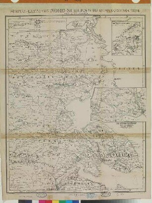
Special-Karte Von Nord-Schleswig
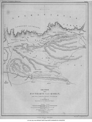
Skizze des Distrikts von Kohat
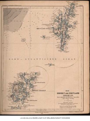
Die Orkney und Shetland Inseln : nach Aufnahmen der Britischen Admiralität und anderen Quellen
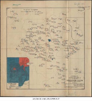
Wahlkarte über das Ergebniss der Reichstagswahlen am 30. Juli 1878 im Herzogthum S. Gotha
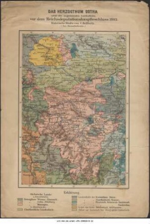
Das Herzogthum Gotha nebst den angrenzenden Landestheilen vor dem Reichsdeputationshauptbeschluss 1803 : historische Studie

Kartenskizze über das Ergebniss der Reichstagswahlen am 10. Januar 1877 im Herzogthum S. Gotha
![[Carl Hellfarth Steindruckerei und Verlagsanstalt] : [Anzeige der Wohnungsänderung und Verlagsverzeichnis]](https://iiif.deutsche-digitale-bibliothek.de/image/2/bc92b172-ca78-47a2-932b-8ec1080baccf/full/!306,450/0/default.jpg)
[Carl Hellfarth Steindruckerei und Verlagsanstalt] : [Anzeige der Wohnungsänderung und Verlagsverzeichnis]
Justus Perthes' Specialkarte der deutsch-französischen Grenzländer von Mainz bis Bern (Aus Stielers 25-Blatt-Karte)
Süd-Schleswig, Holstein, Lauenburg und die umliegenden Gebiete im Maassstabe 1:750.000
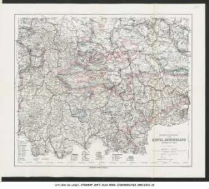
Übersichts-Karte von Mittel-Deutschland : mittlerer Theil
Strassen-Karte der lombardischen Ebene
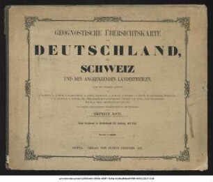
Geognostische Übersichtskarte von Deutschland, der Schweiz und den angrenzenden Ländertheilen
Special-Karte Von Nord-Schleswig
Skizze des Distrikts von Kohat
Die Orkney und Shetland Inseln : nach Aufnahmen der Britischen Admiralität und anderen Quellen
Wahlkarte über das Ergebniss der Reichstagswahlen am 30. Juli 1878 im Herzogthum S. Gotha
Das Herzogthum Gotha nebst den angrenzenden Landestheilen vor dem Reichsdeputationshauptbeschluss 1803 : historische Studie
Kartenskizze über das Ergebniss der Reichstagswahlen am 10. Januar 1877 im Herzogthum S. Gotha
[Carl Hellfarth Steindruckerei und Verlagsanstalt] : [Anzeige der Wohnungsänderung und Verlagsverzeichnis]
Justus Perthes' Specialkarte der deutsch-französischen Grenzländer von Mainz bis Bern (Aus Stielers 25-Blatt-Karte)
Süd-Schleswig, Holstein, Lauenburg und die umliegenden Gebiete im Maassstabe 1:750.000
Übersichts-Karte von Mittel-Deutschland : mittlerer Theil
Strassen-Karte der lombardischen Ebene