Karten und Pläne
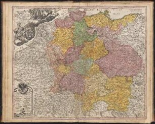
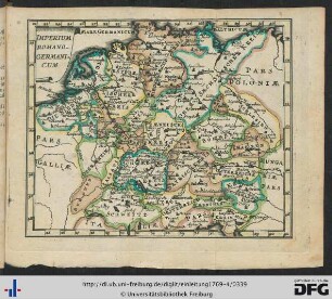
"Imperium Romano-Germanicum in suos circulos divisum geographice exhibitum et in usum scholarum ad mentem Joh[annis] Hübneri, Collegii Johannei Hamburgi Rectoris, excellentissimi destinatum [...]"
Enthält u. a.: Porträt in Medaillon links oben.
- Reference number
-
Sächsisches Staatsarchiv, 12884 Karten, Risse, Bilder, Nr. Schr 001, F 009, Nr 003e (Zu benutzen im Hauptstaatsarchiv Dresden)
- Further information
-
Fertigungsart: Kupferstich, koloriert
Personen/Institutionen: Homann, Johann Baptist, Nürnberg.
Maßstab: 20 Deutsche Kommunmeilen=16 Große Deutsche Meilen=6 cm
Umfang: 1
Farbe: mehrfarbig
Format: 55,5x46,3
Registratursignatur: Abt. 11, Bd. 2, S. 95, Nr. 1a
- Context
-
12884 Karten, Risse, Bilder >> 1. Karten >> 1.19. Deutschland >> 1.19.01. Bis 1945
- Holding
-
12884 Karten, Risse, Bilder
- Date of creation
-
1732
- Other object pages
- Rights
-
Es gilt die Sächsische Archivbenutzungsverordnung vom 8. September 2022 (SächsGVBl. S. 526).
- Last update
-
21.03.2024, 8:13 AM CET
Data provider
This object is provided by:
Sächsisches Staatsarchiv. If you have any questions about the object, please contact the data provider.
Sächsisches Staatsarchiv. If you have any questions about the object, please contact the data provider.
Object type
- Karten und Pläne
Time of origin
- 1732
Other Objects (12)

Imperium Romano-Germanicum in suos Circulos Divisum Geographice exhibitum et in Usum Scholarum ad mentem Ioh. Hübneri Collegii Iohannei Hamburgi Rectoris Excellentissimi destinatum;. Bildfläche: Nordseeküste Calais bis Elbmündung – Danzig – Lyon – Rator (Kroatien);. Inhalt: Jülich
Imperium Romano-Germanicum In Suos Circulos Divisum : Cum Privilegio Sac. Cæs. Majest.
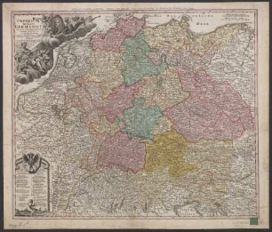
Imperium Romano-germanicum In Suos Circulos Divisum : Cum Privilegio Sac. Caes. Maiest.
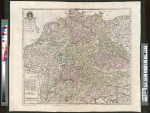
Imperium Romano-Germanicum in suos Circulos Electoratus Et Status Summa cura et Studio divisum
![Imperium Romano-Germanicum in suos Circulos Electorat[us] Et Status Summâ curâ et Studio divisum](https://iiif.deutsche-digitale-bibliothek.de/image/2/291c97e1-1827-4366-936f-58c89ce73a44/full/!306,450/0/default.jpg)
Imperium Romano-Germanicum in suos Circulos Electorat[us] Et Status Summâ curâ et Studio divisum
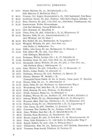
Discipuli Johannei
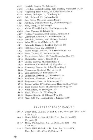
Praeceptores Johannei
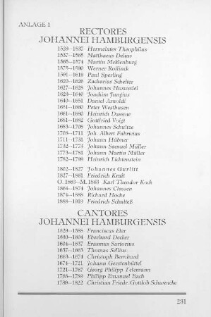
Anlage 1 Rectores Johannei Hamburgensis Cantores Johannei Hamburgensis
Círculos
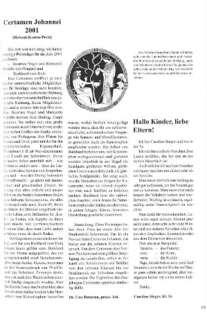
Certamen Johannei 2001
Salto Mortale Johannei?
Imperium Romano-Germanicum.
Imperium Romano-Germanicum in suos Circulos Divisum Geographice exhibitum et in Usum Scholarum ad mentem Ioh. Hübneri Collegii Iohannei Hamburgi Rectoris Excellentissimi destinatum;. Bildfläche: Nordseeküste Calais bis Elbmündung – Danzig – Lyon – Rator (Kroatien);. Inhalt: Jülich
Imperium Romano-Germanicum In Suos Circulos Divisum : Cum Privilegio Sac. Cæs. Majest.
Imperium Romano-germanicum In Suos Circulos Divisum : Cum Privilegio Sac. Caes. Maiest.
Imperium Romano-Germanicum in suos Circulos Electoratus Et Status Summa cura et Studio divisum
Imperium Romano-Germanicum in suos Circulos Electorat[us] Et Status Summâ curâ et Studio divisum
Discipuli Johannei
Praeceptores Johannei
Anlage 1 Rectores Johannei Hamburgensis Cantores Johannei Hamburgensis
Círculos
Certamen Johannei 2001
Salto Mortale Johannei?