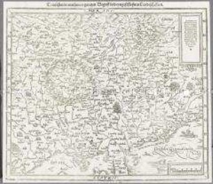
Regionalkarte
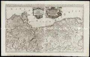
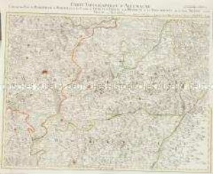
Quarta Europae Tabula. Magna Germania. Aus: Martin Waldseemüller, Geographia des Claudius Ptolemäus, Straßburg 1513. Nachdruck von 1520
- Alternative title
-
QVARTA EVROPAE TABVLA. / MAGNA GERMANIA
- Location
-
Deutsches Historisches Museum, Berlin
- Inventory number
-
1990/765
- Measurements
-
Höhe x Breite: 44,8 x 61,2 cm (Blatt)
- Material/Technique
-
Druckfarbe, Papier, Holzschnitt
- Classification
-
Kartografie (Gattung)
- Subject (what)
-
Deutschland
- Event
-
Herstellung
- (who)
-
Geograph: Claudius Ptolemäus
Drucker: Johannes Schott
Kartograf: Martin Waldseemüller
- (where)
-
Strasbourg [historisch: Straßburg], Frankreich [historisch: Heiliges Römisches Reich]; Landschaft: Elsass
- (when)
-
1520
- Rights
-
Deutsches Historisches Museum
- Last update
-
24.03.2023, 9:30 AM CET
Data provider
This object is provided by:
Stiftung Deutsches Historisches Museum. If you have any questions about the object, please contact the data provider.
Stiftung Deutsches Historisches Museum. If you have any questions about the object, please contact the data provider.
Object type
- Regionalkarte
Associated
- Geograph: Claudius Ptolemäus
- Drucker: Johannes Schott
- Kartograf: Martin Waldseemüller
Time of origin
- 1520
Other Objects (12)
Das Hertzogthum Pommern
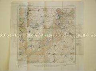
Landkarte aus der Serie "Berlin und Umgebung", Blatt 8: Strausberg

Ducatus Breslanus
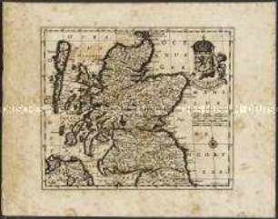
Scotiae Regnum / Königreich Schottland.
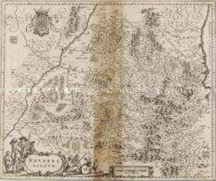
Navarra Regnum
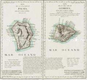
Mapa de la Isla de la Palma / Mapa de la Isla de la Gomera
Grand Atlas . Bl. 43 (Böhmen...): Contenant une Partie du Royaume de Boheme, Scavoir la Ville de Prague, les Cercles de Ragonitz, Saatz, Leitmeriz, Kaurizim et de Buntzlau.
Ducatus Brunsvicensis Fereque Lunaeburgensis
Teutschlandt / mit seinem gantzen Begriff vnd eyngeschlossnen Landtschafften. Aus: Sebastian Münster: Cosmographey, das ist Beschreibung Aller Laender, Herrschafften und fuernemesten Stetten des gantzen Erdbodens. (Basel: Sebastian Henricpetri, 1598), Bl. 7
Marchia Media
Grand Atlas . Bl. 54 (Mähren, Niederschlesien : Contenant une Partie du Margraviat de Moravie, savoir les Cercles d'Olmutz de Prerau et de Hradisch et les Principautés de la haute Silesie savoir Tropau et Teschen et et
Geographisch-statistische und historische Karte von Alabama. Weimar: Verlag des Geographischen Institutes, 1825. Fragment
Das Hertzogthum Pommern
Landkarte aus der Serie "Berlin und Umgebung", Blatt 8: Strausberg
Ducatus Breslanus
Scotiae Regnum / Königreich Schottland.
Navarra Regnum
Mapa de la Isla de la Palma / Mapa de la Isla de la Gomera
Grand Atlas . Bl. 43 (Böhmen...): Contenant une Partie du Royaume de Boheme, Scavoir la Ville de Prague, les Cercles de Ragonitz, Saatz, Leitmeriz, Kaurizim et de Buntzlau.
Ducatus Brunsvicensis Fereque Lunaeburgensis
Teutschlandt / mit seinem gantzen Begriff vnd eyngeschlossnen Landtschafften. Aus: Sebastian Münster: Cosmographey, das ist Beschreibung Aller Laender, Herrschafften und fuernemesten Stetten des gantzen Erdbodens. (Basel: Sebastian Henricpetri, 1598), Bl. 7
Marchia Media
Grand Atlas . Bl. 54 (Mähren, Niederschlesien : Contenant une Partie du Margraviat de Moravie, savoir les Cercles d'Olmutz de Prerau et de Hradisch et les Principautés de la haute Silesie savoir Tropau et Teschen et et