Karte
Karte der deutsch-französischen Gränzländer : mit Angabe der seit dem 17. Jahrh. von Deutschland abgerissenen Landtheile und der deutsch-französischen Sprachgränze
- Location
-
München, Bayerische Staatsbibliothek -- Mapp. II,128
- Dimensions
-
23 x 27 cm
- Extent
-
1 Kt.
- Language
-
Deutsch
- Notes
-
Lithographie
- Keyword
-
Grenzgebiet
Karte
Deutsch
Französisch
Sprachgrenze
Frankreich
Deutschland
- Event
-
Veröffentlichung
- (where)
-
Berlin
- (who)
-
Nicolai
- (when)
-
1859
- Contributor
-
Kutscheit, Johann V. (Sonstige)
- URN
-
urn:nbn:de:bvb:12-bsb00028477-9
- Last update
-
27.11.2025, 8:39 AM CET
Data provider
This object is provided by:
Bayerische Staatsbibliothek. If you have any questions about the object, please contact the data provider.
Bayerische Staatsbibliothek. If you have any questions about the object, please contact the data provider.
Object type
- kartografisches Bild
Associated
- Kutscheit, Johann V. (Sonstige)
- Nicolai
Time of origin
- 1859
Other Objects (12)
![Die französischen Holzarbeiten des XVIII. Jahrh., [2]](https://iiif.deutsche-digitale-bibliothek.de/image/2/9de50647-b456-4399-9c15-7df3199bf141/full/!306,450/0/default.jpg)
Die französischen Holzarbeiten des XVIII. Jahrh., [2]

Anfrage wegen einer abgerissenen französischen Bekanntmachung an der Rathaustreppe zu Clausthal
deutsch-französischen Regierungsabkommen

Miniatur aus einer französischen Handschrift (13. Jahrh.) des "Alexander-Romans"
I. Unterkommission der Deutsch-französischen Wirtschaftskommission.- Revision der deutsch-französischen Handelsvereinbarungen, insb. des deutsch-französischen Handelsabkommens von 1927
I. Unterkommission der Deutsch-französischen Wirtschaftskommission.- Revision der deutsch-französischen Handelsvereinbarungen, insb. des deutsch-französischen Handelsabkommens von 1927
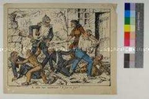
französische Karikatur zum Deutsch-französischen Krieg
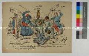
französische Karikatur zum Deutsch-französischen Krieg

französische Karikatur zum Deutsch-französischen Krieg
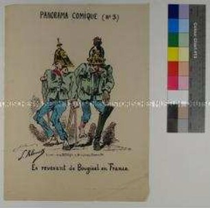
französische Karikatur zum Deutsch-französischen Krieg
Allgemeine deutsch-französischen Handelsbeziehungen

Im Deutsch-Französischen Kriege
Die französischen Holzarbeiten des XVIII. Jahrh., [2]
Anfrage wegen einer abgerissenen französischen Bekanntmachung an der Rathaustreppe zu Clausthal
deutsch-französischen Regierungsabkommen
Miniatur aus einer französischen Handschrift (13. Jahrh.) des "Alexander-Romans"
I. Unterkommission der Deutsch-französischen Wirtschaftskommission.- Revision der deutsch-französischen Handelsvereinbarungen, insb. des deutsch-französischen Handelsabkommens von 1927
I. Unterkommission der Deutsch-französischen Wirtschaftskommission.- Revision der deutsch-französischen Handelsvereinbarungen, insb. des deutsch-französischen Handelsabkommens von 1927
französische Karikatur zum Deutsch-französischen Krieg
französische Karikatur zum Deutsch-französischen Krieg
französische Karikatur zum Deutsch-französischen Krieg
französische Karikatur zum Deutsch-französischen Krieg
Allgemeine deutsch-französischen Handelsbeziehungen