Altkarte
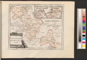
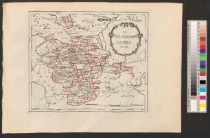
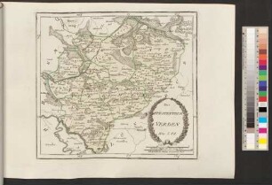
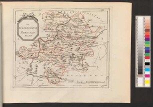
Karte von dem Hochstift und Fürstenthum Bamberg nebst verschiedenen angraenzenden Gegenden : in vier Blättern
- Alternative title
-
Fürstentum angrenzenden
- Location
-
München, Bayerische Staatsbibliothek -- Mapp. XI,332
- Dimensions
-
Gesamtgröße 73 x 72 cm
- Extent
-
1 Karte auf 4 Blättern
- Language
-
Deutsch
- Notes
-
Kupferstich
Maßstab in graphischer Form (Geographische Meilen, 15. auf einen Grad des Aequators; Stunden Weegs, 20. auf einen Grad; Stunden Weegs, 25. auf einen Grad)
Erscheint als Beilage zu: Roppelt, Johann Baptist: Historisch-topographische Beschreibung des Kaiserlichen Hochstifts und Fürstenthums Bamberg
- Keyword
-
Amtsbezirk
Hochstift Bamberg
- Event
-
Veröffentlichung
- (where)
-
Nürnberg
- (who)
-
in der Schneider u: Weigel, K.K. priv. Kunsth.
- (when)
-
1801
- Contributor
- URN
-
urn:nbn:de:bvb:12-bsb00090738-2
- Last update
-
12.05.2025, 11:34 AM CEST
Data provider
This object is provided by:
Bayerische Staatsbibliothek. If you have any questions about the object, please contact the data provider.
Bayerische Staatsbibliothek. If you have any questions about the object, please contact the data provider.
Object type
- Altkarte
Associated
- Roppelt, Johann Baptist
- Schneider, Adam Gottlieb
- Weigel, ...
- in der Schneider u: Weigel, K.K. priv. Kunsth.
Time of origin
- 1801
Other Objects (12)

Karte von dem Hochstift und Fürstenthum Bamberg nebst verschiedenen angraenzenden Gegenden
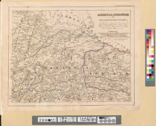
Rhaetia, Noricum und die angränzenden Länder
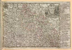
Das Hertzogthum Schlesien : nebst Angraenzenden Laendern
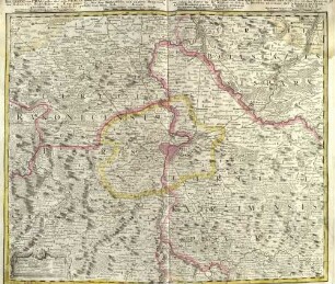
Die Gegend um Prag oder der alte Prager Kreys ; nebst den angränzenden Landschafften des Rakonizer, Boleslawer u. Kaurzimer Cr.
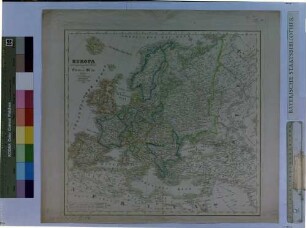
Europa mit angränzenden Theilen von Asien und Africa
Geognostische Carte von Ober-Schlesien und den angränzenden Ländern
Das Fürstenthum Querfurt
Das Fürstenthum Gotha

Das Fürstenthum Rügen
Das Fürstenthum Verden
Das Fürstenthum Eisenach
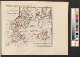
Das Fürstenthum Hildburghausen
Karte von dem Hochstift und Fürstenthum Bamberg nebst verschiedenen angraenzenden Gegenden
Rhaetia, Noricum und die angränzenden Länder
Das Hertzogthum Schlesien : nebst Angraenzenden Laendern
Die Gegend um Prag oder der alte Prager Kreys ; nebst den angränzenden Landschafften des Rakonizer, Boleslawer u. Kaurzimer Cr.
Europa mit angränzenden Theilen von Asien und Africa
Geognostische Carte von Ober-Schlesien und den angränzenden Ländern
Das Fürstenthum Querfurt
Das Fürstenthum Gotha
Das Fürstenthum Rügen
Das Fürstenthum Verden
Das Fürstenthum Eisenach