Karte / Plan
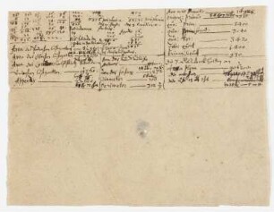
Plan von dem bei der Niedernmühle in Kalldorf anzulegenden neuen Weg von Erder nach Vlotho (Amt Varenholz),. mit Vermessungstabelle
- Reference number
-
D 73, 4/6079
- Dimensions
-
Höhe: 28, Breite: 44, Maßstab: ca. 1:1.930
- Context
-
Allgemeine Kartensammlung (bisherige Kartei) >> 22. Tit. 4 (noch nicht klassifiziert) >> 22.15. Nr. 6001 - 6200
- Holding
-
D 73 Allgemeine Kartensammlung (bisherige Kartei)
- Date of creation
-
1799
- Other object pages
- Provenance
-
Behörden, Institutionen, Einzelpersonen (Sammlungen)
- Delivered via
- Last update
-
05.11.2025, 3:10 PM CET
Data provider
This object is provided by:
Landesarchiv Nordrhein-Westfalen. Abteilung Ostwestfalen-Lippe. If you have any questions about the object, please contact the data provider.
Landesarchiv Nordrhein-Westfalen. Abteilung Ostwestfalen-Lippe. If you have any questions about the object, please contact the data provider.
Object type
- Karten / Pläne
Time of origin
- 1799
Other Objects (12)

Auszug aus dem Flurbuch Amt Varenholz Gemarkung Kalldorf und Erder
Hypothekenbuchbelege (Almena, Kalldorf, Erder)

Straße von Erder nach Kalldorf
Gesuch um Diensterleichterung von Einwohnern zu Erder, Kalldorf, Langenholzhausen und Stemmen, alle Amt Varenholz
Den Schullehrern zu Kalldorf, Erder und Varenholz aus dem gemeinschaflichen Kalldorfer Holz zukommendes Deputat-Holz
Vermessungstabelle
Vermessungstabelle
Vermessungstabelle
Landesstraße von Varenholz nach Erder
Geborene (Erder), Konfirmationen (Gemeinde: Varenholz)
Geborene (Erder), Konfirmationen (Gemeinde: Varenholz)
Prozess der Amtsgemeinde Varenholz gegen Schöttker Nr. 8 in Erder wegen Umbaus der Landstraße Langenholzhausen nach Kalldorf
Auszug aus dem Flurbuch Amt Varenholz Gemarkung Kalldorf und Erder
Hypothekenbuchbelege (Almena, Kalldorf, Erder)
Straße von Erder nach Kalldorf
Gesuch um Diensterleichterung von Einwohnern zu Erder, Kalldorf, Langenholzhausen und Stemmen, alle Amt Varenholz
Den Schullehrern zu Kalldorf, Erder und Varenholz aus dem gemeinschaflichen Kalldorfer Holz zukommendes Deputat-Holz
Vermessungstabelle
Vermessungstabelle
Vermessungstabelle
Landesstraße von Varenholz nach Erder
Geborene (Erder), Konfirmationen (Gemeinde: Varenholz)
Geborene (Erder), Konfirmationen (Gemeinde: Varenholz)