- Alternative title
-
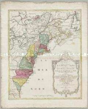
PARTIE / ORIENTALE / de la / NOUVELLE FRANCE
- Location
-
Deutsches Historisches Museum, Berlin
- Inventory number
-
Do 2006/592
- Measurements
-
Höhe x Breite: 70,8 x 58,8 cm (Blatt)
Höhe x Breite: 55,3 x 47,3 cm (Karte)
Höhe x Breite: 58,5 x 50,3 cm (Platte)
- Material/Technique
-
Papier, Kupferstich, koloriert
- Classification
-
Kartografie (Gattung)
- Subject (what)
-
Kanada
- Event
-
Herstellung
- (who)
-
Stecher, Verleger, Geograph: Tobias Konrad Lotter
Stecher, Kartograf: Albrecht Carl Seutter
- (where)
-
Augsburg, Deutschland [historisch: Heiliges Römisches Reich deutscher Nation]
- (when)
-
um 1750
- Rights
-
Deutsches Historisches Museum
- Last update
-
24.03.2023, 9:31 AM CET
Data provider
This object is provided by:
Stiftung Deutsches Historisches Museum. If you have any questions about the object, please contact the data provider.
Stiftung Deutsches Historisches Museum. If you have any questions about the object, please contact the data provider.
Object type
- Regionalkarte
Associated
- Stecher, Verleger, Geograph: Tobias Konrad Lotter
- Stecher, Kartograf: Albrecht Carl Seutter
Time of origin
- um 1750
Other Objects (12)
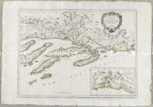
Nouvelle Carte de la Partie Orientale de Dalmatie. Mit einer Nebenkarte: Baye ou Bocche di Cattaro
Nouvelle Carte de la Partie Occidentale de Dalmatie
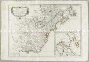
Carte Générale du Canada, de la Louisiane, de la Floride, de la Caroline, de la Virginie, de la Nouvelle Angleterre etc. Mit einer Anschlusskarte
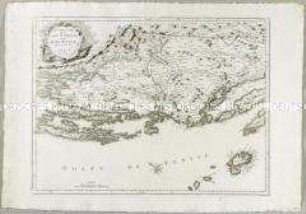
Nouvelle Carte de l'Istrie
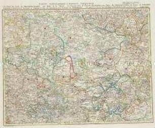
Grand Atlas . Bl. 32 (Thüringen, Hessen...): Contenante Une Partie du Cercle de Thuringen Orientale, une Partie de la Hesse, les Principautés de Gotta, Elsenach et une Partie du Schwartzburg, les Comtes de Stollberg Mansfeld et Hatzfeld, le Territoire d'Erfurt, le Pais de Eichsfeld et le Territoire de Muhlhausen
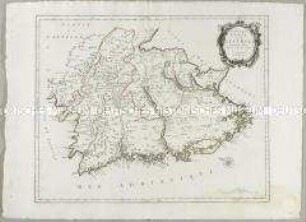
Carte Nouvelle de l'Amerique Angloise
Grand Atlas . Bl. 12 (Münster, Oldenburg, Osnabrück, Ostfriesland): Contenant une Partie inferieure de l'Evêché de Munster, une Partie du Duche D'Oldenbourg, de l'Evêché d'Osnabruck, de Friesland Orientale de Gröningen et d'Over-Yssel, les Comtés de Benthem de Lingen et et
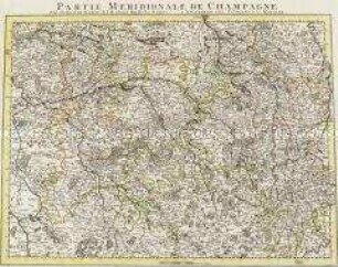
Partie Meridionale de Champagne
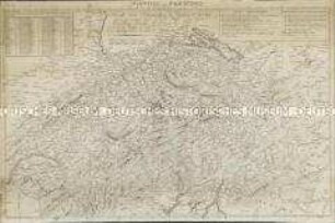
Nouvelle Carte Hydrographique et Routiere de la Suisse
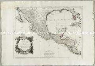
Carte du Mexique et de la Nouvelle Espagne
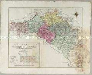
Carte nouvelle des Royaumes de Galizie et Lodomerie
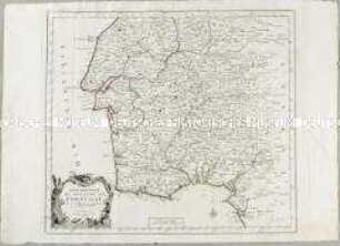
Partie Méridionale du Royaume de Portugal
Nouvelle Carte de la Partie Orientale de Dalmatie. Mit einer Nebenkarte: Baye ou Bocche di Cattaro
Nouvelle Carte de la Partie Occidentale de Dalmatie
Carte Générale du Canada, de la Louisiane, de la Floride, de la Caroline, de la Virginie, de la Nouvelle Angleterre etc. Mit einer Anschlusskarte
Nouvelle Carte de l'Istrie
Grand Atlas . Bl. 32 (Thüringen, Hessen...): Contenante Une Partie du Cercle de Thuringen Orientale, une Partie de la Hesse, les Principautés de Gotta, Elsenach et une Partie du Schwartzburg, les Comtes de Stollberg Mansfeld et Hatzfeld, le Territoire d'Erfurt, le Pais de Eichsfeld et le Territoire de Muhlhausen
Carte Nouvelle de l'Amerique Angloise
Grand Atlas . Bl. 12 (Münster, Oldenburg, Osnabrück, Ostfriesland): Contenant une Partie inferieure de l'Evêché de Munster, une Partie du Duche D'Oldenbourg, de l'Evêché d'Osnabruck, de Friesland Orientale de Gröningen et d'Over-Yssel, les Comtés de Benthem de Lingen et et
Partie Meridionale de Champagne
Nouvelle Carte Hydrographique et Routiere de la Suisse
Carte du Mexique et de la Nouvelle Espagne
Carte nouvelle des Royaumes de Galizie et Lodomerie