Altkarte
Charte vom Königreiche Bayern : nach seinen dermaligen Bestandtheilen, und der neuesten Eintheilung in XV Kreise berichtigt im August 1808
- Location
-
München, Bayerische Staatsbibliothek -- Mapp. XI,50 f
- Dimensions
-
45 x 52 cm
- Extent
-
1 Kt.
- Language
-
Deutsch
- Notes
-
Kupferstich
Maßstab in graph. Form (Geogr. od. Deutsche Meilen, Französische Lieues)
- Keyword
-
Geschichte 1808
Verwaltungsgrenze
Bayern
- Event
-
Veröffentlichung
- (where)
-
Weimar
- (who)
-
Verl. des Geograph. Inst.
- (when)
-
1808
- Contributor
- URN
-
urn:nbn:de:bvb:12-bsb00010905-9
- Last update
-
16.04.2025, 8:40 AM CEST
Data provider
This object is provided by:
Bayerische Staatsbibliothek. If you have any questions about the object, please contact the data provider.
Bayerische Staatsbibliothek. If you have any questions about the object, please contact the data provider.
Object type
- Altkarte
Associated
- Güssefeld, Franz L.
- Ehnlich, I. F. C.
- Verl. des Geograph. Inst.
Time of origin
- 1808
Other Objects (12)

Eintheilung des Mergels nach seinen Bestandtheilen.

"Charte von dem Königreiche Westphalen nach seinen dermaligen Bestandtheilen." Ausf.-Art: Farbiger Druck Herst.: Friedr. Wilh. Streit Format: 49 x 57 cm Maßstab: 1 : 700 000
"Charte von dem Königreiche Westphalen nach seinen dermaligen Bestandtheilen." Ausf.-Art: Farbiger Druck Herst.: Friedr. Wilh. Streit Format: 49 x 57 cm Maßstab: 1 : 700 000
"Charte von dem Königreiche Westphalen nach seinen dermaligen Bestandtheilen." Ausf.-Art: Farbiger Druck Herst.: Friedr. Wilh. Streit Format: 49 x 57 cm Maßstab: 1 : 700 000
"Charte von dem Königreiche Westphalen nach seinen dermaligen Bestandtheilen." Ausf.-Art: Farbiger Druck Herst.: Friedr. Wilh. Streit Format: 49 x 57 cm Maßstab: 1 : 700 000
"Charte von dem Königreiche Westphalen nach seinen dermaligen Bestandtheilen." Ausf.-Art: Farbiger Druck Herst.: Friedr. Wilh. Streit Format: 49 x 57 cm Maßstab: 1 : 700 000
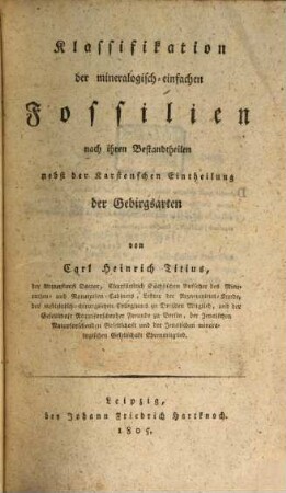
Klassifikation der mineralogisch-einfachen Fossilien nach ihren Bestandtheilen nebst der Karstenschen Eintheilung der Gebirgsarten
Klassifikation der mineralogisch-einfachen Fossilien nach ihren Bestandtheilen nebst der Karstenschen Eintheilung der Gebirgsarten
Klassifikation der mineralogisch-einfachen Fossilien nach ihren Bestandtheilen nebst der Karstenschen Eintheilung der Gebirgsarten
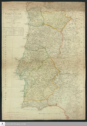
Charte von Portugal : Nach W. Faden's Charte (Aug. 1797) durch beygesetzte Ortsbestimmungen berichtigt

Charte des Schwaebischen Kreises nach der neuesten Eintheilung entworfen

Von den Bestandtheilen der Kartoffeln
Eintheilung des Mergels nach seinen Bestandtheilen.
"Charte von dem Königreiche Westphalen nach seinen dermaligen Bestandtheilen." Ausf.-Art: Farbiger Druck Herst.: Friedr. Wilh. Streit Format: 49 x 57 cm Maßstab: 1 : 700 000
"Charte von dem Königreiche Westphalen nach seinen dermaligen Bestandtheilen." Ausf.-Art: Farbiger Druck Herst.: Friedr. Wilh. Streit Format: 49 x 57 cm Maßstab: 1 : 700 000
"Charte von dem Königreiche Westphalen nach seinen dermaligen Bestandtheilen." Ausf.-Art: Farbiger Druck Herst.: Friedr. Wilh. Streit Format: 49 x 57 cm Maßstab: 1 : 700 000
"Charte von dem Königreiche Westphalen nach seinen dermaligen Bestandtheilen." Ausf.-Art: Farbiger Druck Herst.: Friedr. Wilh. Streit Format: 49 x 57 cm Maßstab: 1 : 700 000
"Charte von dem Königreiche Westphalen nach seinen dermaligen Bestandtheilen." Ausf.-Art: Farbiger Druck Herst.: Friedr. Wilh. Streit Format: 49 x 57 cm Maßstab: 1 : 700 000
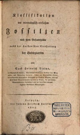
Klassifikation der mineralogisch-einfachen Fossilien nach ihren Bestandtheilen nebst der Karstenschen Eintheilung der Gebirgsarten
Klassifikation der mineralogisch-einfachen Fossilien nach ihren Bestandtheilen nebst der Karstenschen Eintheilung der Gebirgsarten
Klassifikation der mineralogisch-einfachen Fossilien nach ihren Bestandtheilen nebst der Karstenschen Eintheilung der Gebirgsarten
Charte von Portugal : Nach W. Faden's Charte (Aug. 1797) durch beygesetzte Ortsbestimmungen berichtigt
Charte des Schwaebischen Kreises nach der neuesten Eintheilung entworfen
Von den Bestandtheilen der Kartoffeln
Eintheilung des Mergels nach seinen Bestandtheilen.
"Charte von dem Königreiche Westphalen nach seinen dermaligen Bestandtheilen." Ausf.-Art: Farbiger Druck Herst.: Friedr. Wilh. Streit Format: 49 x 57 cm Maßstab: 1 : 700 000
"Charte von dem Königreiche Westphalen nach seinen dermaligen Bestandtheilen." Ausf.-Art: Farbiger Druck Herst.: Friedr. Wilh. Streit Format: 49 x 57 cm Maßstab: 1 : 700 000
"Charte von dem Königreiche Westphalen nach seinen dermaligen Bestandtheilen." Ausf.-Art: Farbiger Druck Herst.: Friedr. Wilh. Streit Format: 49 x 57 cm Maßstab: 1 : 700 000
"Charte von dem Königreiche Westphalen nach seinen dermaligen Bestandtheilen." Ausf.-Art: Farbiger Druck Herst.: Friedr. Wilh. Streit Format: 49 x 57 cm Maßstab: 1 : 700 000
"Charte von dem Königreiche Westphalen nach seinen dermaligen Bestandtheilen." Ausf.-Art: Farbiger Druck Herst.: Friedr. Wilh. Streit Format: 49 x 57 cm Maßstab: 1 : 700 000
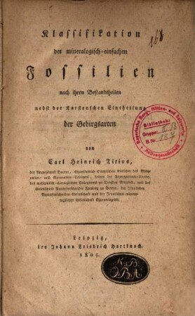
Klassifikation der mineralogisch-einfachen Fossilien nach ihren Bestandtheilen nebst der Karstenschen Eintheilung der Gebirgsarten
Klassifikation der mineralogisch-einfachen Fossilien nach ihren Bestandtheilen nebst der Karstenschen Eintheilung der Gebirgsarten
Klassifikation der mineralogisch-einfachen Fossilien nach ihren Bestandtheilen nebst der Karstenschen Eintheilung der Gebirgsarten
Charte von Portugal : Nach W. Faden's Charte (Aug. 1797) durch beygesetzte Ortsbestimmungen berichtigt
Charte des Schwaebischen Kreises nach der neuesten Eintheilung entworfen