Verzeichnung
"Topographische Karte des Amtes Uchte". Fortführung der Kurhannoverschen Landesaufnahme von 1764/86 (Reproduktion s. 600 Nr. 12). 6 Blätter. Titel und Erklärungen auf Bl. 5. Lit.: Franz Engel in Niedersächs. Jahrbuch 31, 1959, S. 3 f Ausf.-Art: Druck Herst.: F. Hartmann; C. Tomforde Format: 39 x 45 cm Maßstab: 1 : 21 333 1/3
- Reference number
-
NLA OS, K, 600 Nr. 13 H
- Former reference number
-
Rep 200 Nr. 2075
- Context
-
Karten >> 3 Regierungsbezirk Hannover >> 3.7 Kreis Nienburg >> 3.7.1 größere Gebietsteile
- Holding
-
NLA OS, K Karten
- Indexentry person
-
Hartmann, F.
Tomforde, C.
- Indexentry place
-
Uchte, Amt
- Date of creation
-
- 1832
- Other object pages
- Last update
-
16.06.2025, 11:08 AM CEST
Data provider
This object is provided by:
Niedersächsisches Landesarchiv. If you have any questions about the object, please contact the data provider.
Niedersächsisches Landesarchiv. If you have any questions about the object, please contact the data provider.
Object type
- Verzeichnung
Time of origin
- - 1832
Other Objects (12)

"Topographische Karte des Amtes Uchte". Fortführung der Kurhannoverschen Landesaufnahme von 1764/86 (Reproduktion s. 600 Nr. 12). 6 Blätter. Titel und Erklärungen auf Bl. 5. Lit.: Franz Engel in Niedersächs. Jahrbuch 31, 1959, S. 3 f Ausf.-Art: Druck Herst.: F. Hartmann; C. Tomforde Format: 39 x 45 cm Maßstab: 1 : 21 333 1/3
"Topographische Karte des Amtes Uchte". Fortführung der Kurhannoverschen Landesaufnahme von 1764/86 (Reproduktion s. 600 Nr. 12). 6 Blätter. Titel und Erklärungen auf Bl. 5. Lit.: Franz Engel in Niedersächs. Jahrbuch 31, 1959, S. 3 f Ausf.-Art: Druck Herst.: F. Hartmann; C. Tomforde Format: 39 x 45 cm Maßstab: 1 : 21 333 1/3
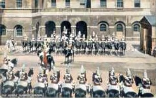
Parade der "Horse guards" in London
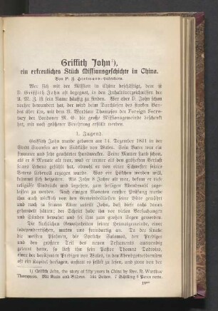
Griffith John ein erfreuliches Stück Missionsgeschichte in China
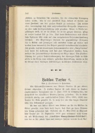
Hydson Taylor †
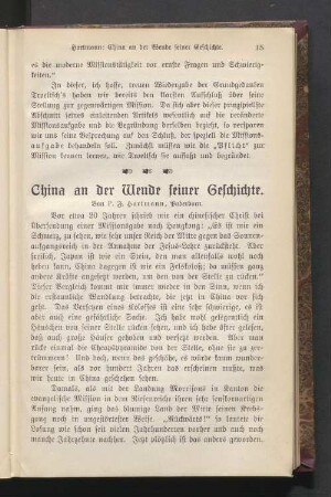
China an der Wende seiner Geschichte
Hartmann, F.
Missionsrundschau. China II (Fortsetzung)
Die neueren christenfeindlichen Bewegungen in China
"Topographische Karte der Vogtei Auburg, Amt Diepholz". Fortführung der Kurhannoverschen Landesaufnahme von 1764/86 (Reproduktion s. 600 Nr. 12). 4 Blätter. Titel auf Bl. 1, Erklärungen auf Bl. 2. Lit.: Franz Engel in Niedersächs. Jahrbuch 31, 1959, S. 3 f Ausf.-Art: Druck Herst.: Gauß; Steineshoff; E. Hartmann; C. Tomforde Format: 39 x 45 cm Maßstab: 1 : 21 333 1/3
"Topographische Karte der Vogtei Auburg, Amt Diepholz". Fortführung der Kurhannoverschen Landesaufnahme von 1764/86 (Reproduktion s. 600 Nr. 12). 4 Blätter. Titel auf Bl. 1, Erklärungen auf Bl. 2. Lit.: Franz Engel in Niedersächs. Jahrbuch 31, 1959, S. 3 f Ausf.-Art: Druck Herst.: Gauß; Steineshoff; E. Hartmann; C. Tomforde Format: 39 x 45 cm Maßstab: 1 : 21 333 1/3
"Topographische Karte der Vogtei Auburg, Amt Diepholz". Fortführung der Kurhannoverschen Landesaufnahme von 1764/86 (Reproduktion s. 600 Nr. 12). 4 Blätter. Titel auf Bl. 1, Erklärungen auf Bl. 2. Lit.: Franz Engel in Niedersächs. Jahrbuch 31, 1959, S. 3 f Ausf.-Art: Druck Herst.: Gauß; Steineshoff; E. Hartmann; C. Tomforde Format: 39 x 45 cm Maßstab: 1 : 21 333 1/3
"Topographische Karte des Amtes Uchte". Fortführung der Kurhannoverschen Landesaufnahme von 1764/86 (Reproduktion s. 600 Nr. 12). 6 Blätter. Titel und Erklärungen auf Bl. 5. Lit.: Franz Engel in Niedersächs. Jahrbuch 31, 1959, S. 3 f Ausf.-Art: Druck Herst.: F. Hartmann; C. Tomforde Format: 39 x 45 cm Maßstab: 1 : 21 333 1/3
"Topographische Karte des Amtes Uchte". Fortführung der Kurhannoverschen Landesaufnahme von 1764/86 (Reproduktion s. 600 Nr. 12). 6 Blätter. Titel und Erklärungen auf Bl. 5. Lit.: Franz Engel in Niedersächs. Jahrbuch 31, 1959, S. 3 f Ausf.-Art: Druck Herst.: F. Hartmann; C. Tomforde Format: 39 x 45 cm Maßstab: 1 : 21 333 1/3
Parade der "Horse guards" in London
Griffith John ein erfreuliches Stück Missionsgeschichte in China
Hydson Taylor †
China an der Wende seiner Geschichte
Hartmann, F.
Missionsrundschau. China II (Fortsetzung)
Die neueren christenfeindlichen Bewegungen in China
"Topographische Karte der Vogtei Auburg, Amt Diepholz". Fortführung der Kurhannoverschen Landesaufnahme von 1764/86 (Reproduktion s. 600 Nr. 12). 4 Blätter. Titel auf Bl. 1, Erklärungen auf Bl. 2. Lit.: Franz Engel in Niedersächs. Jahrbuch 31, 1959, S. 3 f Ausf.-Art: Druck Herst.: Gauß; Steineshoff; E. Hartmann; C. Tomforde Format: 39 x 45 cm Maßstab: 1 : 21 333 1/3
"Topographische Karte der Vogtei Auburg, Amt Diepholz". Fortführung der Kurhannoverschen Landesaufnahme von 1764/86 (Reproduktion s. 600 Nr. 12). 4 Blätter. Titel auf Bl. 1, Erklärungen auf Bl. 2. Lit.: Franz Engel in Niedersächs. Jahrbuch 31, 1959, S. 3 f Ausf.-Art: Druck Herst.: Gauß; Steineshoff; E. Hartmann; C. Tomforde Format: 39 x 45 cm Maßstab: 1 : 21 333 1/3