Archivale
Canalisation eines Theiles der Rudolfstraße u. deren Fortsetzung bis zum Ringcanal (Kanalisation)
Lageplan von der Ringstraße bis zur Friedensstraße.
- Reference number
-
Slg-KUP, A 134,18,21
- Dimensions
-
Bl. 29,4 x 33,1
- Formal description
-
Leinenpergament leicht geknickt.
- Further information
-
Ausführung: Zeichnung, koloriert
Maßstab: 1:1250
- Context
-
Karten und Pläne >> 01. Stadtdarstellungen >> 01.03. Gewässer, Kanalisation, Brücken
- Holding
-
Slg-KUP Karten und Pläne
- Indexentry place
-
Rudolfstraße
- Date of creation
-
1899, 03. 31.
- Other object pages
- Provenance
-
. Stadtbauamt II
- Delivered via
- Last update
-
05.11.2025, 3:42 PM CET
Data provider
This object is provided by:
Stadtarchiv Münster. If you have any questions about the object, please contact the data provider.
Stadtarchiv Münster. If you have any questions about the object, please contact the data provider.
Object type
- Archivale
Time of origin
- 1899, 03. 31.
Other Objects (12)

Rudolfstraße, Kanalisation
Lageplan betr. Neu-Canalisation eines Theiles der Fürstenbergstraße (Kanalisation)
Lageplan betr. Neu-Canalisation eines Theiles der Fürstenbergstraße (Kanalisation)
Kanalisation (Canalisation) der Stadt Kempen von 1
Canalisation.
Rudolfstraße
Rudolfstraße
Rudolfstraße
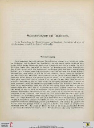
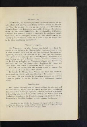
Wasserversorgung und Canalisation
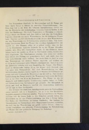
Wasserversorgung und Canalisation.
Feuerversicherungsbuch Rudolfstraße
Bauakte Rudolfstraße
Rudolfstraße, Kanalisation
Lageplan betr. Neu-Canalisation eines Theiles der Fürstenbergstraße (Kanalisation)
Lageplan betr. Neu-Canalisation eines Theiles der Fürstenbergstraße (Kanalisation)
Kanalisation (Canalisation) der Stadt Kempen von 1
Canalisation.
Rudolfstraße
Rudolfstraße
Rudolfstraße
Wasserversorgung und Canalisation
Wasserversorgung und Canalisation.
Feuerversicherungsbuch Rudolfstraße