Near-field tsunami hazard map Padang, West Sumatra: Utilizing high resolution geospatial data and reseasonable source scenarios
- Location
-
Deutsche Nationalbibliothek Frankfurt am Main
- Extent
-
Online-Ressource
- Language
-
Englisch
- Bibliographic citation
-
In: Schlurmann, T.; Kongko, W.; Goseberg, N.; Natawidjaja, D.H.; Sieh, K.: Near-field tsunami hazard map Padang, West Sumatra: Utilizing high resolution geospatial data and reseasonable source scenarios. In: Coastal Engineering Proceedings : Proceedings of the International Conference on Coastal Engineering 32 (2010), management.26. DOI: https://doi.org/10.9753/icce.v32.management.26
- Classification
-
Soziale Probleme, Sozialdienste, Versicherungen
- Event
-
Veröffentlichung
- (where)
-
Hannover
- (who)
-
Gottfried Wilhelm Leibniz Universität Hannover
- (when)
-
2010
- Event
-
Veröffentlichung
- (where)
-
Hannover
- (who)
-
Technische Informationsbibliothek (TIB)
- (when)
-
2010
- DOI
-
10.15488/1839
- URN
-
urn:nbn:de:101:1-2020071006442536442472
- Rights
-
Der Zugriff auf das Objekt ist unbeschränkt möglich.
- Last update
-
31.10.0044, 12:50 AM CET
Data provider
This object is provided by:
Deutsche Nationalbibliothek. If you have any questions about the object, please contact the data provider.
Deutsche Nationalbibliothek. If you have any questions about the object, please contact the data provider.
Associated
- Gottfried Wilhelm Leibniz Universität Hannover
- Technische Informationsbibliothek (TIB)
Time of origin
- 2010
Other Objects (12)
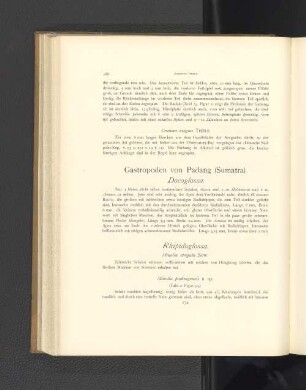
Gastropoden von Padang (Sumatra).
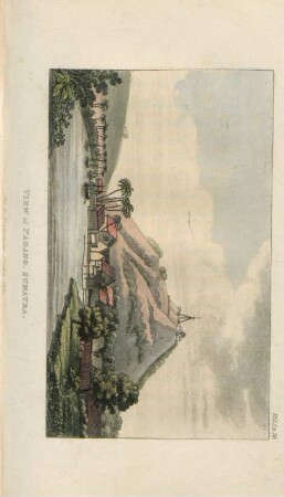
View of Padang, Sumatra
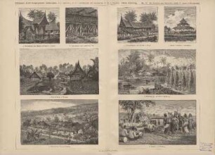
e. Dorf auf Sumatra (Padang)

c. Versammlungssaal auf Sumatra (Padang)
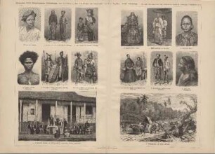
c. Mal. Frauen von Sumatra (Padang)
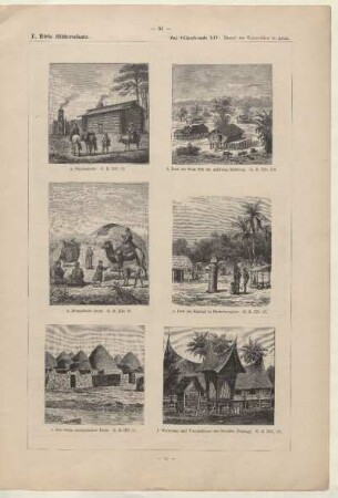
Wohnhaus und Vorratshäuser auf Sumatra (Padang)

c. Mal. Frauen von Sumatra (Padang)

a. Seitenansicht eines Hauses auf Sumatra (Padang)

b. Malayen von Java und Sumatra (Padang)
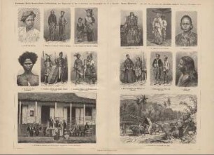
b. Malayen von Java und Sumatra (Padang)
Winke für den Handelsverkehr mit Padang (Sumatra).

Vollmachten der Freiherren von Liebenstein in Padang, Sumatra
Gastropoden von Padang (Sumatra).
View of Padang, Sumatra
e. Dorf auf Sumatra (Padang)
c. Versammlungssaal auf Sumatra (Padang)
c. Mal. Frauen von Sumatra (Padang)
Wohnhaus und Vorratshäuser auf Sumatra (Padang)
c. Mal. Frauen von Sumatra (Padang)
a. Seitenansicht eines Hauses auf Sumatra (Padang)
b. Malayen von Java und Sumatra (Padang)
b. Malayen von Java und Sumatra (Padang)
Winke für den Handelsverkehr mit Padang (Sumatra).