- Alternative title
-
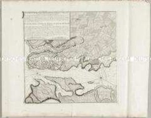
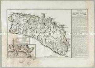
PLAN / DU FORT SAINT PHILIPPE / DANS L'ISLE MINORQUE / DÉDIÉE ET PRÉSENTÉE
- Location
-
Deutsches Historisches Museum, Berlin
- Inventory number
-
Do 2006/299
- Measurements
-
Höhe x Breite: 56 x 77,8 cm (Blatt)
Höhe x Breite: 44 x 49 cm (Karte)
Höhe x Breite: 46 x 51,4 cm (Platte)
- Material/Technique
-
Druckfarbe, Papier, Kupferstich, teilkoloriert
- Classification
-
Kartografie (Gattung)
- Subject (what)
-
Menorca
- Event
-
Herstellung
- (who)
-
Geograph: Jean de Beaurain
Stecher: ? Chicot
- (where)
-
Frankreich ?
- (when)
-
1781
- Rights
-
Deutsches Historisches Museum
- Last update
-
24.03.2023, 9:31 AM CET
Data provider
This object is provided by:
Stiftung Deutsches Historisches Museum. If you have any questions about the object, please contact the data provider.
Stiftung Deutsches Historisches Museum. If you have any questions about the object, please contact the data provider.
Object type
- Fortifikationsplan
Associated
- Geograph: Jean de Beaurain
- Stecher: ? Chicot
Time of origin
- 1781
Other Objects (12)
Plan de la Ville et du Port Mahon et du Fort St. Philippe. Mit einer Nebenkarte: Plan du Fort S. Philippe und einem Profil: Profil du Fort Saint Philippe
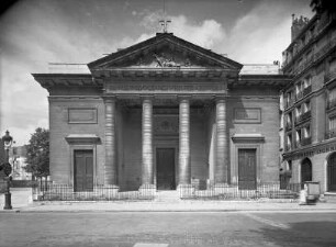
Saint-Philippe-du-Roule

Plan du Fort St. Philippe et de ses attaques
Paris, Saint-Philippe-du-Roule,Paris, Saint-Philippe-du-Roule in der Rue du Faubourg Saint-Honoré
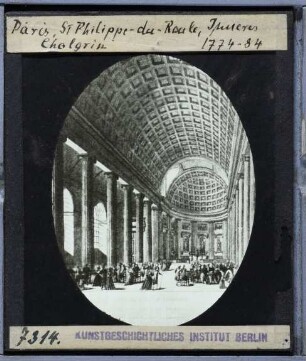
Paris, Saint-Philippe-du-Roule
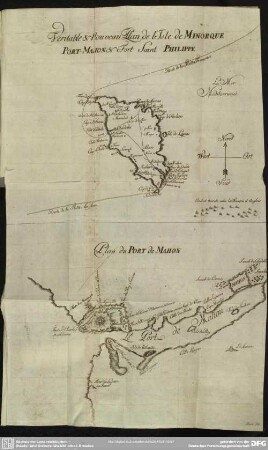
Veritable & Nouveau Plan de l'Isle de Minorque Port Maihon & Fort Saint Philippe
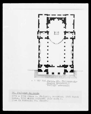
Paris, Saint-Philippe-du-Roule : Grundriss
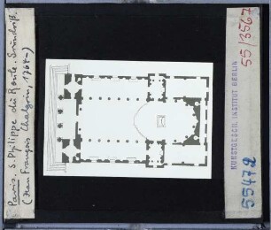
Grundriss der Église Saint Philippe-du-Roule
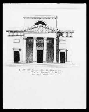
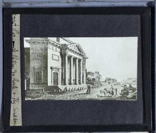
Fassade der Église Saint Philippe-du-Roule
![[Philippus; Saint Philip; Saint Philippe]](https://iiif.deutsche-digitale-bibliothek.de/image/2/4d2b695a-18e7-42fa-a4ba-fb1b9cd8078f/full/!306,450/0/default.jpg)
[Philippus; Saint Philip; Saint Philippe]
![[Philippus; Saint Philippe; Saint Philip (second version?)]](https://iiif.deutsche-digitale-bibliothek.de/image/2/cc96763f-a3bb-4f0e-b5ac-82c727b9da69/full/!306,450/0/default.jpg)
[Philippus; Saint Philippe; Saint Philip (second version?)]
Carte Topographique et Militaire de l'Isle Minorque. Mit zwei Ansichten: Vue du Fort St. Philippe, einer Nebenkarte: (Port Mahon) und einem Fortifikationsplan: Plan du Fort St. Philippe
Plan de la Ville et du Port Mahon et du Fort St. Philippe. Mit einer Nebenkarte: Plan du Fort S. Philippe und einem Profil: Profil du Fort Saint Philippe
Saint-Philippe-du-Roule
Plan du Fort St. Philippe et de ses attaques
Paris, Saint-Philippe-du-Roule,Paris, Saint-Philippe-du-Roule in der Rue du Faubourg Saint-Honoré
Paris, Saint-Philippe-du-Roule
Veritable & Nouveau Plan de l'Isle de Minorque Port Maihon & Fort Saint Philippe
Paris, Saint-Philippe-du-Roule : Grundriss
Grundriss der Église Saint Philippe-du-Roule
Fassade der Église Saint Philippe-du-Roule
[Philippus; Saint Philip; Saint Philippe]
[Philippus; Saint Philippe; Saint Philip (second version?)]