Illustration
Map of Manila Bay, port of Cavite, and lake of Bay, showing depths of various parts of the bay, drawn by the engineer Feliciano Márquez, September 28, 1767

- Sprache
-
Englisch
- Erschienen in
-
The Philippine Islands 1493-1803 : explorations by early navigators, descriptions of the islands and their peoples, their history and records of the Catholic missions, as related in contemporaneous books and manuscripts, showing the political, economic, commercial and religious conditions of those islands, from their earliest relations with European nations to the beginning of the nineteenth century ; translated from the originals ; Vol. 50
- Beteiligte Personen und Organisationen
-
Márquez, Feliciano
- Erschienen
-
1907
- Letzte Aktualisierung
-
22.04.2025, 14:08 MESZ
Datenpartner
Dieses Objekt wird bereitgestellt von:
Staatsbibliothek zu Berlin - Preußischer Kulturbesitz. Bei Fragen zum Objekt wenden Sie sich bitte an den Datenpartner.
Staatsbibliothek zu Berlin - Preußischer Kulturbesitz. Bei Fragen zum Objekt wenden Sie sich bitte an den Datenpartner.
Objekttyp
- Illustration
Beteiligte
- Márquez, Feliciano
Entstanden
- 1907
Ähnliche Objekte (12)
Bay of Waikouaiti.
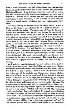
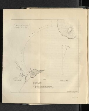
Bay of Bamba,
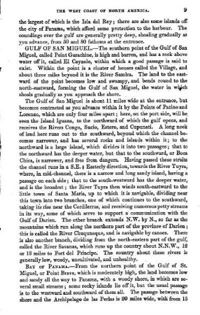
Bay of Panama,
Bay of Wodowara
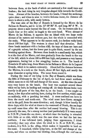
Bay of Rosario,
Bay of Sooson,
CHAPTER XXIX. - THE BAY OF VIGO AND THE BAY OF BISCAY
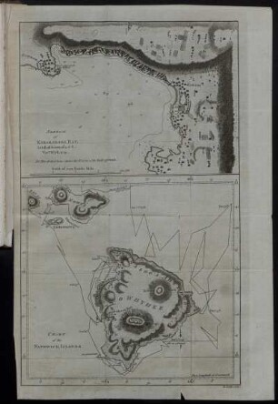
Sketch of Karakakooa Bay
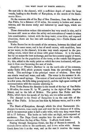
Bay of San Pablo,
Bay of La Paz,
Bay of San Pedro,
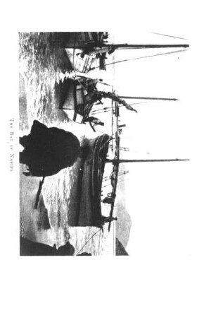
THE BAY OF NAPLES
Bay of Waikouaiti.
Bay of Bamba,
Bay of Panama,
Bay of Wodowara
Bay of Rosario,
Bay of Sooson,
CHAPTER XXIX. - THE BAY OF VIGO AND THE BAY OF BISCAY
Sketch of Karakakooa Bay
Bay of San Pablo,
Bay of La Paz,
Bay of San Pedro,
THE BAY OF NAPLES
Bay of Waikouaiti.
Bay of Bamba,
Bay of Panama,
Bay of Wodowara
Bay of Rosario,
Bay of Sooson,
CHAPTER XXIX. - THE BAY OF VIGO AND THE BAY OF BISCAY
Sketch of Karakakooa Bay
Bay of San Pablo,
Bay of La Paz,
Bay of San Pedro,