Atlas
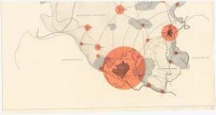
France : atlas routier et touristique ; [1:200000 ; Karten der Hauptverkehrswege, Sehenswürdigkeiten und malerische Strecken, 38 Stadtpläne]
- Location
-
Deutsche Nationalbibliothek Frankfurt am Main
- ISBN
-
9782067193017
2067193015
- Dimensions
-
40 cm
- Extent
-
F, 272 S.
- Edition
-
[Ausg.] einfach zu lesen
- Language
-
Mehrere Sprachen
- Notes
-
Ill., zahlr. Kt.
Text dt., engl., franz. und niederländ.
- Keyword
-
Straße
Karte
Weltkarte
Stadtplan
Atlas
Topografische Karte
Frankreich
Frankreich
- Event
-
Veröffentlichung
- (where)
-
Boulogne-Billancourt
- (who)
-
Michelin Cartes et Plans
- (when)
-
2014
- Table of contents
- Rights
-
Bei diesem Objekt liegt nur das Inhaltsverzeichnis digital vor. Der Zugriff darauf ist unbeschränkt möglich.
- Last update
-
11.06.2025, 1:52 PM CEST
Data provider
This object is provided by:
Deutsche Nationalbibliothek. If you have any questions about the object, please contact the data provider.
Deutsche Nationalbibliothek. If you have any questions about the object, please contact the data provider.
Object type
- Atlas
Associated
- Michelin Cartes et Plans
Time of origin
- 2014
Other Objects (12)
![France : atlas routier et touristique ; [1:200000 ; Karten der Hauptverkehrsstraßen, Sicherheitshinweise, 40 Stadtpläne, Bonus Sehenswürdigkeiten aus dem grünen Reiseführer ; der beste Frankreich-Atlas]](/assets/placeholder/searchResultMediaNoDigitisedMedia.png)
France : atlas routier et touristique ; [1:200000 ; Karten der Hauptverkehrsstraßen, Sicherheitshinweise, 40 Stadtpläne, Bonus Sehenswürdigkeiten aus dem grünen Reiseführer ; der beste Frankreich-Atlas]
Europe : atlas routier et touristique = Europa : Strassen- und Reiseatlas
Refraktionsseismikkarte 1:200000
Refraktionsseismikkarte 1:200000
Bohrkarten 1:200.000
Geol. Karte 1:200.000
Geschichtliche Karten 1:200000
Hydrogeologische Kartierung 1:200000
Italia : 1:200000 ; atlante stradale e turistico ; [Blitzer, Autobahnnetze mit Tankstellen und Rastplätzen, 53 Stadtpläne]
Landschaftsaufbauplanung Ratzeburg: Lageplan 1:200000
Betr. Verkehrskarte NW 1:200.000
Straßenkarten 1:200.000: Bd. 1
France : atlas routier et touristique ; [1:200000 ; Karten der Hauptverkehrsstraßen, Sicherheitshinweise, 40 Stadtpläne, Bonus Sehenswürdigkeiten aus dem grünen Reiseführer ; der beste Frankreich-Atlas]
Europe : atlas routier et touristique = Europa : Strassen- und Reiseatlas
Refraktionsseismikkarte 1:200000
Refraktionsseismikkarte 1:200000
Bohrkarten 1:200.000
Geol. Karte 1:200.000
Geschichtliche Karten 1:200000
Hydrogeologische Kartierung 1:200000
Italia : 1:200000 ; atlante stradale e turistico ; [Blitzer, Autobahnnetze mit Tankstellen und Rastplätzen, 53 Stadtpläne]
Landschaftsaufbauplanung Ratzeburg: Lageplan 1:200000
Betr. Verkehrskarte NW 1:200.000