Landkarte
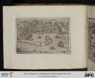
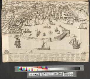
La Nobile Citta di Messina
Plastische Ansicht Messinas und des Umlandes aus der Vogelperspektive. Die Karte ist mit einem numerierten Index der wichtigsten topographischen und architektonischen Gegebenheiten versehen. Zahlreiche Schiffsdarstellungen.
- Location
-
Internationales Maritimes Museum Hamburg
- Collection
-
Karten/Seekarten
- Other number(s)
-
104136 (Objektnummer)
- Measurements
-
520 mm x 610 mm (HxB)
- Material/Technique
-
Kolorierter Kupferstich
- Inscription/Labeling
-
Übersetzung: Die [noble] Stadt Messina
- Classification
-
Karte (Gattung)
- Subject (where)
-
Italien
- Event
-
Herstellung
- (when)
-
1567
- Event
-
Veröffentlichung
- (description)
-
Rom: Antoni Lafreri
- Sponsorship
-
Gefördert von: Die Beauftragte der Bundesregierung für Kultur und Medien
- Last update
-
05.03.2025, 4:05 PM CET
Data provider
This object is provided by:
Peter Tamm Sen. Stiftung. If you have any questions about the object, please contact the data provider.
Peter Tamm Sen. Stiftung. If you have any questions about the object, please contact the data provider.
Object type
- Landkarte
Time of origin
- 1567
Other Objects (12)
La Nobile Citta di Messina
La Nobile Citta Di Messina
Sacri privilegi della città di Méssina
Messina, citta nobilissima
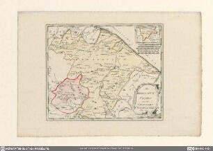
Das Herzogthum Urbino mit der Grafschaft Citta di Castello
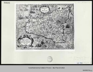
Regno di Sicilia
!["Nuova Pianta Elevata della Nobile E Cospicua Citta Di Venezia [Venedig]"](/assets/placeholder/searchResultMediaNoDigitisedMedia.png)
"Nuova Pianta Elevata della Nobile E Cospicua Citta Di Venezia [Venedig]"
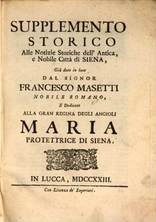
Supplemento storico alle notizie storiche dell'antica e nobile città di Siena

Saggi di dissertazioni accademiche : pubbl. lette nella Nobile Accademia Etrusca dell'Antichissima Città di Cortona
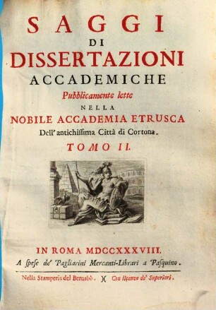
Saggi di dissertazioni accademiche pubblicamente lette nella nobile Accademia Etrusca dell'antichissima città di Cortona, 2
Saggi di dissertazioni accademiche pubblicamente lette nella nobile Accademia Etrusca dell'antichissima città di Cortona, 3

Memorie historiche dell'antichissima e nobile città D'Osimo
La Nobile Citta di Messina
La Nobile Citta Di Messina
Sacri privilegi della città di Méssina
Messina, citta nobilissima
Das Herzogthum Urbino mit der Grafschaft Citta di Castello
Regno di Sicilia
"Nuova Pianta Elevata della Nobile E Cospicua Citta Di Venezia [Venedig]"
Supplemento storico alle notizie storiche dell'antica e nobile città di Siena
Saggi di dissertazioni accademiche : pubbl. lette nella Nobile Accademia Etrusca dell'Antichissima Città di Cortona
Saggi di dissertazioni accademiche pubblicamente lette nella nobile Accademia Etrusca dell'antichissima città di Cortona, 2
Saggi di dissertazioni accademiche pubblicamente lette nella nobile Accademia Etrusca dell'antichissima città di Cortona, 3