- Location
-
Deutsche Nationalbibliothek Frankfurt am Main
- Extent
-
Online-Ressource
- Language
-
Englisch
- Classification
-
Informatik
- Event
-
Veröffentlichung
- (where)
-
Dortmund
- (who)
-
Universitätsbibliothek Dortmund
- (when)
-
2006
- Creator
-
Brill, Bastian
Cagliyan, Müjdat
Feldhorst, Sascha
Fiedler, Martin
Gaeb, Jörn
Heinemann, Michael
Karakoyun, Töresin
Konieczny, Jan
Mayer, Tobias
Niehoff, Holger
Peper, Tobias
Rüsing, Lars
- Contributor
-
HERRMANN, P.
Krumm, H.
Pohl, A.
- Handle
-
2003/22718
- URN
-
urn:nbn:de:101:1-201607122352
- Rights
-
Der Zugriff auf das Objekt ist unbeschränkt möglich.
- Last update
-
14.08.2025, 10:51 AM CEST
Data provider
This object is provided by:
Deutsche Nationalbibliothek. If you have any questions about the object, please contact the data provider.
Deutsche Nationalbibliothek. If you have any questions about the object, please contact the data provider.
Associated
- Brill, Bastian
- Cagliyan, Müjdat
- Feldhorst, Sascha
- Fiedler, Martin
- Gaeb, Jörn
- Heinemann, Michael
- Karakoyun, Töresin
- Konieczny, Jan
- Mayer, Tobias
- Niehoff, Holger
- Peper, Tobias
- Rüsing, Lars
- HERRMANN, P.
- Krumm, H.
- Pohl, A.
- Universitätsbibliothek Dortmund
Time of origin
- 2006
Other Objects (12)

Blauer Deckel eines Mülleimers mit weißer Markierung liegt auf einem Teppich (Sonderthema: Außerirdische)
Plüschtier mit Fahne, im Hintergrund blauer Deckel eines Mülleimers (Sonderthema: Außerirdische)
Remarques sur le rapport des quatre périodes lunaires des Brames, avec les élémens des Tables de la Lune de Mayer
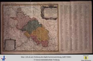
Circulus Austriacus

Junge in seinem Kinderzimmer (Altersgruppe 14-17)

Dvcatvs Silesiae Tabula geographica generalis : statui hodierno, ei nempe qui post pacem Dresdensem locum obtinet, adaptata, iustaque Graducatione rectificata

La Comte De Glatz : avec le Principaute de Munsterberg
Blauer Deckel eines Mülleimers liegt auf dem Teppich (Sonderthema: Außerirdische)
Ducatus Silesiae tabula geographica generalis
![Karte von Polen und Litauen, 1:2 900 000, Kupferstich, 1773. - Aus: Atlas mapparum geographicarum generalium & specialium Centum Foliis compositum et quotidianis usibus accommodatum - Norimbergae, 1791 : Mappa Geographica Regni Poloniae : C. P. S. C. M. = Carte des Etats de la Couronne de Pologne / ex novissimis quotquot sunt mappis specialibus composita et ad LL. stereographica proiectionis revocata a Tob. Mayero, S. C. S. Luci publicae tradita per Homannianos Heredes. - [Ca. 1:2.900.000]. - Norimb.//Nürnberg, 1773. - 1 Kt : Kupferst ; 50 x 43 cm. - Maßstab in graph. Form (Milliaria Germanica, Leucae Gallicae). - Nullmeridian: Ferro](https://iiif.deutsche-digitale-bibliothek.de/image/2/f9fec02e-60be-4683-8544-99a33c6ef7e8/full/!306,450/0/default.jpg)
Karte von Polen und Litauen, 1:2 900 000, Kupferstich, 1773. - Aus: Atlas mapparum geographicarum generalium & specialium Centum Foliis compositum et quotidianis usibus accommodatum - Norimbergae, 1791 : Mappa Geographica Regni Poloniae : C. P. S. C. M. = Carte des Etats de la Couronne de Pologne / ex novissimis quotquot sunt mappis specialibus composita et ad LL. stereographica proiectionis revocata a Tob. Mayero, S. C. S. Luci publicae tradita per Homannianos Heredes. - [Ca. 1:2.900.000]. - Norimb.//Nürnberg, 1773. - 1 Kt : Kupferst ; 50 x 43 cm. - Maßstab in graph. Form (Milliaria Germanica, Leucae Gallicae). - Nullmeridian: Ferro
![Karte von Polen und Litauen, 1:2 900 000, Kupferstich, 1773. - Aus: Atlas mapparum geographicarum generalium & specialium Centum Foliis compositum et quotidianis usibus accommodatum - Norimbergae, 1791 : Mappa Geographica Regni Poloniae : C. P. S. C. M. = Carte des Etats de la Couronne de Pologne / ex novissimis quotquot sunt mappis specialibus composita et ad LL. stereographica proiectionis revocata a Tob. Mayero, S. C. S. Luci publicae tradita per Homannianos Heredes. - [Ca. 1:2.900.000]. - Norimb.//Nürnberg, 1773. - 1 Kt : Kupferst ; 50 x 43 cm. - Maßstab in graph. Form (Milliaria Germanica, Leucae Gallicae). - Nullmeridian: Ferro](https://iiif.deutsche-digitale-bibliothek.de/image/2/cf8fa853-2908-40ab-b319-c01aac56f905/full/!306,450/0/default.jpg)
Karte von Polen und Litauen, 1:2 900 000, Kupferstich, 1773. - Aus: Atlas mapparum geographicarum generalium & specialium Centum Foliis compositum et quotidianis usibus accommodatum - Norimbergae, 1791 : Mappa Geographica Regni Poloniae : C. P. S. C. M. = Carte des Etats de la Couronne de Pologne / ex novissimis quotquot sunt mappis specialibus composita et ad LL. stereographica proiectionis revocata a Tob. Mayero, S. C. S. Luci publicae tradita per Homannianos Heredes. - [Ca. 1:2.900.000]. - Norimb.//Nürnberg, 1773. - 1 Kt : Kupferst ; 50 x 43 cm. - Maßstab in graph. Form (Milliaria Germanica, Leucae Gallicae). - Nullmeridian: Ferro

Mayer, Tobias
Blauer Deckel eines Mülleimers mit weißer Markierung liegt auf einem Teppich (Sonderthema: Außerirdische)
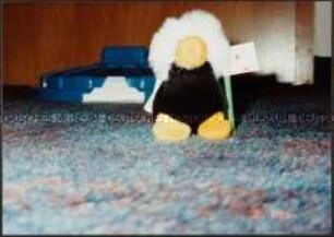
Plüschtier mit Fahne, im Hintergrund blauer Deckel eines Mülleimers (Sonderthema: Außerirdische)
Remarques sur le rapport des quatre périodes lunaires des Brames, avec les élémens des Tables de la Lune de Mayer
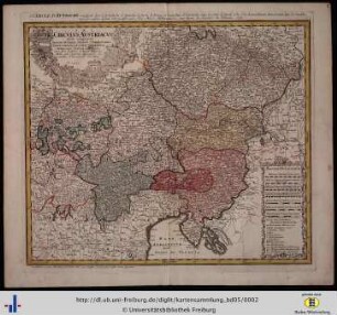
Circulus Austriacus
Junge in seinem Kinderzimmer (Altersgruppe 14-17)
Dvcatvs Silesiae Tabula geographica generalis : statui hodierno, ei nempe qui post pacem Dresdensem locum obtinet, adaptata, iustaque Graducatione rectificata
La Comte De Glatz : avec le Principaute de Munsterberg
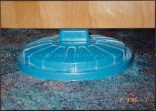
Blauer Deckel eines Mülleimers liegt auf dem Teppich (Sonderthema: Außerirdische)
Ducatus Silesiae tabula geographica generalis
Karte von Polen und Litauen, 1:2 900 000, Kupferstich, 1773. - Aus: Atlas mapparum geographicarum generalium & specialium Centum Foliis compositum et quotidianis usibus accommodatum - Norimbergae, 1791 : Mappa Geographica Regni Poloniae : C. P. S. C. M. = Carte des Etats de la Couronne de Pologne / ex novissimis quotquot sunt mappis specialibus composita et ad LL. stereographica proiectionis revocata a Tob. Mayero, S. C. S. Luci publicae tradita per Homannianos Heredes. - [Ca. 1:2.900.000]. - Norimb.//Nürnberg, 1773. - 1 Kt : Kupferst ; 50 x 43 cm. - Maßstab in graph. Form (Milliaria Germanica, Leucae Gallicae). - Nullmeridian: Ferro
Karte von Polen und Litauen, 1:2 900 000, Kupferstich, 1773. - Aus: Atlas mapparum geographicarum generalium & specialium Centum Foliis compositum et quotidianis usibus accommodatum - Norimbergae, 1791 : Mappa Geographica Regni Poloniae : C. P. S. C. M. = Carte des Etats de la Couronne de Pologne / ex novissimis quotquot sunt mappis specialibus composita et ad LL. stereographica proiectionis revocata a Tob. Mayero, S. C. S. Luci publicae tradita per Homannianos Heredes. - [Ca. 1:2.900.000]. - Norimb.//Nürnberg, 1773. - 1 Kt : Kupferst ; 50 x 43 cm. - Maßstab in graph. Form (Milliaria Germanica, Leucae Gallicae). - Nullmeridian: Ferro
Mayer, Tobias
Blauer Deckel eines Mülleimers mit weißer Markierung liegt auf einem Teppich (Sonderthema: Außerirdische)
Plüschtier mit Fahne, im Hintergrund blauer Deckel eines Mülleimers (Sonderthema: Außerirdische)
Remarques sur le rapport des quatre périodes lunaires des Brames, avec les élémens des Tables de la Lune de Mayer
Circulus Austriacus
Junge in seinem Kinderzimmer (Altersgruppe 14-17)
Dvcatvs Silesiae Tabula geographica generalis : statui hodierno, ei nempe qui post pacem Dresdensem locum obtinet, adaptata, iustaque Graducatione rectificata
La Comte De Glatz : avec le Principaute de Munsterberg
Blauer Deckel eines Mülleimers liegt auf dem Teppich (Sonderthema: Außerirdische)
Ducatus Silesiae tabula geographica generalis
Karte von Polen und Litauen, 1:2 900 000, Kupferstich, 1773. - Aus: Atlas mapparum geographicarum generalium & specialium Centum Foliis compositum et quotidianis usibus accommodatum - Norimbergae, 1791 : Mappa Geographica Regni Poloniae : C. P. S. C. M. = Carte des Etats de la Couronne de Pologne / ex novissimis quotquot sunt mappis specialibus composita et ad LL. stereographica proiectionis revocata a Tob. Mayero, S. C. S. Luci publicae tradita per Homannianos Heredes. - [Ca. 1:2.900.000]. - Norimb.//Nürnberg, 1773. - 1 Kt : Kupferst ; 50 x 43 cm. - Maßstab in graph. Form (Milliaria Germanica, Leucae Gallicae). - Nullmeridian: Ferro
Karte von Polen und Litauen, 1:2 900 000, Kupferstich, 1773. - Aus: Atlas mapparum geographicarum generalium & specialium Centum Foliis compositum et quotidianis usibus accommodatum - Norimbergae, 1791 : Mappa Geographica Regni Poloniae : C. P. S. C. M. = Carte des Etats de la Couronne de Pologne / ex novissimis quotquot sunt mappis specialibus composita et ad LL. stereographica proiectionis revocata a Tob. Mayero, S. C. S. Luci publicae tradita per Homannianos Heredes. - [Ca. 1:2.900.000]. - Norimb.//Nürnberg, 1773. - 1 Kt : Kupferst ; 50 x 43 cm. - Maßstab in graph. Form (Milliaria Germanica, Leucae Gallicae). - Nullmeridian: Ferro