Karte / Plan
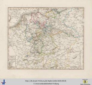
Amtliche Entfernungskarte 1 : 50.000 Kreis Höxter, SK 50E Nr. 23 Fortführungsstand: 1984
- Reference number
-
S 5/2, (S 5/2 ), Nr. 8
- Formal description
-
Einfarbige Lichtpause; Kartengrundlage: Amtliche topographische Karte 1 : 50.000, 3. Aufl. 1983 (hrsg. vom Landesvermessungsamt Nordrhein-Westfalen)
- Further information
-
Maßstab: 1 : 50.000
Anzahl: 1
Druck / Verlag: Oberkreisdirektor des Kreises Höxter – Kataster- und Vermessungsamt
- Context
-
S 5/2 >> unklassifiziert
- Holding
-
S 5/2
- Date of creation
-
1984
- Other object pages
- Delivered via
- Last update
-
05.11.2025, 3:30 PM CET
Data provider
This object is provided by:
Kreisarchiv Höxter. If you have any questions about the object, please contact the data provider.
Kreisarchiv Höxter. If you have any questions about the object, please contact the data provider.
Object type
- Karten und Pläne
Time of origin
- 1984
Other Objects (12)

Entfernungskarte Kreis Höxter; nach der Kreiskarte SK 50 K 23 Kreis Höxter des Landesvermessungsamts NW
Entfernungskarte Dinslaken und Sterkrade. 1:50000
Amtliche Entfernungskarte Kreis Höxter
Amtliche Entfernungskarte des Kreises Höxter
Kreis Tecklenburg, amtliche Entfernungskarte von 1904, M. 1:50.000
Amtliche Entfernungskarte des Kreises Höxter; auf Transparentfolie
Amtliche Entfernungskarte vom Landesteil Lübeck Maßstab: 1:50.000 Hersteller: Vermessungsdirektion Oldenburg
Amtliche Entfernungskarte Rheinisch-Bergischer Kreis - Stadt Leverkusen (SK 50 E-Nr. 47)
Amtliche Entfernungskarte
Amtliche Entfernungskarte
Deutschland, Entfernungskarte.
Übersichts- und Entfernungskarte
Entfernungskarte Kreis Höxter; nach der Kreiskarte SK 50 K 23 Kreis Höxter des Landesvermessungsamts NW
Entfernungskarte Dinslaken und Sterkrade. 1:50000
Amtliche Entfernungskarte Kreis Höxter
Amtliche Entfernungskarte des Kreises Höxter
Kreis Tecklenburg, amtliche Entfernungskarte von 1904, M. 1:50.000
Amtliche Entfernungskarte des Kreises Höxter; auf Transparentfolie
Amtliche Entfernungskarte vom Landesteil Lübeck Maßstab: 1:50.000 Hersteller: Vermessungsdirektion Oldenburg
Amtliche Entfernungskarte Rheinisch-Bergischer Kreis - Stadt Leverkusen (SK 50 E-Nr. 47)
Amtliche Entfernungskarte
Amtliche Entfernungskarte
Deutschland, Entfernungskarte.