- Alternative title
-
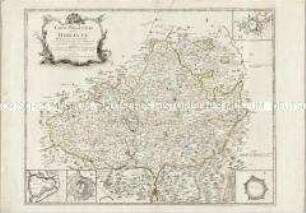
An ACCURATE MAP of / HEREFORD SHIRE / Divided into its / HUNDREDS
- Location
-
Deutsches Historisches Museum, Berlin
- Inventory number
-
Do 2006/103
- Measurements
-
Höhe x Breite: 61 x 77 cm (Blatt)
Höhe x Breite: 49,8 x 67, 8 cm (Karte)
Höhe x Breite: 52,5 x 71 cm (Platte)
- Material/Technique
-
Druckfarbe, Papier, Kupferstich, grenzkoloriert
- Classification
-
Kartografie (Gattung)
- Subject (what)
-
England
Großbritannien
- Event
-
Herstellung
- (who)
-
Geograph, Kartograf, Stecher, Verleger: Emanuel Bowen
Verleger: John Bowles
Verleger: Carington Bowles
Verleger: Robert Sayer
- (where)
-
London, Großbritannien und Nordirland
- (when)
-
um 1750
- Rights
-
Deutsches Historisches Museum
- Last update
-
24.03.2023, 9:28 AM CET
Data provider
This object is provided by:
Stiftung Deutsches Historisches Museum. If you have any questions about the object, please contact the data provider.
Stiftung Deutsches Historisches Museum. If you have any questions about the object, please contact the data provider.
Object type
- Kreiskarte
Associated
- Geograph, Kartograf, Stecher, Verleger: Emanuel Bowen
- Verleger: John Bowles
- Verleger: Carington Bowles
- Verleger: Robert Sayer
Time of origin
- um 1750
Other Objects (12)

Hochzeitslager
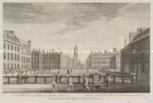
London, Hanover Square - aus einer Folge
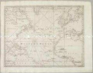
A Chart of the Atlantic Ocean I. Sheet. Mit vier Ansichten
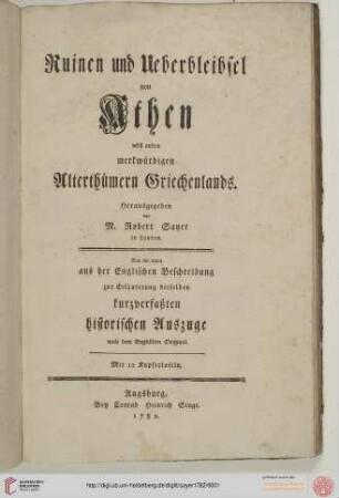
Ruinen und Ueberbleibsel von Athen nebst andern merkwuerdigen Alterthuemern Griechenlands
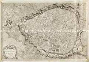
Plan routier de la Ville de Bruxelles
![Karte der Niederlausitz, 1:170 000, Kupferstich., vor 1726 : Nova et accurata Descriptio Marchionatus Lusatiae Inferioris oder Neue und accurate Beschreibung der Margrafthums Nieder-Lausitz / gestochen von Peter Schencken jun. - [Ca. 1:170 000]. - Amsterdam , [vor 1726]. - 1 Kt. : Kupferst. ; 54 x 41 cm](https://iiif.deutsche-digitale-bibliothek.de/image/2/e9dc3a9e-9b55-47f5-bad4-42a246eec9e1/full/!306,450/0/default.jpg)
Karte der Niederlausitz, 1:170 000, Kupferstich., vor 1726 : Nova et accurata Descriptio Marchionatus Lusatiae Inferioris oder Neue und accurate Beschreibung der Margrafthums Nieder-Lausitz / gestochen von Peter Schencken jun. - [Ca. 1:170 000]. - Amsterdam , [vor 1726]. - 1 Kt. : Kupferst. ; 54 x 41 cm

Le Cercle de Baviere
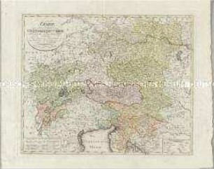
Charte den Oesterreichischen Kreis nach seinen Haupt- und Unter-Abtheilungen vorstellend
Atlas Regni Bohemiae: Repraesentatio Geographica Circuli Egerani, nec non Elnbogensis / Carte du Territoire d'Egra, & du Cercle d'Elnbogue
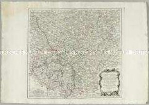
Carte particuliere de la Moravie. Mit vier Stadtplänen: Brunn; Olmutz; Iglaw; Neustatt
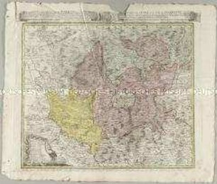
Carte des Cercles du Haut et du Bas Rhin
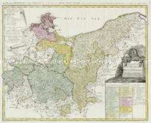
Der nördliche Theil des Obersächsischen Kreises oder die Mark Brandenburg und das Herzogthum Pommern
Hochzeitslager
London, Hanover Square - aus einer Folge
A Chart of the Atlantic Ocean I. Sheet. Mit vier Ansichten
Ruinen und Ueberbleibsel von Athen nebst andern merkwuerdigen Alterthuemern Griechenlands
Plan routier de la Ville de Bruxelles
Karte der Niederlausitz, 1:170 000, Kupferstich., vor 1726 : Nova et accurata Descriptio Marchionatus Lusatiae Inferioris oder Neue und accurate Beschreibung der Margrafthums Nieder-Lausitz / gestochen von Peter Schencken jun. - [Ca. 1:170 000]. - Amsterdam , [vor 1726]. - 1 Kt. : Kupferst. ; 54 x 41 cm
Le Cercle de Baviere
Charte den Oesterreichischen Kreis nach seinen Haupt- und Unter-Abtheilungen vorstellend
Atlas Regni Bohemiae: Repraesentatio Geographica Circuli Egerani, nec non Elnbogensis / Carte du Territoire d'Egra, & du Cercle d'Elnbogue
Carte particuliere de la Moravie. Mit vier Stadtplänen: Brunn; Olmutz; Iglaw; Neustatt
Carte des Cercles du Haut et du Bas Rhin