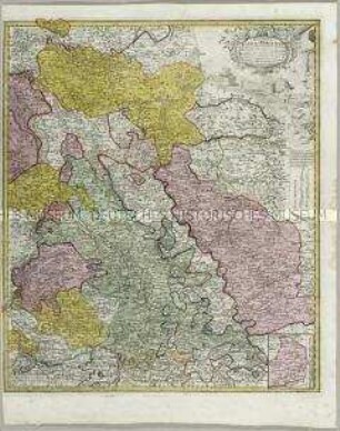
Grenzkarte
Tabula Geographica, Totam Borussiam ut et Districtum Notecensem, M ca. 1 : 740 000
- Standort
-
Deutsches Historisches Museum, Berlin
- Inventarnummer
-
1989/845
- Maße
-
Höhe x Breite: 51,9 x 61,5 cm (Blatt), Höhe x Breite: 45,9 x 54,2 cm (Karte), Höhe x Breite: 5159,2 ca (Platte)
- Material/Technik
-
Papier, Kupferstich, koloriert
- Klassifikation
-
Kartografie (Gattung)
- Bezug (was)
-
Polen
Preußen
Netzedistrikt
- Ereignis
-
Herstellung
- (wer)
-
Stecher: Johann Sebastian Leitner
Druckerei, Verlag: Homann Erben
- (wann)
-
nach 1772
- Rechteinformation
-
Deutsches Historisches Museum
- Letzte Aktualisierung
-
24.03.2023, 09:29 MEZ
Datenpartner
Dieses Objekt wird bereitgestellt von:
Stiftung Deutsches Historisches Museum. Bei Fragen zum Objekt wenden Sie sich bitte an den Datenpartner.
Stiftung Deutsches Historisches Museum. Bei Fragen zum Objekt wenden Sie sich bitte an den Datenpartner.
Objekttyp
- Grenzkarte
Beteiligte
- Stecher: Johann Sebastian Leitner
- Druckerei, Verlag: Homann Erben
Entstanden
- nach 1772
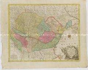
Ähnliche Objekte (12)
Ducatus Iuliaci et Bergensis Tabula geographica. Mit einer Anschlusskarte
Tabula Hungaria

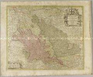
Accuratissima Germaniae Tabula
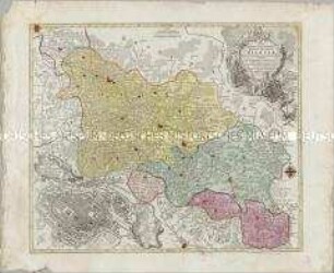
Nova Mappa Geographica Totius Ducatus Silesiae. Mit einem Stadtplan: Prospectus Vratislaviae

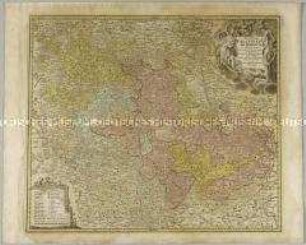
Tabula Generalis Totius Pomeraniae
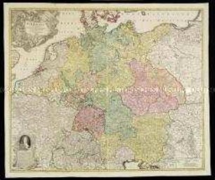
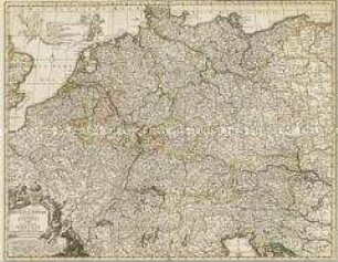
Tabula Novissima Totius Germaniae
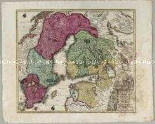
Nova Mappa Geographica Sueciae ac Gothiae Regna ut et Finlandiae Ducatum ac Lapponiam
Exactissima Palatinatus ad Rhenum Tabula
Peraccurata S. Romani Imperii Tabula comprehendens Regiones vulgo Sub Nomine Germaniae Nuncupantes
Archiepiscopatus et Electoratus Coloniensis ut et Ducatuum Iuliacensis et Montensis nec non Comitatus Meursiae Nova Tabula
Karte: Beschreibung der Schweiz; 1751

Deutschland vom Major C. F. Hammer. Nürnberg bey Friedrich Campe
Ducatus Iuliaci et Bergensis Tabula geographica. Mit einer Anschlusskarte
Tabula Hungaria
Accuratissima Germaniae Tabula
Nova Mappa Geographica Totius Ducatus Silesiae. Mit einem Stadtplan: Prospectus Vratislaviae
Tabula Generalis Totius Pomeraniae
Tabula Novissima Totius Germaniae
Nova Mappa Geographica Sueciae ac Gothiae Regna ut et Finlandiae Ducatum ac Lapponiam
Exactissima Palatinatus ad Rhenum Tabula
Peraccurata S. Romani Imperii Tabula comprehendens Regiones vulgo Sub Nomine Germaniae Nuncupantes
Archiepiscopatus et Electoratus Coloniensis ut et Ducatuum Iuliacensis et Montensis nec non Comitatus Meursiae Nova Tabula
Karte: Beschreibung der Schweiz; 1751