- Alternative title
-
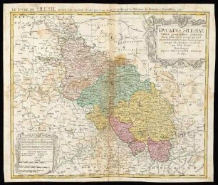
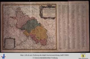
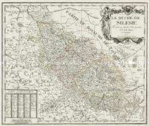
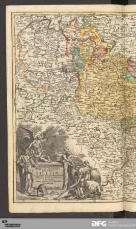
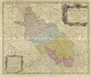
Le Duché De Silesie
- Location
-
München, Bayerische Staatsbibliothek -- 2 Mapp. 167#Blatt62
- Dimensions
-
53 x 44 cm
- Extent
-
1 Kt.
- Notes
-
Kupferstich
Maßstab in graph. Form (Milliaria Silesiaca, Milliaria Germanica). - Nullmeridian: Ferro
- Bibliographic citation
-
Beigebunden zu: Schatz, Johann J.: Schul-Atlas von zwantzig General- und Special-Landkarten ; [53]
- Keyword
-
Geschichte 1163-1742
Schlesien
- Event
-
Veröffentlichung
- (where)
-
Norimbergae//Nürnberg//
- (who)
-
Homanniani Heredes
- (when)
-
1749
- Contributor
- URN
-
urn:nbn:de:bvb:12-bsb00076413-1
- Last update
-
16.04.2025, 8:47 AM CEST
Data provider
This object is provided by:
Bayerische Staatsbibliothek. If you have any questions about the object, please contact the data provider.
Bayerische Staatsbibliothek. If you have any questions about the object, please contact the data provider.
Object type
- Altkarte
Associated
- Mayer, Tobias
- Homann, Johann Christoph
- Homanniani Heredes
Time of origin
- 1749
Other Objects (12)
Ducatus Silesiae Tabula geographica

Ducatus Silesiae tabuls geographica generalis
Ducatus Silesiae tabula geographica generalis
Ducatus Silesiae Tabula Geographica Prima, Inferiorem Eius Partem
Le Duché De Silesie
Silesiae Ducatus.
Ducatus Silesiae
Silesiae Ducatus
Ducatus Silesiae
Silesiae Ducatus
Silesiae Ducatus

Silesiae Ducatus
Ducatus Silesiae Tabula geographica
Ducatus Silesiae tabuls geographica generalis
Ducatus Silesiae tabula geographica generalis
Ducatus Silesiae Tabula Geographica Prima, Inferiorem Eius Partem
Le Duché De Silesie
Silesiae Ducatus.
Ducatus Silesiae
Silesiae Ducatus
Ducatus Silesiae
Silesiae Ducatus
Silesiae Ducatus
Silesiae Ducatus
Ducatus Silesiae Tabula geographica
Ducatus Silesiae tabuls geographica generalis
Ducatus Silesiae tabula geographica generalis
Ducatus Silesiae Tabula Geographica Prima, Inferiorem Eius Partem
Le Duché De Silesie
Silesiae Ducatus.
Ducatus Silesiae
Silesiae Ducatus
Ducatus Silesiae
Silesiae Ducatus
Silesiae Ducatus