
- Alternative title
-
Übersichtskarte des aegyptischen Reiches im Februar 1884
- Location
-
Forschungsbibliothek Gotha -- SPA 4° 00415 (35)
- Extent
-
1 Kt, Blattgr. 54 x 41 cm
- Language
-
Deutsch
- Notes
-
Nullmeridian: Greenwich. - Maßstab in graph. Form (Kilometer, Engl. Statute Miles). - Mit Bergstrichen. - Mit 5 enth. Kt.: Übersichtskarte des aegyptischen Reiches im Februar 1884 im Maßstab 1:12.500.000, Umgegend von Suakin im Maßstab 1:1.000.000, Hafen von Suakin im Maßstab 1:50.000, Östlicher Sudan & Abessinien im Maßstab 1:7.500.000, Umgegend von Carthum im Maßstab 1:250.000 Sammlung Perthes
- Contributor
- Published
-
Gotha : Justus Perthes , 1884
- URN
-
urn:nbn:de:urmel-2d22bbbf-f175-421d-b5b5-609decd905275-00011426-15
- PURL
- Last update
-
14.04.2025, 12:54 PM CEST
Data provider
This object is provided by:
Forschungsbibliothek Gotha der Universität Erfurt. If you have any questions about the object, please contact the data provider.
Forschungsbibliothek Gotha der Universität Erfurt. If you have any questions about the object, please contact the data provider.
Object type
- Karte
Associated
- Forschungsbibliothek Gotha
- Hassenstein, Bruno
- Perthes, Bernhard
- Perthes, Justus
Time of origin
- Gotha : Justus Perthes , 1884
Other Objects (12)
Amerikanisch-Spanischer Kriegsschauplatz
Österreichisch-serbischer Kriegsschauplatz
Kriegsschauplatz der deutschen Truppen in China

Deutsch-Französisch-Belgischer Kriegsschauplatz : Auf Grundlage von Karten aus Stielers Handatlas
Schulatlas zur Geschichte des Altertums : 64 Haupt- und Nebenkarten auf 28 Seiten
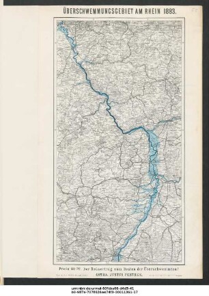
Überschwemmungsgebiet am Rhein 1883

Karte des Thüringer Waldes um Tabarz
Aegypten und Sues-Canal
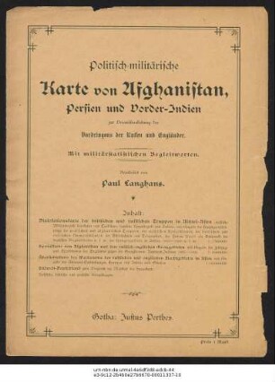
Politisch-militärische Karte von Afghanistan, Persien und Vorder-Indien : zur Veranschaulichung des Vordringens der Russen und Engländer
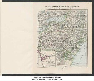
Das Überschwemmungsgebiet in Pennsylvanien : (Justus Perthes' Gelegenheitskarten zur Tagesgeschichte)
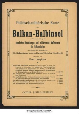
Politisch-militärische Karte der Balkan-Halbinsel : Auf Grundlage von Karten aus Stielers Handatlas
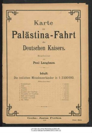
Die Palästina-Fahrt des deutschen Kaisers
Amerikanisch-Spanischer Kriegsschauplatz
Österreichisch-serbischer Kriegsschauplatz
Kriegsschauplatz der deutschen Truppen in China
Deutsch-Französisch-Belgischer Kriegsschauplatz : Auf Grundlage von Karten aus Stielers Handatlas
Schulatlas zur Geschichte des Altertums : 64 Haupt- und Nebenkarten auf 28 Seiten
Überschwemmungsgebiet am Rhein 1883
Karte des Thüringer Waldes um Tabarz
Aegypten und Sues-Canal
Politisch-militärische Karte von Afghanistan, Persien und Vorder-Indien : zur Veranschaulichung des Vordringens der Russen und Engländer
Das Überschwemmungsgebiet in Pennsylvanien : (Justus Perthes' Gelegenheitskarten zur Tagesgeschichte)
Politisch-militärische Karte der Balkan-Halbinsel : Auf Grundlage von Karten aus Stielers Handatlas